Boston Weather: Severe Thunderstorms Possible Tuesday Afternoon
BOSTON (CBS) – This hasn't been the nicest month as we've seen more cooler than normal days in April, above average rainfall and even some snow this past weekend. Sure we've had a few nice days sprinkled in, but most weeks have had a fair share of unsettled conditions and this week is no different.
EYE TO THE SKY TUESDAY AFTERNOON
A cold front will approach the area from west to east bringing the risk of showers and storms Tuesday afternoon and evening for central and eastern Mass.
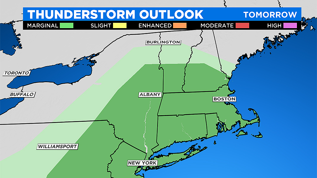
Some of these storms across southern New England may be strong to severe.
TIMING
It will be dry and chilly this morning. Morning through midday is your best bet to get any outdoor chores completed or get in a walk/run. Clouds and southerly winds will increase by midday as the cold front approaches. Showers will arrive in the afternoon, but the highest risk of an isolated strong to severe storms would be from 4-to-8 p.m. before this line of downpours pushes off the coast later tonight.
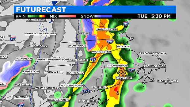
As this line of showers and storms roll through, higher elevations west of I-495 may even experience a brief burst of snow, but for eastern areas it will be just showers and downpours. Most areas will see about .20" to .50" of rain, with the highest amounts where thunderstorms occur. A reminder that not every town will experience thunderstorms, as they'll be isolated to scattered in nature.
IMPACTS
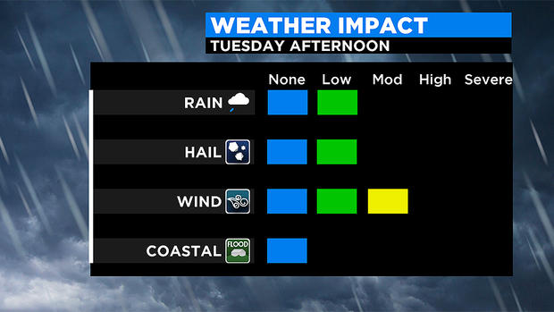
For any town that does experience a thunderstorm, it may turn strong to severe. Besides a burst of rain and rumble of thunder, the main threat with stronger storms would be damaging wind gusts of 40 to 50 mph, especially at higher elevations and along the coast. These strong winds could be capable of tree damage and bringing down power lines. Make sure to charge your devices ahead of time and be prepared for scattered power outages. Small hail is possible in any stronger storm as well.
From southern Worcester County to all of eastern Massachusetts, a Wind Advisory will be in effect through 7 p.m., and for the Cape and Islands until 9 p.m. Gusts will likely exceed 35 mph and could reach up to 50 mph at times. Expect southerly winds this afternoon, followed by west-northwest winds this afternoon and evening as the cold front moves through.
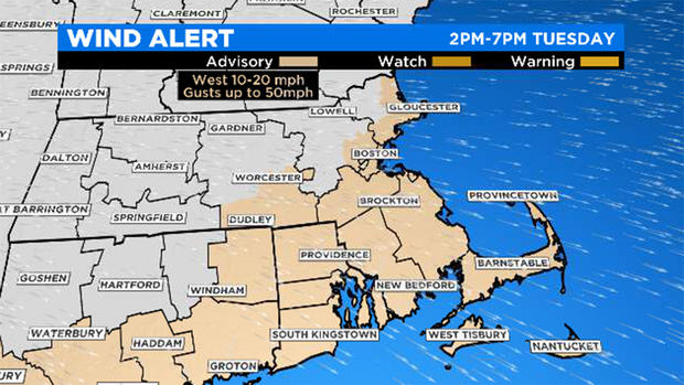
This may ultimately lead to more downed limbs and branches which have been weakened from recent storms. Power outages are possible. While the Advisory ends in the evening as damaging wind gusts subside, it will remain blustery through Wednesday morning. Winds will begin to decrease Wednesday afternoon. Expect a much cooler day on Wednesday with highs in the 40s to near 50 degrees.