Strong Wind Gusts, Rain Continue Monday Evening
BOSTON (CBS) - The wet and windy conditions will continue this evening with over 75,000 people reported without power Monday afternoon.
A High Wind Warning and Wind Advisory remain in effect for the area.
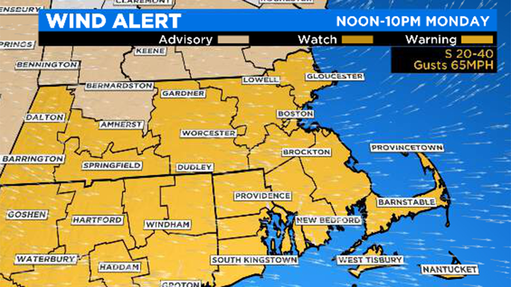
The strongest wind gusts will occur through 7 to 8 PM Monday night. Gusts 55 to 75 mph are capable of downing trees and power lines and creating scattered damage and more power outages. Isolated stronger gusts cannot be ruled out!

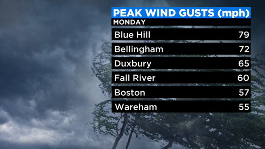
Logan Airport reported a wind gusts of 52 mph, Worcester Airport 58 mph and Blue Hill Observatory in Milton observed an 'unofficial' wind report of near 80 mph!
Along with the wind, scattered rain has led to some ponding on the roads. Another slug of rain, heavy at times, will continue to impact the area through 5-8 PM, which could lead to more minor poor drainage flooding. Small streams will continue to rise, but no major river flooding is expected.
Rainfall totals will range between 1-2", highest where downpours move through. Can't rule out an isolated embedded strong storm, but the highest threat of severe weather is to our southwest.
Nonetheless, the main threat would be damaging wind gusts, lightning and heavy rain. The impact should be generally low regarding coastal flooding. However, waves are rocking off our coast and tides will be churning above average as the seas build, so some splashover and more vulnerable shore roads will be closed, especially at south-facing coastal locations.
Rain showers will decrease in intensity and coverage from west to east later this evening followed by clearing before midnight. Winds will also begin to relax. Quiet weather will follow on Tuesday.