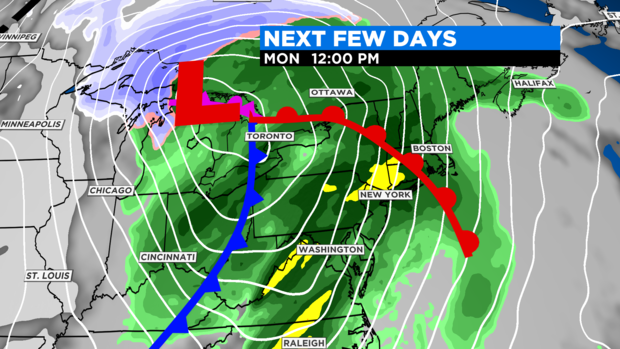
Pleasant Easter Followed By A Wet And Windy Monday
BOSTON (CBS) - The weather will be cooperative Sunday with no rain, but the amount of sunshine will be a bit disappointing. Most of the sunshine will occur early in the day as the cloudiness shifts eastward into the region as the morning progresses. There could still be a little sunshine penetrating through the cloudiness even in the afternoon in a few locations.
The wind will become busy out of the south up to 10-25 mph in the afternoon, and the temperatures will top out closer to 50 degrees in south-facing coastal areas ranging up to 60 or so west-northwest of Boston.
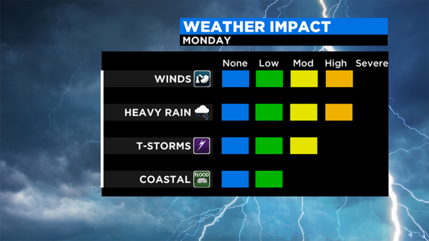
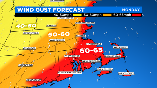
The southerly wind will be blowing and howling all day, with frequent gusts over 30 mph and some gusts up to 50 mph farther inland and the jackpot gusts of 60-65 mph over the coastal plain. There is a risk that a few isolated gusts of 70-75 mph will occur primarily over Cape Cod and the Islands.
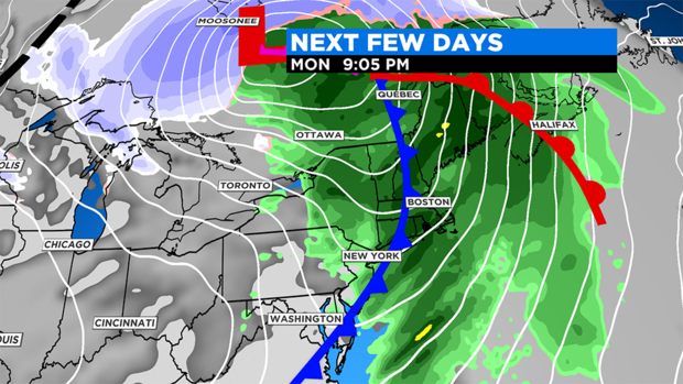
The strongest wind will most likely occur in the late morning to late afternoon, then a cold front will shift eastward across the area during the first half of the evening, putting an end to the showers and shifting the decreasing wind to westerly.
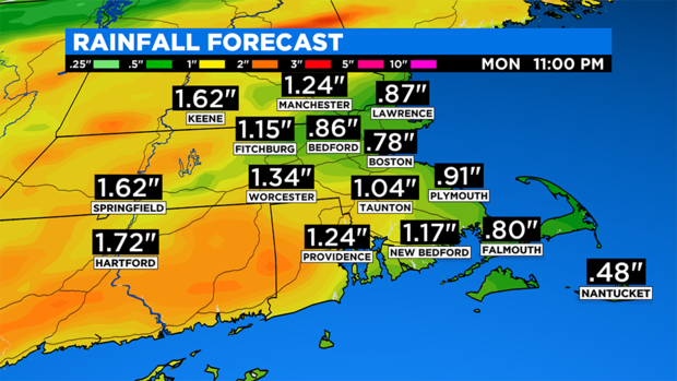
Presently, the projected rainfall will be close to an inch or so over eastern New England, with perhaps less over parts of Cape Cod. The highest amounts of 1.5 to 2 inches is more likely over western New England.
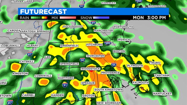
During some of the heavier showers, poor drainage areas will lead to some ponding of roadways. The heaviest showery rain with scattered thunderstorms is most likely to happen from late morning to late afternoon. After that, it will taper off to lighter scattered showers, and end during the evening from west to east.
Check for updates here at CBSBoston.com, CBSN and on WBZ-TV.