Boston Weather: Unsettled Pattern Into The Weekend
BOSTON (CBS) - We are watching a few systems to bring rain chances to the region in the days ahead, but expect plenty of dry times too.
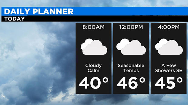
The first area of low pressure will move off the mid-Atlantic today and pass south of New England. This system will keep mostly cloudy skies in place today and allow for an onshore wind to develop. While most of the moisture will stay offshore, can't rule out a stray sprinkle or patchy drizzle at the coast. The highest risk of any steadier rain will develop later today for southeastern MA, mainly over Nantucket.
Not expecting a huge warm up today, with temperatures in the mid to upper 40s, coolest conditions at the coast.
TONIGHT
We remain mostly cloudy, with the best chance of rain over Cape Cod and the Islands. Up to .25" of rain is possible. While most areas will experience NE winds 5-15 mph, it may turn quite gusty over southeastern MA with gusts 25 to 35 mph overnight as the storm passes by. Temperatures will fall back into the 30s in most spots, with a few mid to upper 20s north and west.
LATE WEEK
As showers exit early Thursday, expect improvements through the day. Dry weather and light winds are expected with highs in the upper 40s. Friday will be a bit warmer with temps in the 50s. We'll find a mix of clouds and sun as a disturbance passes to our north and south, so we are caught in the middle. We may see a passing shower, especially over southern parts of the area, but precipitation looks to be on the light side.
WEEKEND
Mostly sunny skies return on Saturday. The day will be dry and the pick of the weekend with temps in the 50s! Unfortunately, high clouds increase late in the day and widespread rain returns overnight Saturday into Sunday.


