Several Inches Of March Snow To Fall In Parts Of Massachusetts, Rain To Follow
BOSTON (CBS) – It's been a while since most of us had to consider shoveling, plowing or traveling in the snow. For many, the last plowable event was way back on Feb. 13. For Boston, you have to go all the way back to Jan. 18! As you all know, winter in New England ain't over just because the calendar says so; it comes and goes on its own timetable.
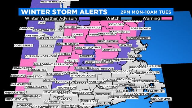
AMOUNTS
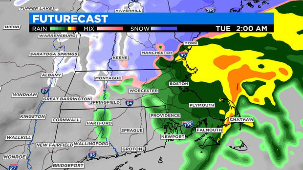
No snow is likely over southeastern Massachusetts, Cape Cod, southern Rhode Island and southern Connecticut. A brief period of wet snow may occur in the Providence to Boston corridor. There is a slight chance of a coating of snow on mainly grassy surfaces in this zone.
Farther west and northwest of this corridor, the snowfall potential increases with a risk of up to 2 inches on grassy surfaces, vehicles and conifers before a switch to rain.
More than 2 inches and perhaps up to 5 inches could accumulate between Route 128 and Interstate 495, northwest of Boston, mainly on the grassy surfaces. The snow will be very heavy and wet, with temperatures in this area a few degrees above freezing. The snow will be compacted quite a bit here with many getting rain on top of the snow before all is said and done.
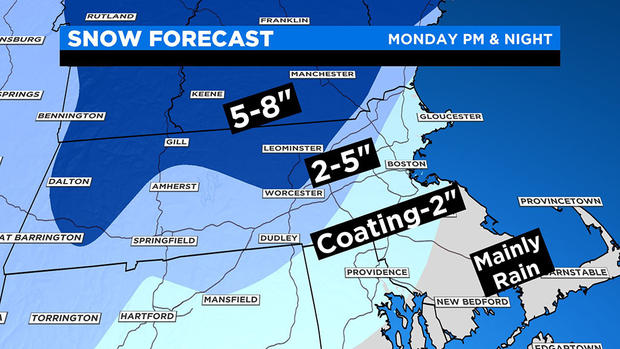
A zone of 5 inches, possibly up to 8 inches, is possible over the elevated areas of southern New England, including northern Worcester county, the Berkshires and southwest New Hampshire. No change to rain in this area, although the snow will be very heavy and wet here as well.
All of the central and northern ski areas will get a major refresh with this storm, most receiving well over half a foot, and many up to a foot or more.
TIMING
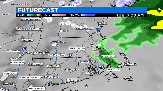
The precipitation arrives mid to late afternoon, starting as snow in most areas. It will be all rain over the Cape, Islands and southeastern Massachusetts.
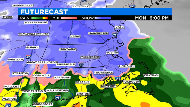
The snow will pick up in intensity by 5 to 6 p.m. and begin to readily accumulate by then as well. The rain-snow line pushes north this evening, through Boston and eventually up to about Interstate 495 (northwest) before midnight.
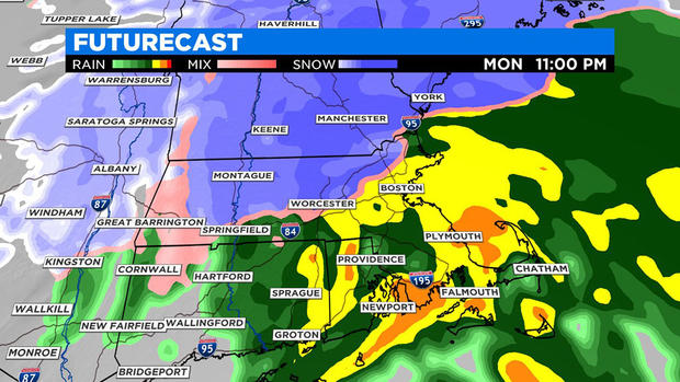
Heaviest rain and snow falls between 6 p.m. and 2 a.m. overnight, tapering off after that. It should be all done by the time most wake up tomorrow morning.
IMPACTS
Caution is most advised farther inland where heavier snow would cause some trickier traveling conditions Monday evening through Tuesday morning, otherwise this storm is not a big deal for most, and fewer people are commuting due to the coronavirus.
The wind will become gustiest up to 20 to 40 mph with a few higher gusts possible over southeastern Massachusetts up to the North Shore with less wind inland. High tides are not expected to be a big factor, although some splash-over is possible tomorrow night an hour or two on either side of midnight.
LOOKING AHEAD
Another storm will move in quickly from late morning into the evening of Wednesday and this one will also produce some wet snow of just a few inches farther inland, especially over higher elevation locations. Little if any snow is anticipated over much of eastern Massachusetts.
Keep up with the latest weather events this week on WBZ-TV, CBSBoston.com and CBSN.


