Snow Exits, But Next Wave Of Precipitation Arrives In New England
BOSTON (CBS) – It has just been one of THOSE winters.
There are some winters in New England when it seems to snow at the drop of a hat. Just about every storm we forecast ends up over-achieving and you just can't seem to keep the driveway clean of snow no matter how hard you try. And then, other winters (see 2019-2020), no matter how promising a storm might look several days in advance, things just don't come together right.
Snow lovers, we are running out of time. The persistent pattern of milder than average temperatures in the East and storms cutting too far inland to produce snowfall seems to be on a never-ending repeat cycle. And here we go again after a "touch" of wintry weather this morning, temperatures rose above freezing and rain has taken over.
REST OF THURSDAY
With temperatures slowly warming above freezing, any leftover spotty showers or drizzle will be plain rain. There may be some spotty areas in northern Worcester County and in higher elevations in western Massachusetts, where temperatures stay just cold enough for some light freezing drizzle to continue through Thursday evening.
THURSDAY NIGHT
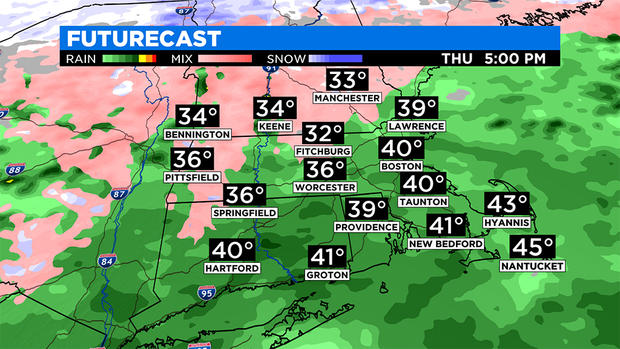
Another wave of precipitation will approach from the south and attempt to push onshore with some heavier bands of rain. Best chance of getting into a steadier/heavier rain Thursday night will be areas south of the Mass Pike.
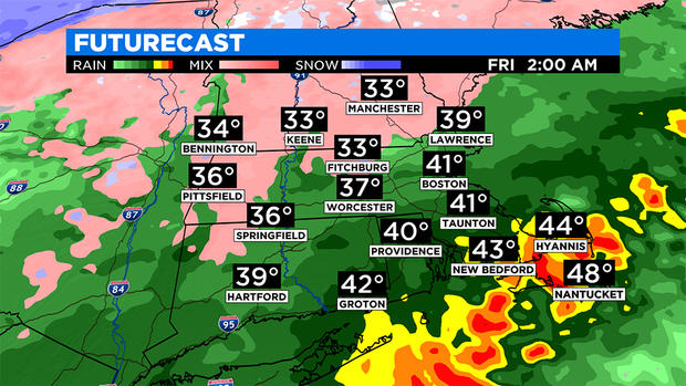
Some very heavy rain bands will be lurking just offshore and may scrape parts of far southeast New England with as much as 1-2 inches of rain overnight. The rest of the area, (Boston north and west), will remain in the lighter/spottier rain area, again with some light freezing rain possible in the higher elevations.
FRIDAY
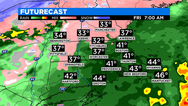
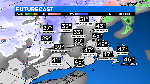
Not over yet. One last area of low pressure will push across our area on Friday. Temperatures will be warm enough Friday morning for this to fall as all rain.
The rain will continue at varying intensity through the afternoon and evening. However, later in the day on Friday, colder air will return to the area, draining in from the north.
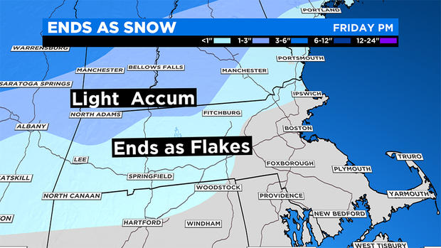
Rain will change back to snow for areas well north and west of Boston, including the Berkshires, southwest New Hampshire and perhaps as close by as the Worcester Hills. Not expecting any snow accumulation locally from this brief changeover.
After the precipitation tapers off Friday evening, the whole area gradually drops below freezing, and any untreated surfaces will ice up.
This weekend will actually feel much more like February. Highs will struggle to reach the freezing mark both days, and there may be a few flurries in the air on Sunday.
Follow Terry on Twitter @TerryWBZ