Messy Winter Storm Arrives Sunday Evening
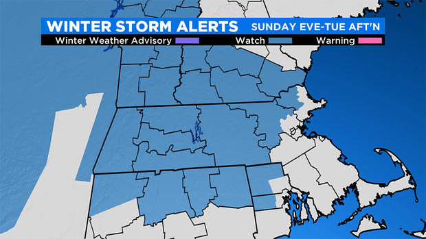
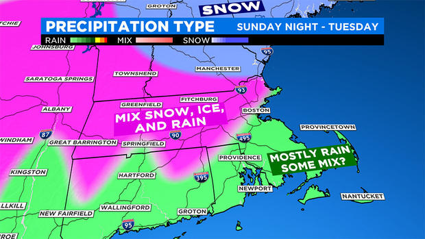
BOSTON (CBS) - After an active first half of the month, the weather has been quite quiet for a couple of weeks, but that will all change tomorrow evening as the next system invades the region with a veritable potpourri of precipitation. The WBZ Weather Team has issued a Storm Watch Weather Alert and the National Weather Service has issued a Winter Storm Watch for the blue-shaded region indicated on the map. Expect precipitation to develop in western New England around 7 p.m. and spread eastward into the Boston area by 10 p.m. or so.
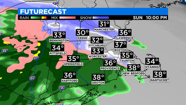
In many areas, it will commence as snow and then transition to rain rather quickly closer to the South Coast and Cape then up into southeastern Massachusetts. Locations farther north and west of these places will experience a transition to ice pellets and then freezing rain. Snow will last longer and accumulate up to a few inches near and north of the Massachusetts/New Hampshire border before switching to sleet and some freezing rain.
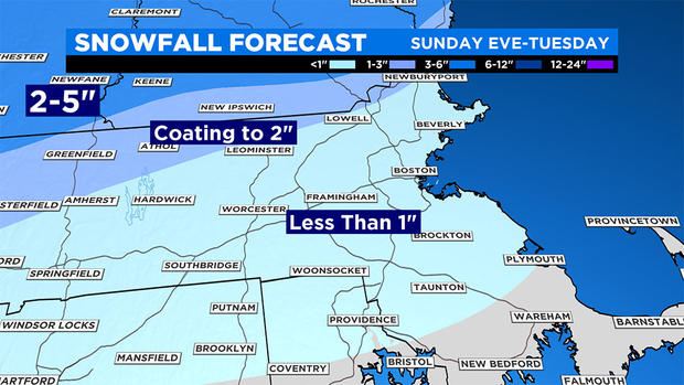
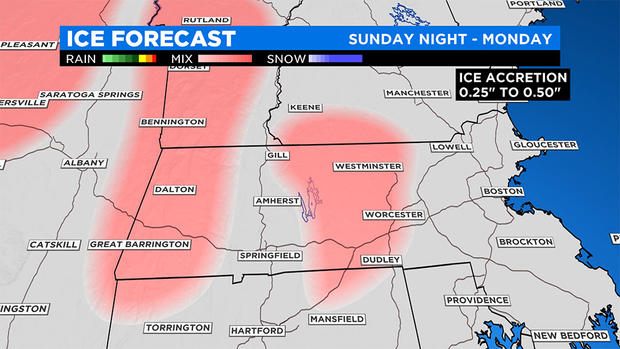
The feature of this storm that will likely generate the greatest impact is the prolonged period of freezing rain primarily poised over the Berkshires and parts of Worcester County. Ice accretion of a quarter- to a half-inch is possible in some of these areas. There is an outside shot of up to three-quarters of an inch of ice buildup on some surfaces like tree branches. Consequently, there will be a risk of some scattered power outages there.
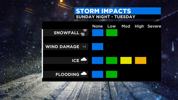
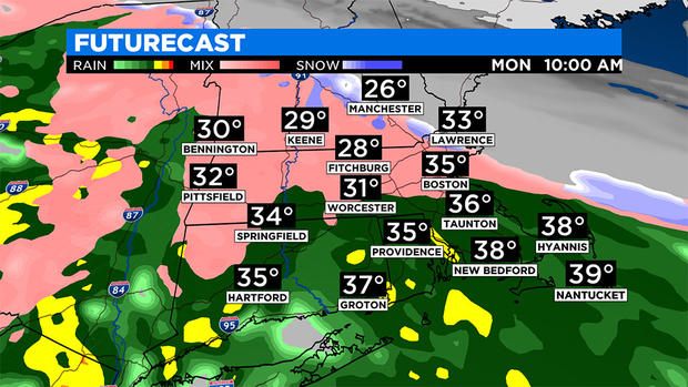
The storm complex will yield a new secondary storm on the New Jersey coast early Monday, and that feature will track east-northeastward over southeastern Massachusetts. So it looks like the heaviest precipitation will likely occur Monday morning to early afternoon with a lighter intensity much of the time Monday night into Tuesday afternoon. Presently, it appears that it should be dwindling to mist and ending by dusk or so on Tuesday as the secondary storm moves east of Boston across the Gulf of Maine. Sufficient warming should occur so ice accretion will diminish farther into central Massachusetts during the day Tuesday while icing changes over to a relatively brief period of snow well north and west Tuesday afternoon. The highest wind gusts of 25 to 50 mph are possible over the Cape and Islands on Monday with 20 to 35 mph winds at other coastal locations and less wind elsewhere.
All systems are go for a cloudy sky and a brisk breeze at times as 2020 begins Tuesday night at midnight. There will not be an arctic blast this time with a temperature near 34 degrees in the Boston area.
Happy New Year everyone!


