Storm Part 2 Could Bring Significant Snow To Eastern Massachusetts
BOSTON (CBS) - The first part of the first snow storm to hit southern New England this season is over.
Check: Snow Totals For December 1-2 Storm
Snow overnight went just about as expected, generally 5-to-10 inches inland from the coastline with a few areas in Worcester County and western Massachusetts checking in a tad higher. Amounts at the coast ranged from nothing over Cape Cod and outer Cape Ann to 1-to-5 inches closer to Route 128.
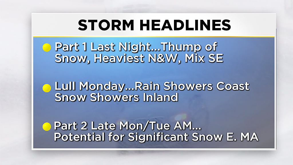
For most of the day on Monday we will be in-between storm phases. Expect a potpourri of snow, sleet, freezing rain and rain across southern New England, varying in intensity, stopping and starting. Through the daylight hours on Monday there could be an additional 1-to-3 inches of snow accumulation in areas around I-495 and points north and west. This should be fairly manageable, plenty of time to get out and clean up before the final wave of snow Monday night.
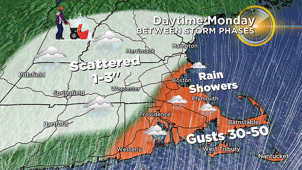
Winds will be gusty along the coast Monday out of the northeast between 30-to-50 mph. There may be some minor coastal flooding Monday afternoon between 2 and 5 p.m., thankfully tides are astronomically low so major flooding is not expected.
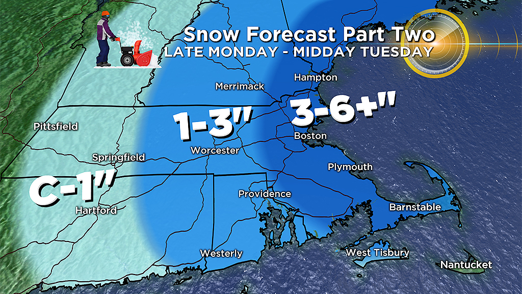
Later Monday, colder air will rush in as winds turn into the north. Temperatures will drop below freezing along the coast and over southeastern Massachusetts, creating very slippery conditions between 4 and 10 p.m. At the same time, the storm will receive a shot of energy and begin to reorganize itself offshore. Steady snow will develop across eastern Mass. after 8 p.m. and continue through the overnight hours. There is potential for some heavy bands of snow in eastern-most Massachusetts Tuesday morning during and just after the commute. Another day of delays, cancellations and treacherous travel, perhaps even worse than Monday in many areas.
Additional snow accumulation from Monday night through midday Tuesday will range between 3-to-6 inches across most of eastern Mass., with the potential of some higher amounts (up to 9 inches) within the heaviest bands. Potential bullseyes include Essex County, Plymouth County and coastal Maine.
As the storm FINALLY pulls away Tuesday afternoon, expect gusty northwest winds (20-40 mph) as you head out one last time to clean up.
You can follow Terry on Twitter at @TerryWBZ


