Sunday Soaker Brings High Winds To South Shore And Cape
/ CBS Boston
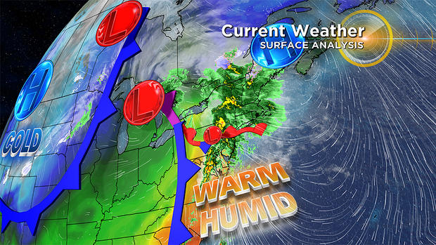
BOSTON (CBS)-- Energy is transferring to a developing wave of low pressure or secondary storm system over northeastern PA at midday. The center of this wave will track across CT this afternoon to northern RI to near Foxboro to just south of Boston from early to mid-evening.
Current weather for Oct. 27 (WBZ-TV)
It does NOT have the atmospheric support for bombogenesis like the ferocious storm during the night of Oct. 16 into Oct. 17.
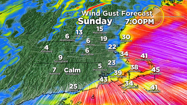
Wind gust forecast for Oct. 27. (WBZ-TV)
This system will not contain the dynamics to trigger considerable coastal wind damage, but it will be capable of cranking up the wind primarily for the Cape resulting in isolated spotty damage.
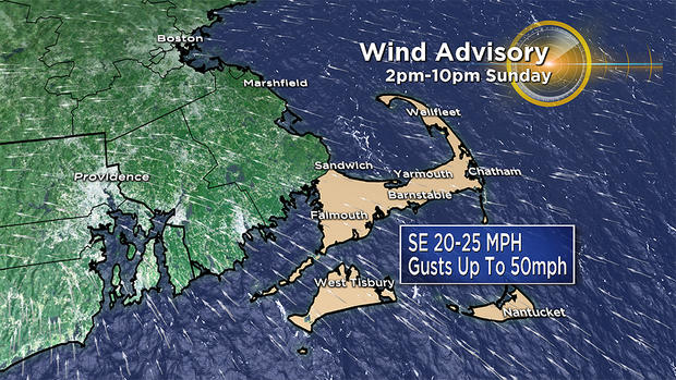
Wind advisory for Oct. 27. (WBZ-TV)
WIND:
Although breezy at times, the wind will be insignificant across much of the region. The exception will be Cape Cod and The Islands where a Wind Advisory is posted from 2 p.m. to 10 p.m. Southeasterly winds of 20-30 mph with some gusts of 40 up to 50 mph are probable and the strongest wind should blow during early to mid-evening. Immediate coastal areas of the South Shore extending up to outer Cape Ann, gusts up to 30-40 mph are possible. Except over some higher hilltops, most inland locations will have wind varying from 10 up to 20-25 mph.
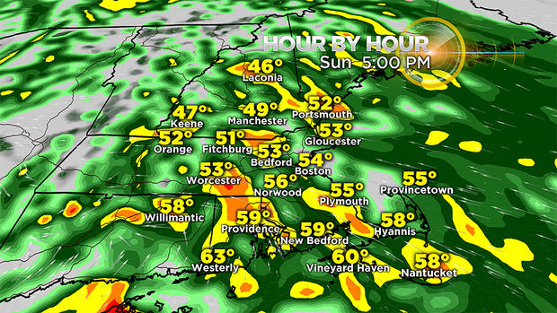
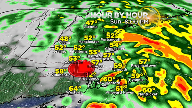
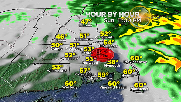
Rain timeline for 5 p.m. Oct. 27. (WBZ-TV)Rain timeline at 8 p.m. for Oct. 27. (WBZ-TV) Rain timeline for 11 p.m. Oct. 27. (WBZ-TV)
TIMING:
After this morning's scattered, mostly light, showers, the rain this afternoon will be steady with variable intensity ranging from light rain to downpours. This will produce the usual puddles and ponding in poor drainage areas especially where catch basins are clogged with leaves. There could be a brief spell of some scattered lightning and thunder mainly near and south of the Mass. Pike as the wave gets closer later this afternoon to early evening. It will taper off to lighter showers and mist from west to east as the wave tracks to the coast. Once the main rain shifts offshore, lingering pockets of mist may migrate across some locations into tomorrow.
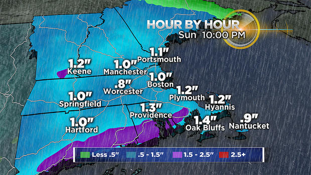
Rain totals for Oct. 27. (WBZ-TV)
RAIN:
This weather-maker will not release copious amounts of rain like the preceding gale center of Oct. 16-17. Instead, widespread 0.75-1.25 inches of rain is anticipated with a few spot totals exceeding that range amount.
TIDES:
Due to astronomical conditions, namely a new moon, the high tides are extra high the next few days. Building waves up to 5 to 9 feet is expected this afternoon into the evening with a subsiding sea tomorrow. The strengthening wind over the Cape this afternoon will be decreasing later this evening before the high tide close to 11:30 p.m. There may be some splash-over on the more vulnerable shore roads down there with some spotty minor lowland flooding. For all coastal areas, the highest scheduled tides up to 12 feet occur during the midday hours tomorrow, Tuesday and Wednesday. During that period, the onshore wind will be relatively light compared to this afternoon and early evening. As a result, some minor lowland flooding in the usual susceptible areas is anticipated.
Please keep apprised of forecast updates on WBZ-TV, CBSBoston.com and now CBSN Boston!