Scattered Thunderstorms Will Finally Break New England Heat Wave
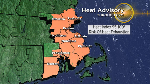
BOSTON (CBS) – Are the heat and humidity wearing on you? Wednesday is the fourth day of our heat wave, and heat index values will once again climb into the 95 to 100 degree range later on this afternoon.
The same rules and tips apply as the past several days. Stay hydrated, find shade if you're outside, take a break in the air conditioning if you can, wear lightweight amd light colored clothing and check on those who need it.
We can now say that this July is the hottest on record for Boston. Some relief is on the way.
The relief will be ushered in by a cold front, which will spark scattered thunderstorms this afternoon. Not every community will see a storm, and not every storm will become severe – but there is a chance that isolated damaging cells will develop.
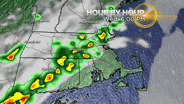
Keep an eye to the sky - a severe thundestorm watch was issued for most of Massachusetts until 9 p.m. Brief damaging wind gusts, localized flooding and frequent lightning are the greatest risks in storms that develop today. If you're outside, have a backup plan to seek shelter indoors if necessary.
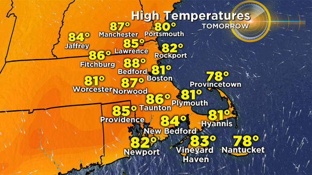
As for Thursday? No more 90s, and no more oppressive humidity. Highs will top out in the 80s region wide, "coolest" at the coast where local sea breezes kick in. I can't rule out a brief shower along that sea breeze boundary tomorrow, but it's a low risk.
Stay cool and stay tuned to WBZ for updates on-air and online as warranted later on today.