One More Day Of Stifling Heat And Humidity
Hang in there and please take it easy through the rest of this weekend! We have just one more day to deal with this stifling heat and humidity before relief arrives!
The Excessive Heat Warning was posted by the National Weather Service on Friday, and it remains in effect through 8 p.m. Sunday! The criteria for this warning is that a heat index in excess of 105 degrees is expected for more than three hours per day for two consecutive days or a heat index of more than 115 degrees for any period of time.
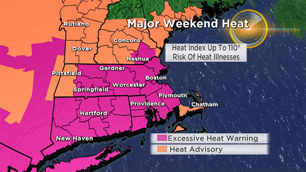
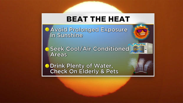
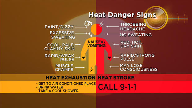
A heat index above 105 degrees is considered dangerous. Use common sense during this harsh weather regime. Avoid strenuous work and exercise and prolonged exposure to the direct sunshine. Seek shade and cool, air-conditioned areas. Stay hydrated with water. Don't mess around with this intense heat and sticky combination. Don't act foolishly and play invincible! Avoid heat-related illnesses and become familiar with the various danger symptoms. It is tough for the body to recover and become energized when the overnight temperatures fail to fall below 80 degrees in oppressive humidity. Fans, air-conditioning and applying cool, wet cloths are beneficial.

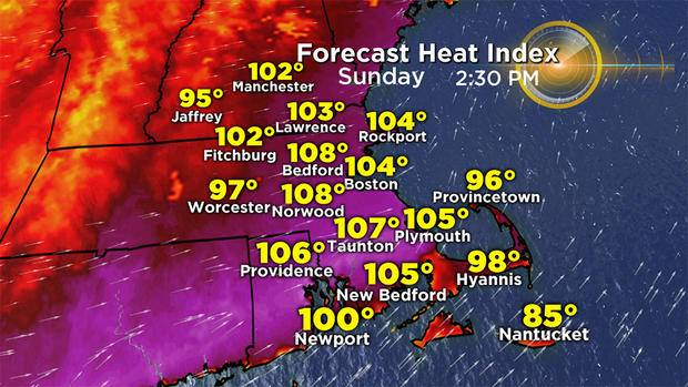
Thanks to some clouds around the high temperature did not strike 100 in Boston on Saturday, but it was close! It maxed out at 97 degrees at 3:45 p.m. This makes Saturday the hottest day of the year so far. However, Sunday will be even hotter by a degree or two. I'm expecting a maximum temperature of 99 degrees, which would make it the city's first heatwave of 2019, following Friday's 93 and satisfying the three consecutive days of 90 or higher criteria. Factoring in the insane humidity, the heat index will exceed 105 and approach or briefly surpass 110 in places! The index will max out in the afternoon between 1-5 p.m.
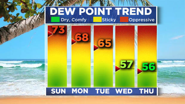
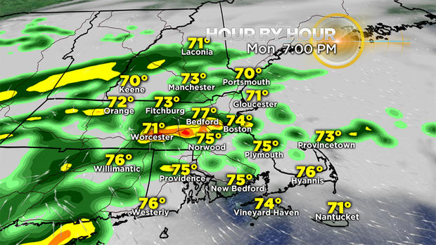
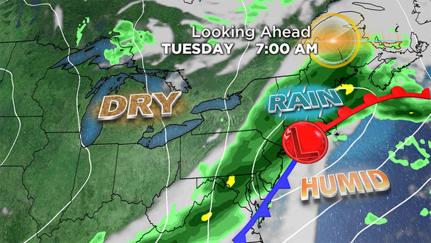
Before this heatwave commenced, we were given a great gift last Thursday, when a refreshing day of clouds, much lower humidity and cool air rejuvenated us. When will the next relief arrive? After another scorcher Sunday, it will be less humid and not so hot on Monday. Showers and storms will break out, mainly in the afternoon. A wave of low pressure will deliver more widespread rain and thunder over the region Monday night into Tuesday morning. Much more refreshing air will make us happy Wednesday, and that will last through Friday. Next weekend will turn out humid again but not oppressive like this weekend.
Take it easy and try to stay cool!
Check our updates here at cbsboston.com and on WBZ-TV.