Severe Thunderstorms With Wind And Hail Possible On Sunday
BOSTON (CBS) – After Saturday's showers and storms featuring localized torrential flooding rains, hail, gusty winds to 50-60 mph and dangerous cloud to ground lightning, the stage is set for another round on Sunday afternoon.
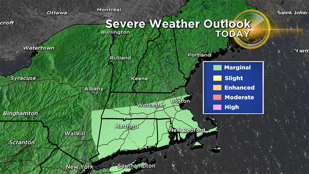
Once again, the action will be spotty as these hit and miss storms migrate about a mid and upper level low pressure system over the eastern Gulf of ME. The atmospheric environment has some dissimilar characteristics to yesterday's parameters but the bottom line is that there are trigger mechanisms in place to ignite some action. The Storm Prediction Center has shrunk the area of marginal risk for severe thunderstorms and it is one notch lower than the slight risk which was advertised yesterday.
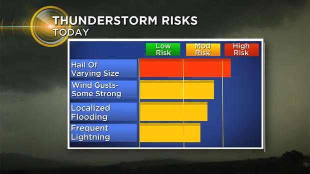
With a pool of unusually cold air aloft passing over the region this afternoon, the main threat from some of these storms is the production of hail of varying size depending upon updraft strength. Pea-sized hailstones possibly up to as much as 1 inch in diameter are probable in scattered locations.
Select cells may release brief wind gusts- some of which could reach or exceed 50 mph. Any localized downpours can create flooding in poor drainage areas. When thunder roars, go indoors and always beware that a sudden cloud to ground lightning strike can happen without warning from any prior rumbles of thunder! Rotation is not anticipated so the risk of any tornado is very low.
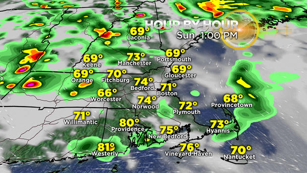
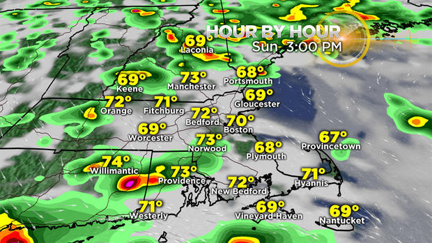
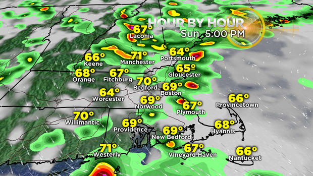
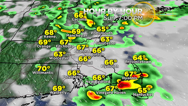
These timeline visuals only serve as a generalization of the scattered nature of the activity for the rest of the afternoon into the early evening. The graphics are not intended to show the precise locations of every cell because they are all in a state of flux. Timing and intensity changes are frequent. You get the idea that much of the time, many areas will be dry. There will be no widespread long-lasting rain anywhere.
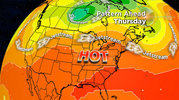
After today, the first week of July looks summery. Initially, the humidity will be relatively comfortable but that will change as steering currents propel stickier weather into the Northeast starting later Wednesday. There will be a noticeable spike to high humidity on Thursday and oppressive conditions on Friday into Saturday morning. All signs point to temperatures reaching or slightly exceeding 90 degrees by the 4th of July. If all goes well, the next round of thunderstorms will not strike until Friday enabling reasonably good viewing of fireworks displays Wednesday evening and Thursday evening.
Have a happy and safe Independence Day week!
Keep an eye on the sky and check updates here on cbsboston.com and on WBZ-TV.