A Look Ahead Through The Rest Of March
BOSTON (CBS) - Well, March is off to a mid-winter kind of start! After our biggest snowfall of the season and several days of much colder than average air, the only thing that feels like spring is coming is the sun angle and increasing daylight. Are we in for another March in the trenches, or just an early blip on the road to spring?
With a few quiet days in weather department I thought I'd jot down a few notes for the next several weeks.
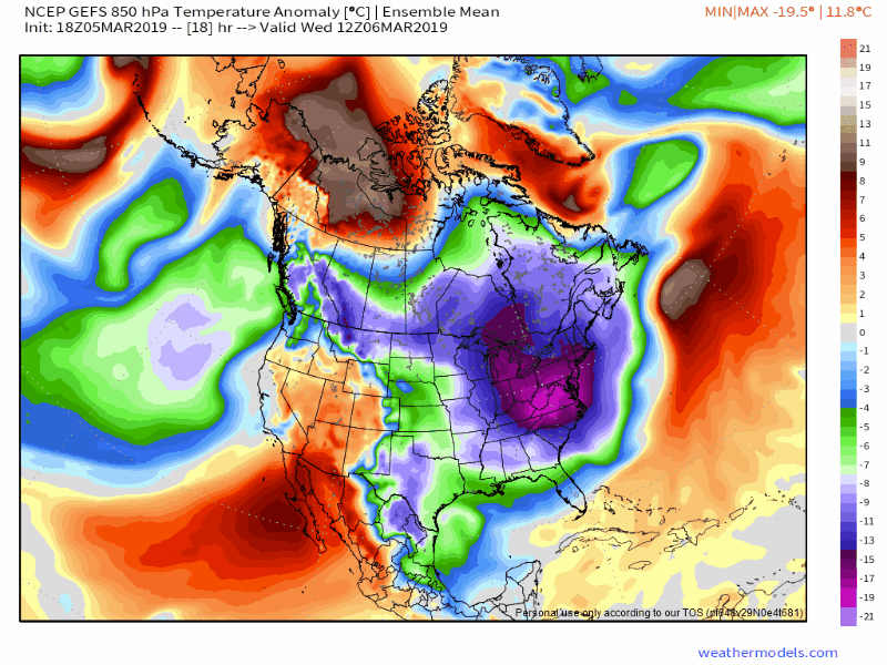
We all know that March can be one of the more frustrating months of the year. It feels like we're so close to daffodils and warmer days but there are all sorts of wintry spurts still in the tank. This opening week will rank among one of the colder ones in recent times for the Boston area. No daily records will be set but the departure from average will be significant enough to make it hard to finish the month warmer than average as a whole.
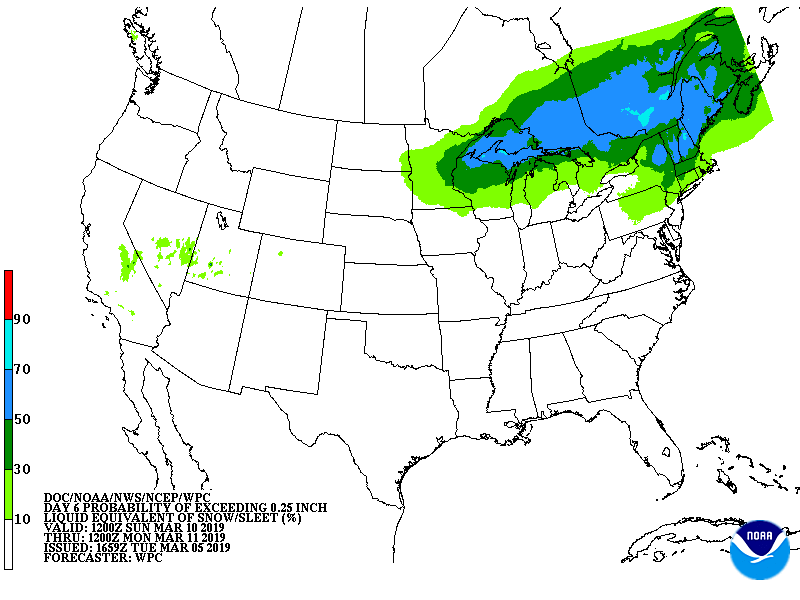
The WPC favoring accumulating wintry precipitation across interior sections of New England on Sunday, which seems likely even with a storm that will track up through the Great Lakes.
But at least we can notch a few mainly dry days! Those have been hard to come by since the middle of last summer.
The next storm of interest heads our way on Sunday and will have some wintry aspects. As high pressure noses down from Canada, there should be enough low-level cold air to help this one start off as a wintry mix of snow/sleet/freezing rain, especially away from the coastline. It may be a battle to kick out that low-level cold on Sunday far to the north and west, but coastal communities and locations south of the Mass Pike will likely change to rain quickly. If you're looking to clear out some snow, this should help a little. A period of temperatures in the mid 30's to mid 40's plus some rainfall should soften up the snow pack and then it'll be ripe for more significant melting on Monday, where temperatures will make a run toward 50 degrees.
Next week favors near or warmer than average temperatures as a whole.
This most recent arctic blast will have moved on with ridging building in behind it. Monday looks the mildest, with a chillier shot diving down for Tuesday and Wednesday and then track another inside-runner type of storm track late in the week. The Bering Sea Rule (BSR) also supports this west-of-New-England type of track, which should bring with it another milder push of air.
It would be pretty surprising if there was much in the way of snow around in the Boston area by the end of next week, unless there is an unforeseen change (always possible especially in a volatile month such as this!). That rapidly increasing sun angle can do a lot of work with temps in the upper 30's to upper 40's. We're gaining nearly 3 minutes of daylight every day, the most rapid gain of any month of the year. Next week also looks like a great one for maple producers!
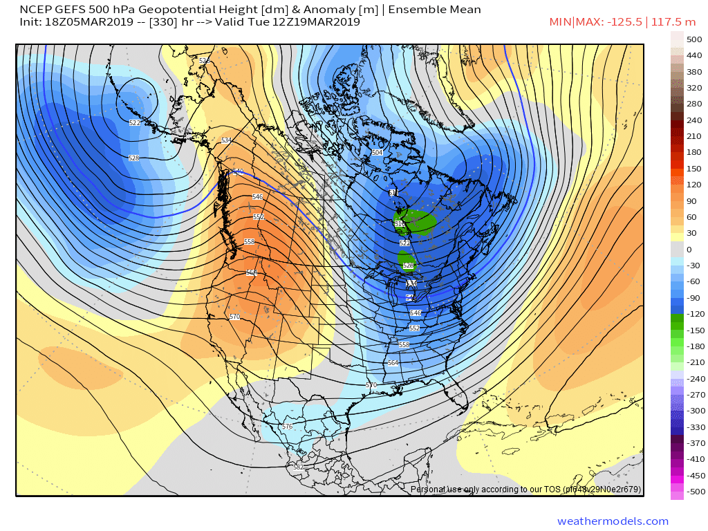
Heading past St. Patrick's Day weekend, we may get one more dance with winter.
Some of the guidance we look at favors a +PNA, or ridging building up across western North America. Yet again there is very little in the way of any Atlantic blocking, but we may be able to stir up a snow threat in this third week of the month along with some chillier temperatures.
By the third week of March, an average high in Boston is in the mid to upper 40's. So even cold shots aren't exactly frigid. Just another bump on the road to spring. I always think of this season as two steps forward and one step back until May.
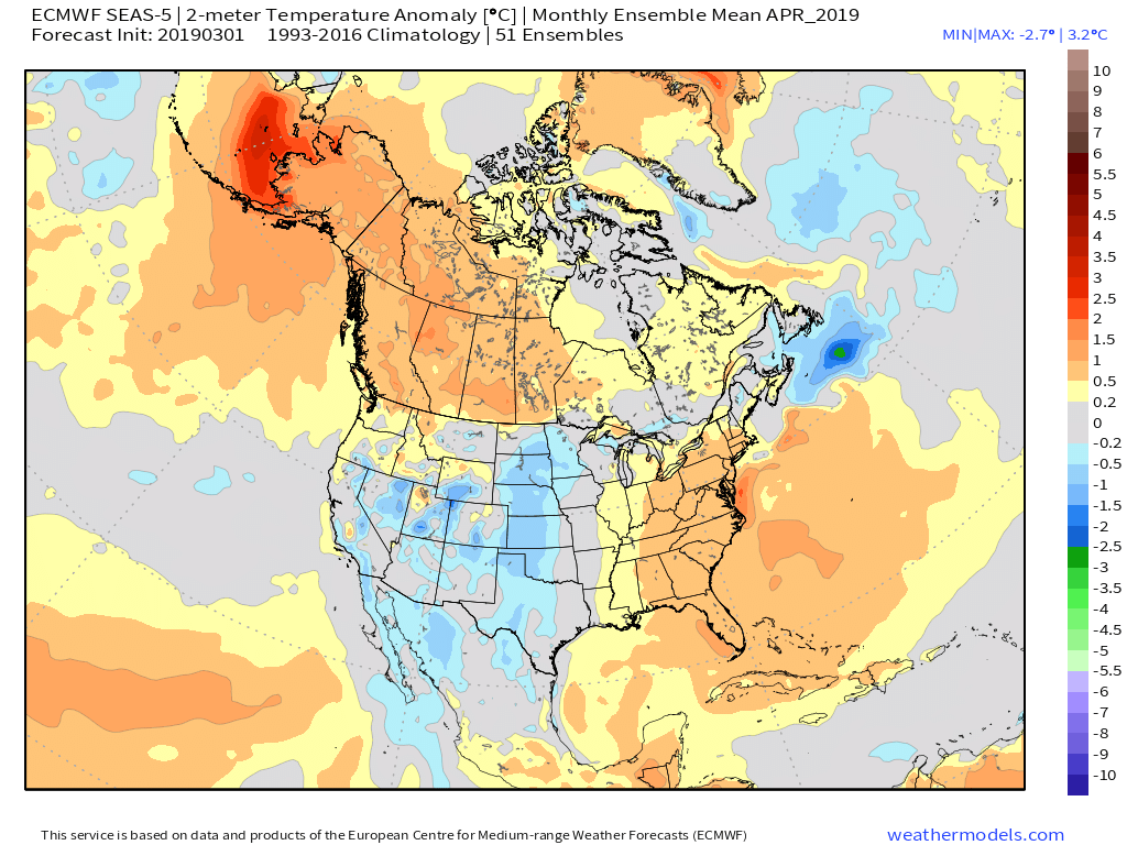
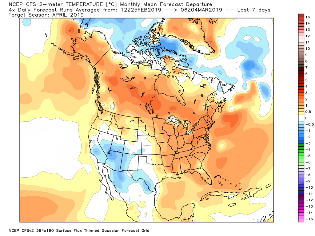
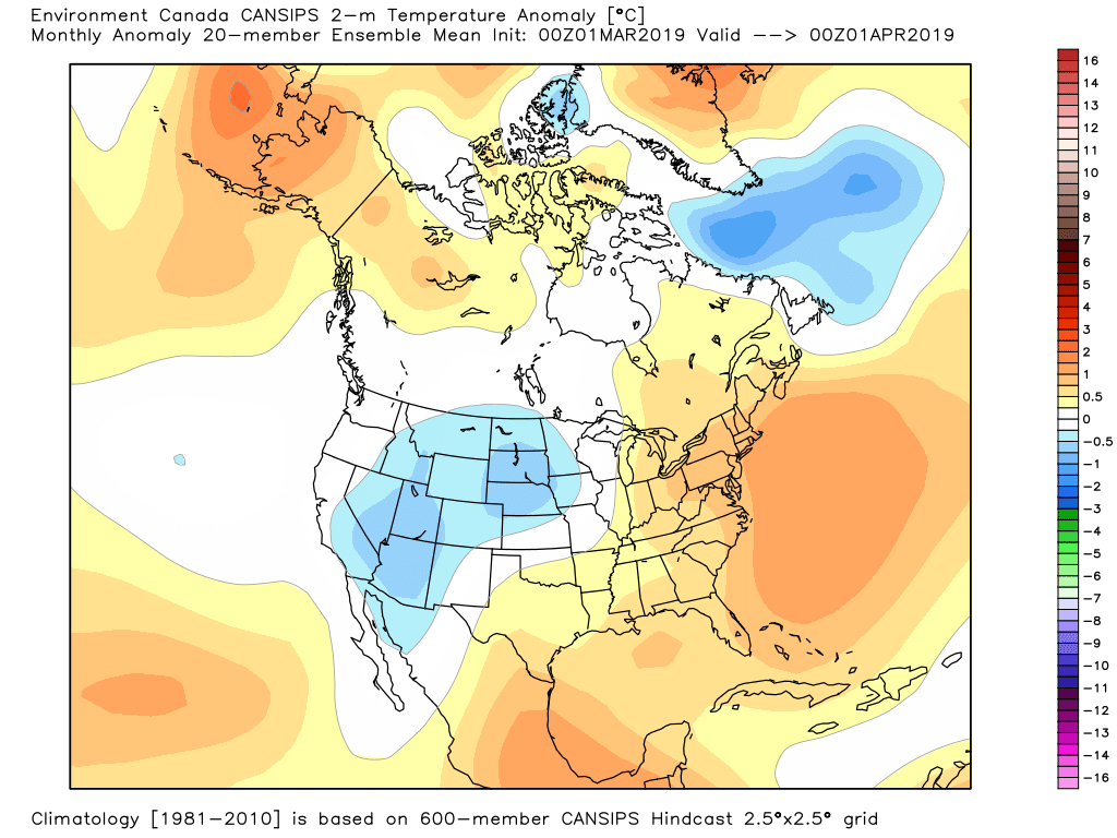
If you really want to look farther out, I've been taking a peek at some of the seasonal guidance for April.
We all know how last April went - a miserable slog of cold rain and wet snow with barely any sunshine. It was rough. I don't forsee a repeat performance this year.
Guidance from the CFSv2 to the Euro SEAS-5 and the Canadian CanSips are all in good agreement about the overall pattern, favoring warmer than average conditions in the eastern U.S. There are also indications of a very strong polar vortex coupling with the troposphere soon, which may settle down some of these major arctic outbreaks that have been dominant over the past 5 weeks.


