Storm Dumps More Snow Than Expected, But Several Inches Should Melt Before Freeze
BOSTON (CBS) - March Madness? Call it what you want but suddenly March is becoming the new February.
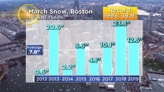
While we may not top the 23.3 inches of snow last March, we are off to a heck of a start with 10.6 inches of new snow in Boston Monday morning.
This is by far our biggest snowstorm of the entire season and it will be our biggest storm since last March 13th when Boston got 14.5 inches.
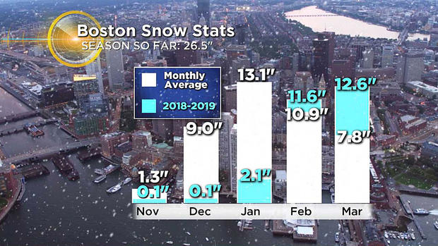
In fact, Boston will have more snow from this one storm than the entire season preceding it.
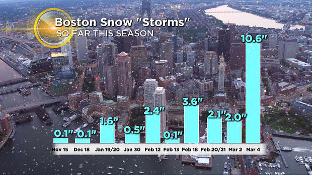
And, prior to today, the biggest single storm in Boston this season was back on February 18th when we had 3.6 inches. This storm more than doubled that output.
The heaviest snow in this storm fell right in Boston and areas just south and west - a swath of 10-to-16 inches So why the over-production compared to forecast?
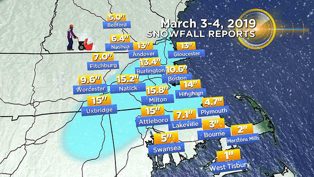
A very heavy band of snow developed between 1 and 5 a.m. right over those areas, dumping as much as 2-to-4 inches per hour! Many towns picked up 4-to-6 inches in just a couple hours, incredible snow production in a very short period of time. This was due to a rapid deepening of the storm as it passed by our latitude, not quite what we would call bombogenesis, but a very powerful storm nonetheless.
Now for some good news. Conditions will be very pleasant for the post-storm cleanup.
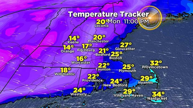
Temperatures will rise as the storm passes Monday morning and sunshine will emerge as well. Temperatures will be above freezing in all of southern New England by late morning, hitting 40 in many areas. We will lose several inches of snow due to melting today alone.
And more good news - while it will be quite chilly for the remainder of the week, we will be storm-free. Likely no precipitation until sometime next weekend.
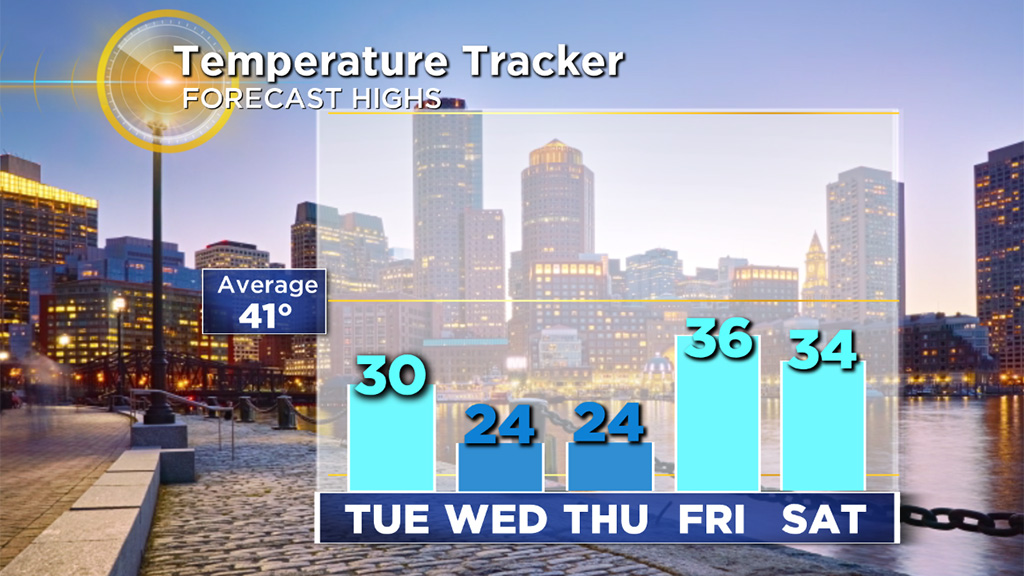
Melting will be a slow go after Monday though. High temperatures the rest of the week will be stuck mainly in the 20's (Tuesday through Thursday).
In fact, we may challenge a few low-max temperatures records on Thursday (the current record in Boston is 22 degrees set back in 1913).
Follow Terry on Twitter @TerryWBZ


