One Storm Leads To Another: More Snow Coming Sunday Night
BOSTON (CBS) -- March is definitely coming in like a lion as we face a one-two punch this weekend from a couple storms impacting the region.
STORM 1
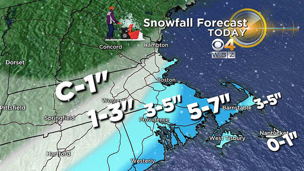
However, like its predecessors, this first one is just another underperformer but it is creating a snowy scene across much of southern New England especially southeastern MA onto Cape Cod where the snow is heaviest and the north-northeasterly wind is the strongest up to 30-40 mph in gusts. Farther inland there is only a cold breeze at times so this is not a blockbuster rather just a sideswiping storm as the center passes well south-southeast of Nantucket. Its east-northeastward track is pushing the greatest potential volume of precipitation out to sea thus warranting the revision downward of some of the projected snow amounts Friday night and early Saturday morning.
Timing:
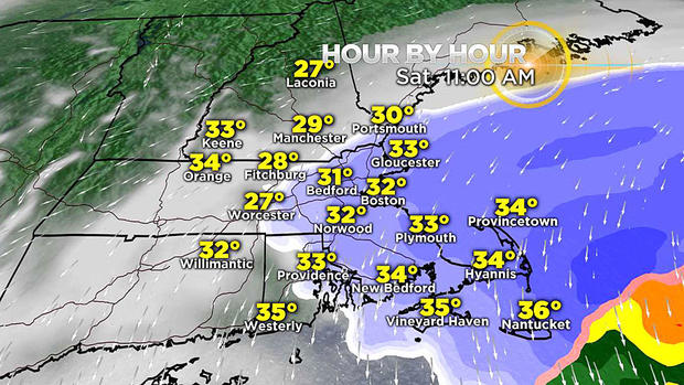
The shield of snow will steadily shift east-northeastward with the back edge exiting most of the coastal plain around 1-2 p.m. Any lingering snow showers after that should be moving offshore. The sky could brighten leading to a few splashes of sunshine developing mainly farther west of Boston later Saturday afternoon.
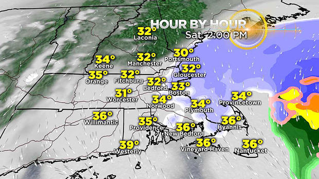
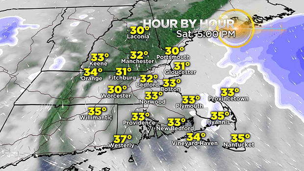
The meager amounts of snow from a coating to an inch or two exist farther west and northwest of Boston while snow will accumulate a few more inches to totals of five-to-seven inches over southeastern Mass. onto Cape Cod. Most of the accumulating snow down there will be completed by noon or so. The wind will decrease along the coast later this afternoon
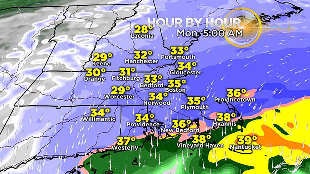
STORM 2
The next storm will also be quite progressive and it will contain more moisture and energy so I am expecting a bigger production. Its track is not etched in stone yet and that is important because a rain/snow line will cut somewhere across southeastern Mass.
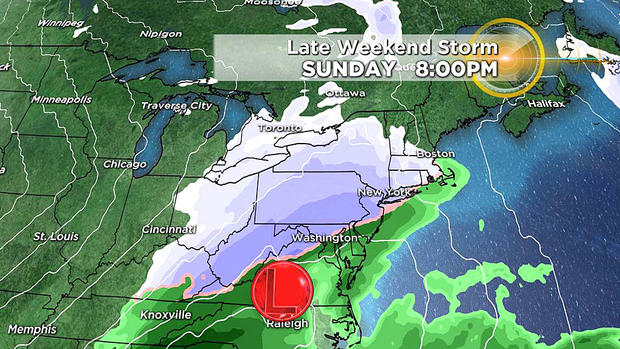
Slight adjustments in the precise positioning of that line will create a much different scenario for a portion of the region. Fresh model guidance in the next 24 hours should add more clarity to the unfolding situation but based on present consensus, this is the projection on timing and amounts.
Timing:
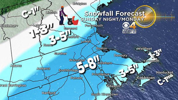
Much of Mass. will be in the zone of highest snowfall and it will be a high density, sticky, heavier-weight snow to deal with.
It is expected to start Sunday around mid-evening and taper off near the beginning of the AM commute on Monday.
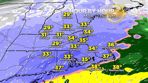
School cancellations and delays are expected in many communities.
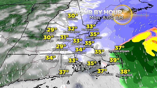
The exiting storm will be followed by some clearing leading to a mix of clouds and sunshine and temperatures rising into the middle 40s supporting some melting. After that, very cold air will rush in for Tuesday through Thursday with high temperatures about 15-20 degrees below the average for early March!
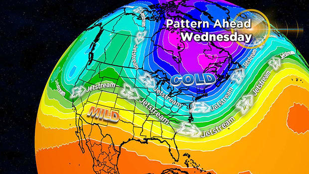
Perhaps after that anomalous cold, warmer weather will arrive by the middle of the month.
Check for updated forecasts here at CBSBoston.com and on WBZ-TV


