Plowable Snow Coming Wednesday Night Into Thursday Morning
BOSTON (CBS) -- February ain't going down without a fight. Wind chills are bottoming out below zero and there is a plowable snowfall on the way.
While it certainly won't be a big storm, it will feature something we have seen very little of this season: Light, fluffy snow! No sleet, no freezing rain, just some fresh, easy-to-move powder.
And, like just about every other storm this season, most of the flakes will fall overnight, in-between commutes.
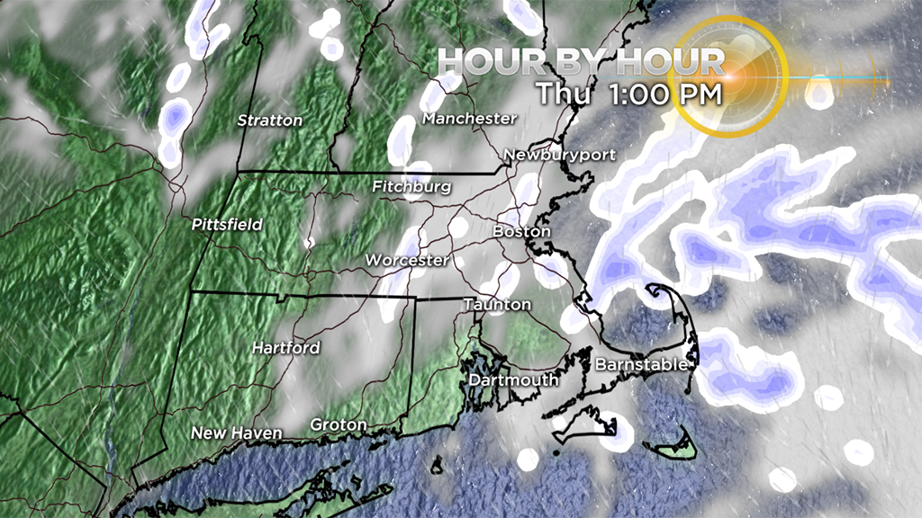
First Flakes:
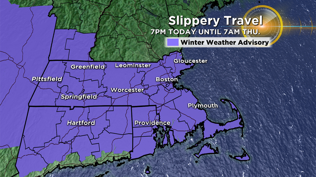
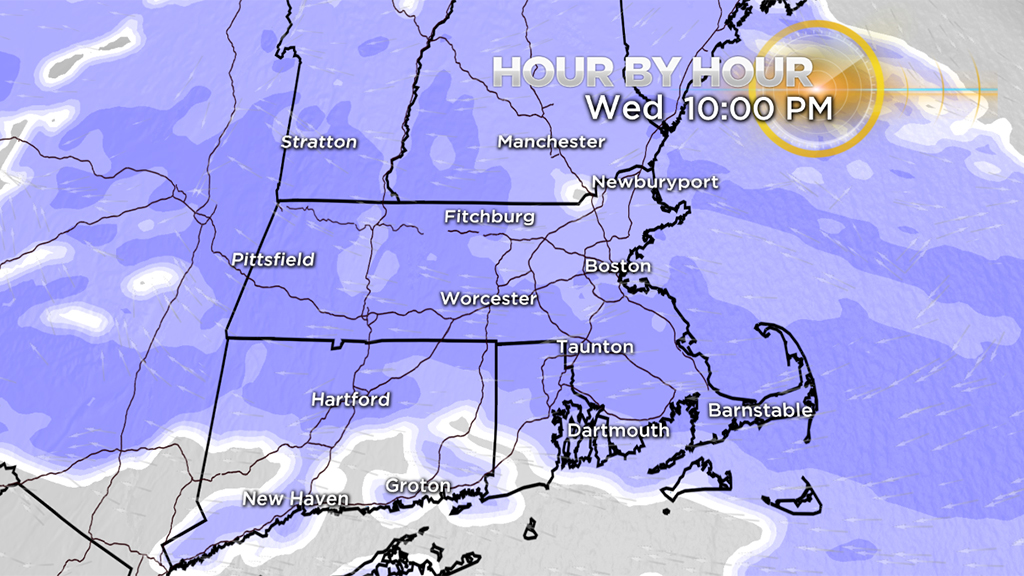
Snow begins from west to east between 6 and 9 p.m. Expect a start time around 7 p.m. in Worcester and 8 p.m. in Boston.
Steady Overnight:
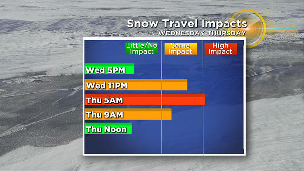
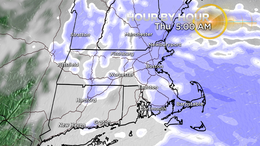
All the accumulation and steadiest snow will fall in the overnight hours, generally between 10 p.m. Wednesday and 5 a.m. Thursday.
Snowfall rates will generally be light to moderate, nothing all that heavy. And, with temperatures in the teens and 20's, the snow will be very light and fluffy. That being said, road treatments have a tough time working with colder air in place, so certainly plan on slippery travel and snow covered roads during this time frame.
Outta Here Quick:
The steady snow tapers to flurries by 7 a.m. Some pockets of light snow showers will continue in eastern Mass. Thursday afternoon, but won't result in much additional accumulation aside from some coatings here and there.
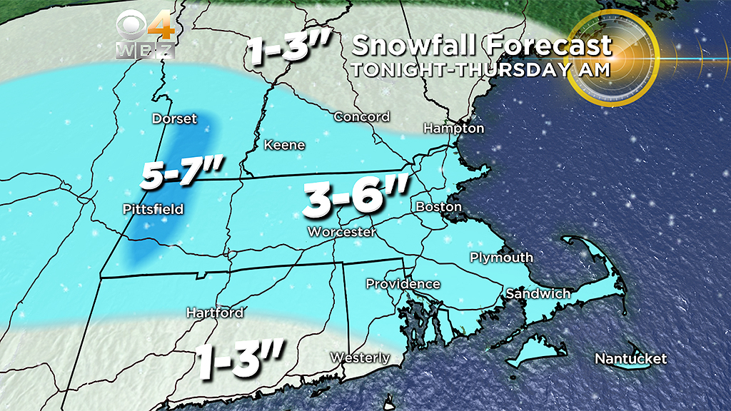
Light Amounts:
Once again we are talking about a very modest snow accumulation.
A widespread 3-to-6 inches for most of eastern Mass. with 5-7 inches in parts of the Berkshires. Break out the shovel or snowblower before work. It will be a quick and easy clean up.
In Like a Lion:
February is going out with wind, cold and snow. Will we turn the page to spring with March arriving Friday?
Come on, you know better than that!
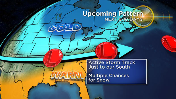
March will be March and like so many other years in recent memory, winter will stick around a while. We have several storm threats through at least the first 10 days and plenty of cold air still hanging around.
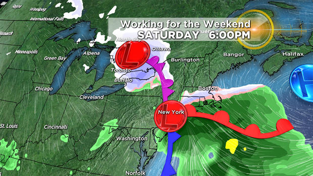
Saturday is our first shot at some "March Madness." A jumbled mess of a storm system will attempt to get its act together as it passes by to our south. We will likely at least be grazed by some precipitation during the day on Saturday, odds favor a mix of rain and snow.
Being the closest to the storm, southeastern Mass. has the highest threat of the steadiest and heaviest precipitation. At this point, this does not look like a major event, it will certainly be fast moving, already well past New England Sunday morning. More on this to come in the next 48 hours.
Right on its heels, yet another storm threat for Sunday night and Monday.
As of this writing, this storm has the biggest potential of the bunch. While it is still too far away for details, (it could still very easily be a miss), this one has a mini-nor'easter type look.
If you read this blog Monday, you may remember we were keying on a mid-week storm more than this one. That just goes to show how much day-to-day variability there is in this pattern.
Lots of action and models are having a hard time deciding which storms to strengthen and which to disregard. The bottom line - the next 10 days should be interesting. Spring remains on hold for now.
Follow Terry on Twitter @TerryWBZ


