Minor Mess Early Sunday Then A Busy Weather Week
BOSTON (CBS) -- While the National Weather Service has posted a Winter Weather Advisory for northern MA northward during the early morning hours of Sunday, it should be just a brief period when roads could become slippery before the changeover to plain rain and a gradual temperature rise.
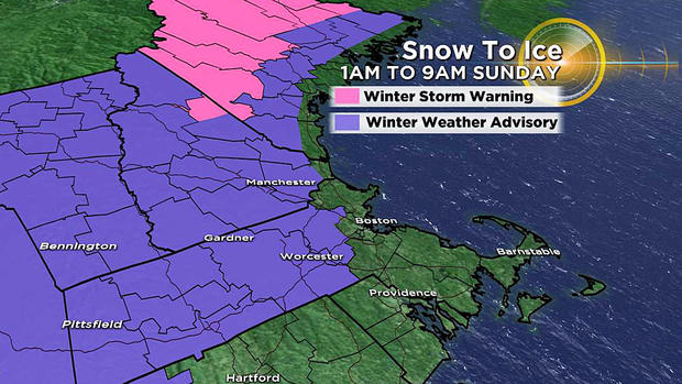
The farther north you might be traveling Sunday morning, the trickier the traveling will be as the spell of snow and mix will linger longer.
TIMELINE
Despite the milky sky Saturday afternoon, the precipitation will not break out until at least a couple of hours after midnight so the roads will be dry in most all locations if you're planning to go out for Saturday evening.
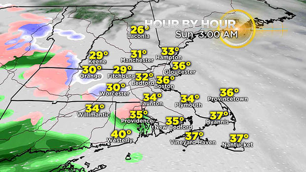
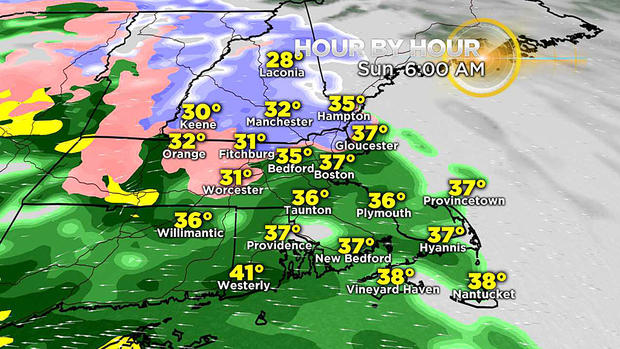
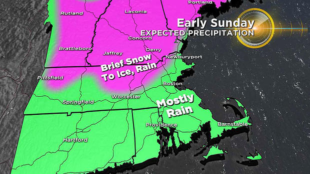
The snow and mix zone will develop across northern MA mainly near or after 3 a.m. and last for only two to three hours as the rain line nudges northward. The snow and icy mix will last through much of the day across the northern mountains.
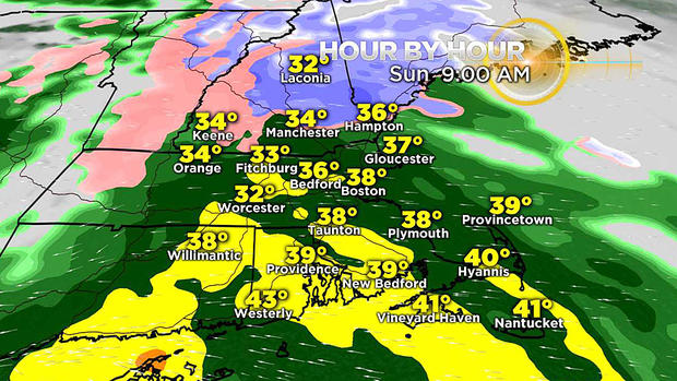
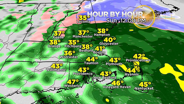
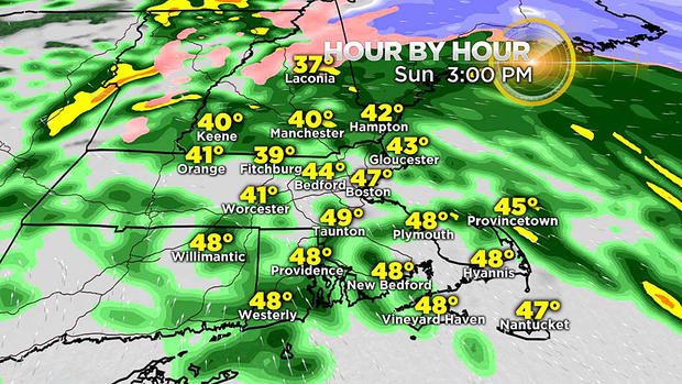
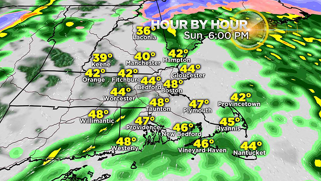
The rainfall intensity will be variable but mostly in the light-to-moderate range with a few embedded heavier downpours into the afternoon. It should taper off to scattered showers deeper into the afternoon and a complete ending takes place in the early evening.
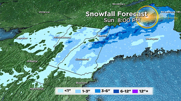
RAINFALL & SNOWFALL
Most locations will receive at least a half inch of rain with higher amounts most likely over portions of southeastern MA and Cape Cod & the Islands. Snowfall will be limited to a coating up to a half inch across northern MA mainly along the Route 2 corridor to just across the border into extreme southern NH.
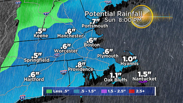
North of that, the amounts will build up to an inch and beyond with the northern Whites and the Western Mountains of ME receiving a few to several inches of snow.
BACKLASH STRONG WINDS
Once the departing storm is beyond our longitude, it will be reorganizing over the Canadian Maritimes. The tight pressure gradient meaning a large difference in air pressure over a relatively small area linked with a strong jetstream will generate strong, howling, damaging wind gusts exceeding 50 mph.
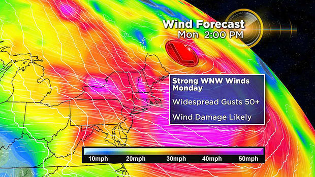
The wind will ramp up late tomorrow night and max out from mid-morning into the afternoon hours of Monday. Gusts exceeding 50 mph will result in scattered tree damage with branches and limbs coming down and perhaps even some entire trees!
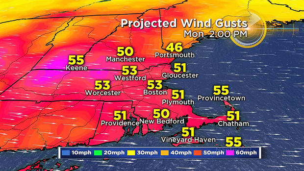
Consequently, be aware of this potential danger and be prepared for some spotty power outages. It will still be windy but it will be less ferocious on Tuesday into Wednesday.
The exiting storm will also tap another chunk of Arctic Air in Canada. The 'Real Feel' temperatures will drop into the subzero zone by late Tuesday and lasting to about midday on Wednesday.
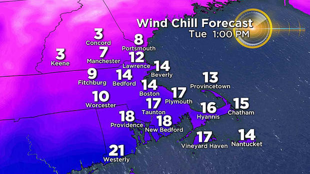
The thermometers will reveal high temperatures around 25 on Tuesday and closer to 21 on Wednesday afternoon!
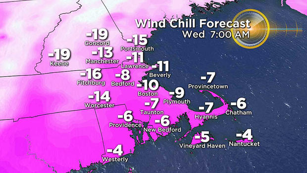
The lowest high temperature on record for Wednesday, February 27 is 14 degrees set way back in 1886 so it will not be a record-breaking blast but cold enough!
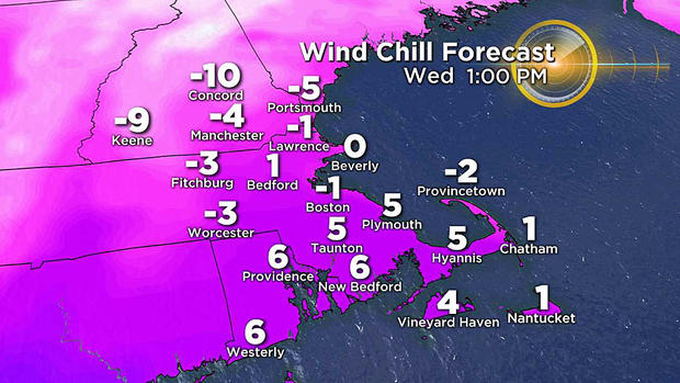
Once this batch of frigid air bypasses the region on Wednesday, it will still be cold but the wind will be much more tranquil Thursday morning. After that, temperatures will bounce back to average or above next weekend.
Check weather updates here at cbsboston.com and on WBZ-TV.


