Snow Storm Tuesday To Make Mess Of Afternoon Commute
BOSTON (CBS) - We've got you on a Storm Watch Weather Alert for impactful weather heading our way. Moisture and energy are gathering in the southern Plains, forming what will be our storm for Tuesday.
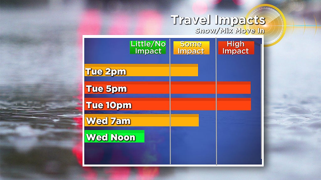
This will be a high impact event for the evening commute. So let's break down the details.
TIMELINE:
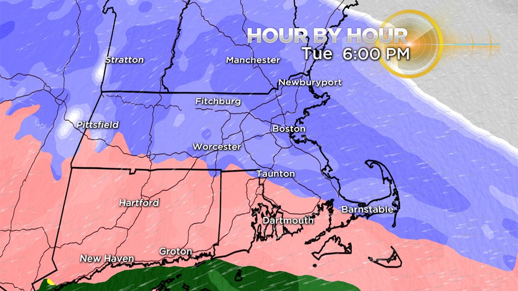
The blue-shaded zones indicate snow, the pink ones indicate sleet and freezing rain and the greens/yellows/oranges represent plain rain.
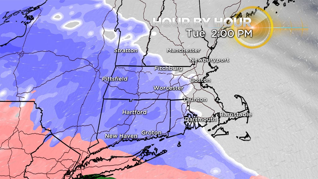
Snow arrives southwest to northeast, moving into Worcester around or just before 2 p.m. Tuesday and into Boston around 3 p.m.
The intensity of the snow will ramp up fairly quickly, with moderate to heavy snow expected for the evening commute. The worst of the travel will be during this time frame with snowfall rates of 1-to-2 inches an hour in spots and limited visibility.
Roads will quickly become snow-covered and slippery during the ride home.
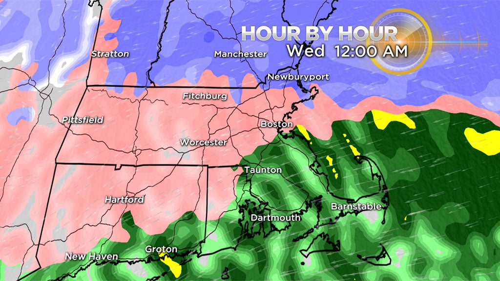
Snow will transition to some sleet and rain from southeastern Mass. northwestward into the Boston area and gradually into the western suburbs to eastern Worcester County during the late evening and overnight.
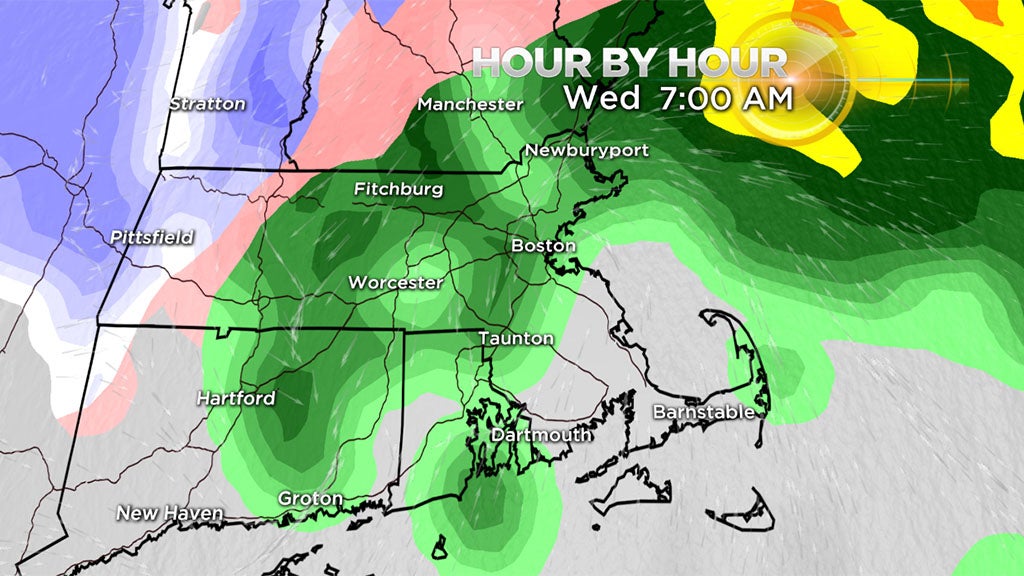
By Wednesday morning, precipitation will be winding down and exiting the region by mid-morning.
SNOWFALL:
All locations including Cape Cod and the Islands will receive a thumping of snow on the front end. As per usual, the length of that period of snow will be shortest on the Cape and longer farther and farther northwest of Boston.
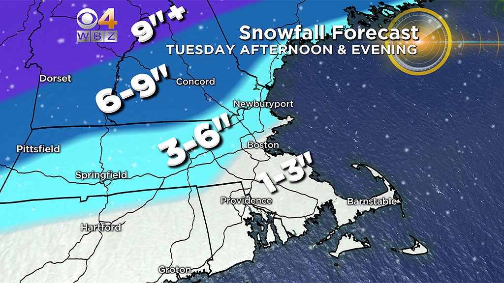
1-to-3 inches: Boston to Providence and areas south and east, all washed away in the end
3-to-6 inches: Areas north and west of 128 and mainly north and west of 495. Again, in the end the snow is severely compressed by ice and rain.
6-to-9 inches: Northern Berkshires, southwest NH, Vermont and all points northward into ski country. Many of the northern peaks could see upwards of a foot.
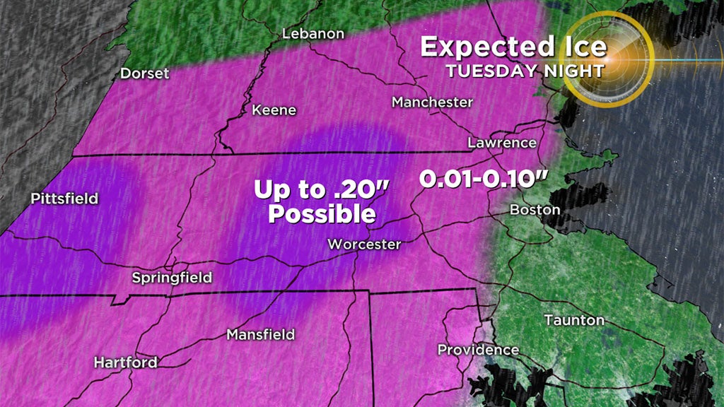
WIND:
The wind will be freshening and may increase to gale force Tuesday night into Wednesday morning as the center of strengthening secondary storm churns up over southeastern Connecticut to northern Rhode Island and close to or just south of Boston.
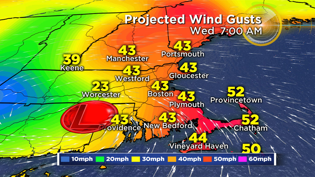
It will blow from the northeast and east but south of the storm track. It will become strong southeast to southerly for a time early Wednesday over southeastern Mass. and the New England south coast. As the system tracks over the Gulf of Maine, the gusty wind on the back side will be blowing from the west everywhere Wednesday afternoon.
REVIEW & PREVIEW:
So what's going on with this winter? Above average snowfall was forecast in our outlook last November!

Are we in for another back-loaded winter again or is spring just around the corner this time? Join us for our weather team thoughts on WBZ-TV News at 5 p.m. Monday.