Spring Fever Is Going To Be Interrupted By Freezing Rain
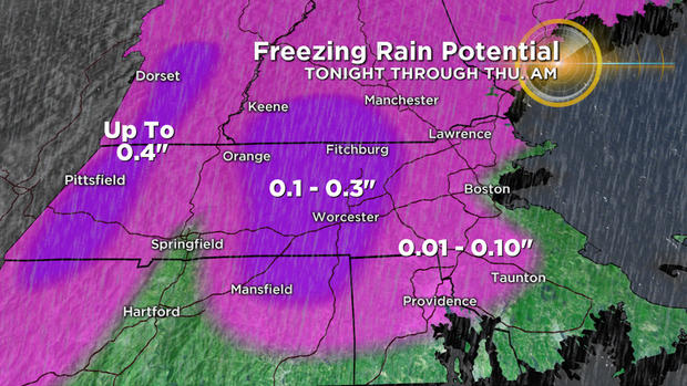
BOSTON (CBS) - We interrupt this edition of "spring fever" with a brief winter announcement. No, it isn't snow, but freezing rain will make for some tricky travel late tonight and early on Thursday. A quick-moving, fairly weak storm will only produce about a half inch of precipitation, but it doesn't take much ice to cause some serious issues.
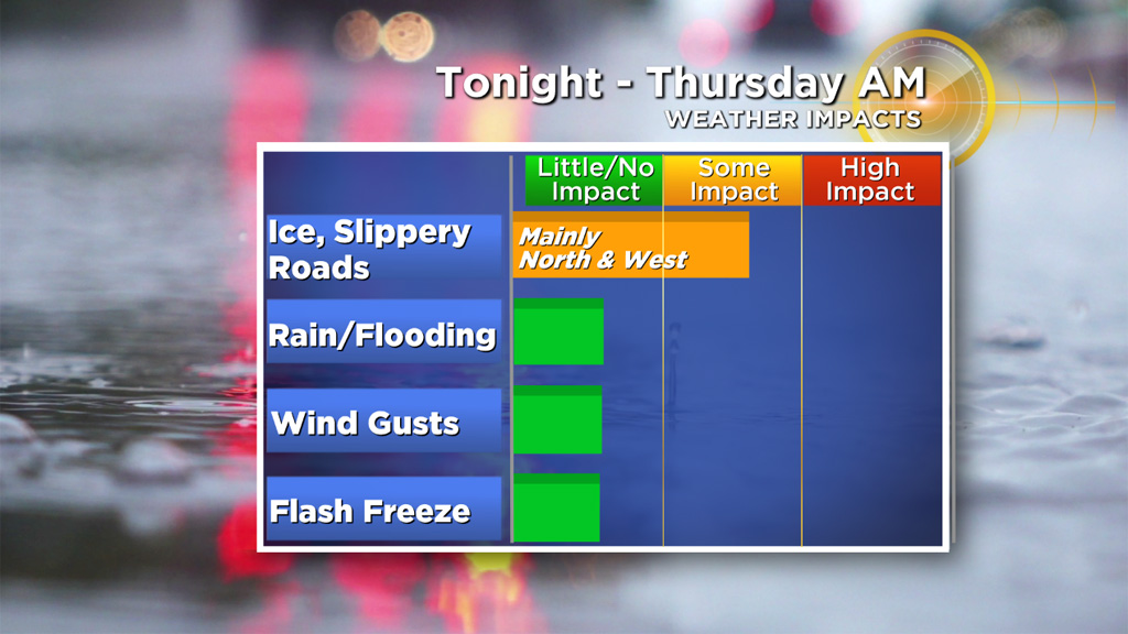
The rain arrives between 8-11 tonight. It will be warm enough "aloft" (above ground level) for just plain 'ol rain. However, temperatures at the surface (where we live) will be very borderline. Most areas away from the immediate coastline and north of Plymouth and Providence will drop a degree or two below freezing. . . just enough for the rainfall to turn to ice as it makes contact at ground level. Downtown Boston, the immediate North and South shores and the South Coast/Cape will all stay above 32 degrees and, therefore, receive only rain.
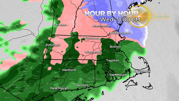
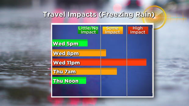
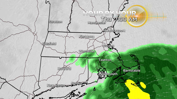
The steady precipitation lasts about six to eight hours, tapering down to a drizzle or sprinkle by Thursday morning's commute. At the same time, temperatures will tick up a few degrees in most areas after 6 a.m., leaving only a few scattered locations still in the "icing zone."
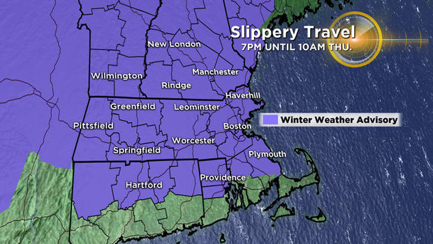
Those areas we are most concerned with include Worcester County and the Berkshires. Ice may accrete up to a quarter inch or more on trees and power lines in those elevated areas.
So, if you are headed out late tonight or early Thursday, be aware that there may be some slippery surfaces (especially early on) outside your door, on your driveway and on untreated roadways. That threat decreases with each hour that passes by Thursday morning.
The remainder of Thursday will be cloudy with some scattered rain showers and pockets of drizzle. Then, another quick warm-up, along with a few more rain showers, on Friday. Certainly no more icing concerns at that point, with temperatures reaching well into the 50s!
The roller coaster temperature ride continues this weekend with another blast of winter. Highs on Saturday will stay in the 20s for most. Those looking for significant snow will have to wait until our next storm chance which comes around the middle of next week. But, no guarantees at this point whether that will be snow or yet another rainy/icy mix.
Follow Terry on Twitter @TerryWBZ.