Polar Vortex Returns: Arctic Chill Follows Rain, Snow
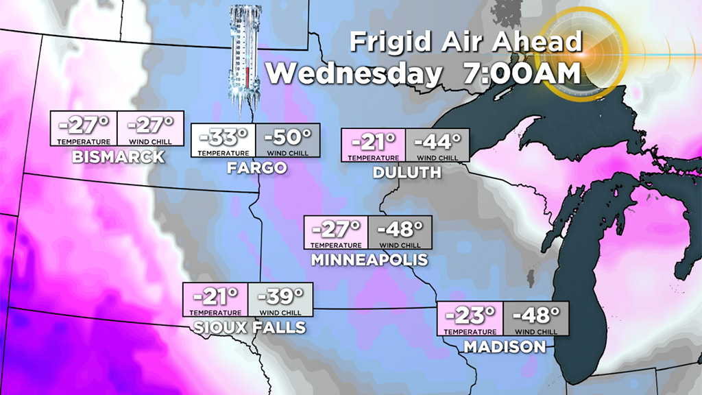
BOSTON (CBS) - It's back! The dreaded and much hyped "Polar Vortex" is once again making headlines. The concern is real for folks in the upper Midwest, the air mass that is descending upon them is literally being displaced right from the North Pole. Thankfully, for us here in New England, we get more of a glancing blow from the Vortex.
But, before the cold arrives, we have a little snow in the forecast. Not a major snow storm by any means, the rain and snow tonight combined with the Arctic chill to follow does make for a busy week of weather ahead.
The Storm
We hesitate to call it a storm, it is really more like a juicy cold front, but nonetheless, it will cause some disruption early on Wednesday.
The first flakes were actually out early Tuesday morning, but not directly from the storm, instead from an onshore wind and unstable atmosphere. Don't expect any accumulation though. Just some light snow and flurries in the air across eastern Mass.
The steadier, heavier precipitation arrives Tuesday night, mainly after 7 p.m. from west to east.
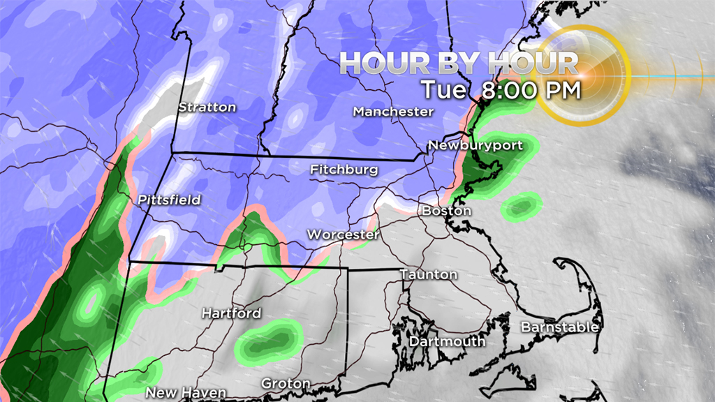
It will come in as mainly snow but change over to rain in most of eastern Mass. overnight as the temperatures gradually rise through the 30's. Then, as it tapers before dawn on Wednesday, it will change back to snow briefly. The unfortunate part of the flip back to snow is it occurs during the early part of the morning commute, generally between 5 and 7 a.m. After that, the sun breaks out very quickly, although temporarily.
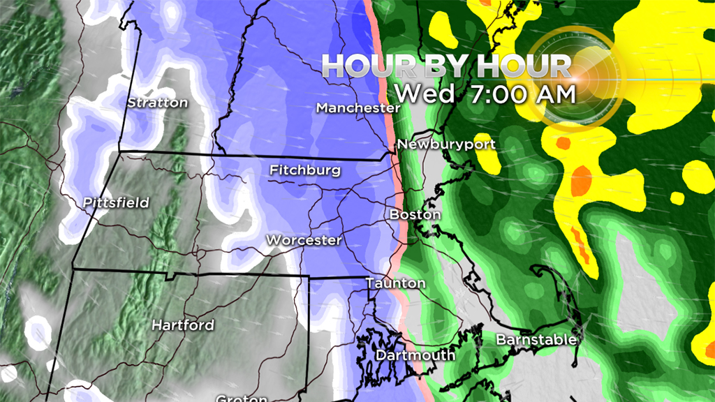
The next round of snow will move in Wednesday afternoon and evening in the form of scattered snow showers and squalls.
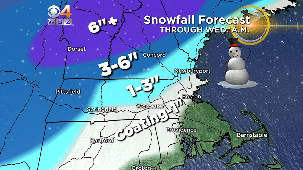
There won't be much additional accumulation, but there will be scattered coatings to 1 inch, gusty wind, brief white-out conditions possible and localized amounts up to 2 inches where the squalls are best organized. Be ready for slippery conditions on the roads during the evening commute where these squalls push through.
Wind and Cold
Again, the harshest of the cold will pass well to our northwest back up into Canada. Temperatures will be similar to that which we experienced back on Martin Luther King Jr day, last week.
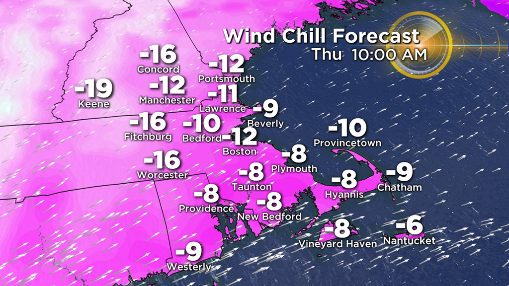
Thursday Morning:
Lows between -10 (well northwest) to +10 (well southeast)
Wind chills will range between -5 and -25
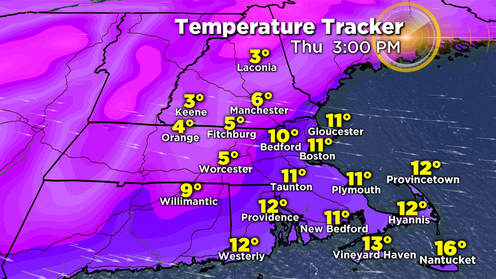
Thursday Afternoon:
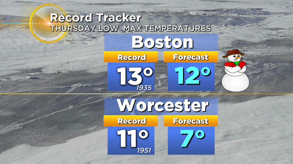
We will challenge record low high temperatures on Thursday. Boston will be very close to the record low max of 12 degrees. Many areas northwest of Boston will stay in the single digits.
Wind chills will average 0 to -10.
Friday and Beyond:
We have another very cold start on Friday but then the recovery begins. Highs in the 20's Friday afternoon, around 30 Saturday afternoon and mid 40's by Sunday.
And what do you know… February is here! Still no major or significant snow in the forecast… yet.


