Heavy Rain, Winds, Flooding Likely To Be An Issue For Evening Commute
BOSTON (CBS) - It feels like spring has sprung with temperatures early Thursday more than 30 degrees higher than they were 24 hours ago. What an amazing turnaround from the record cold of just 3 days ago when the the maximum temperatures were in the single digits most places.
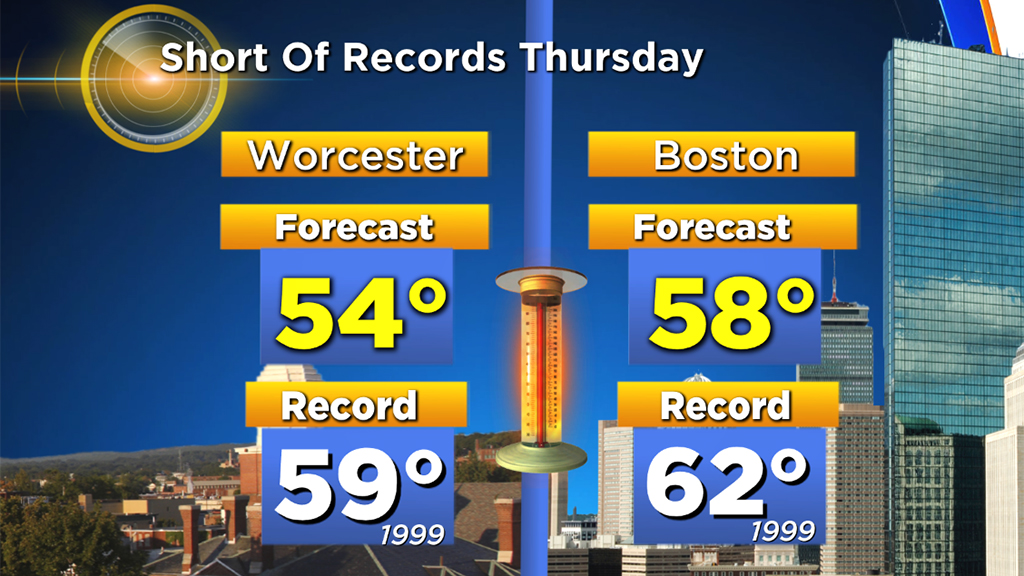
Today's maximum temperatures will be about 50 degrees higher than the highs last Monday afternoon. In fact, they will be just a few degrees short of the records for this date.
TIMING AND FLOODING CONCERNS
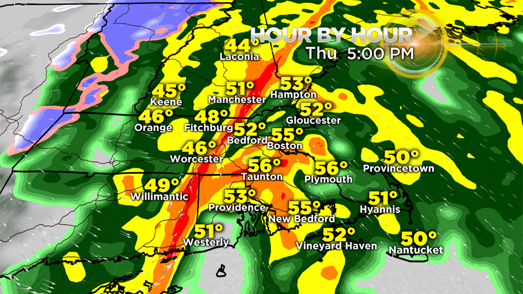
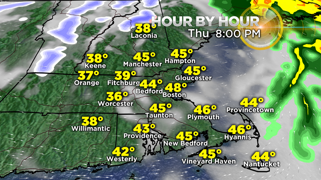
Expect occasional showers of varying intensity but generally light activity probable through the morning followed by steadier and heavier rain this afternoon.
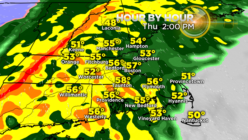
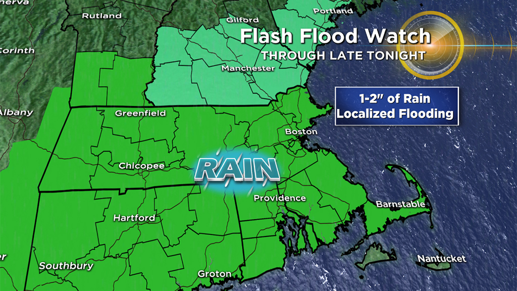
Most of the downpours will be delayed until the period of 2 to 6 p.m. After that, the impact will be decreasing as the rain moves offshore but some residual flooding exists. Ponding on streets and highways will be a issue through the day from the melting snow and ice and rainfall. The biggest concern is this afternoon as the rain tempo increases resulting in totals of 1-to-2 inches.
Consequently, the National Weather Service has issued a Flash Flood Watch for much of the area.
A solid narrow strip of downpours perhaps containing scattered lightning and thunder along with spotty strong winds past 50 mph will transit into the Boston area around 5-6 p.m.
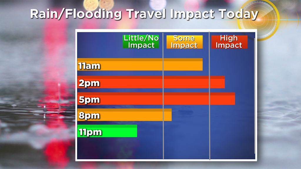
This rain will certainly impact the home bound commute making it a long and slow one!
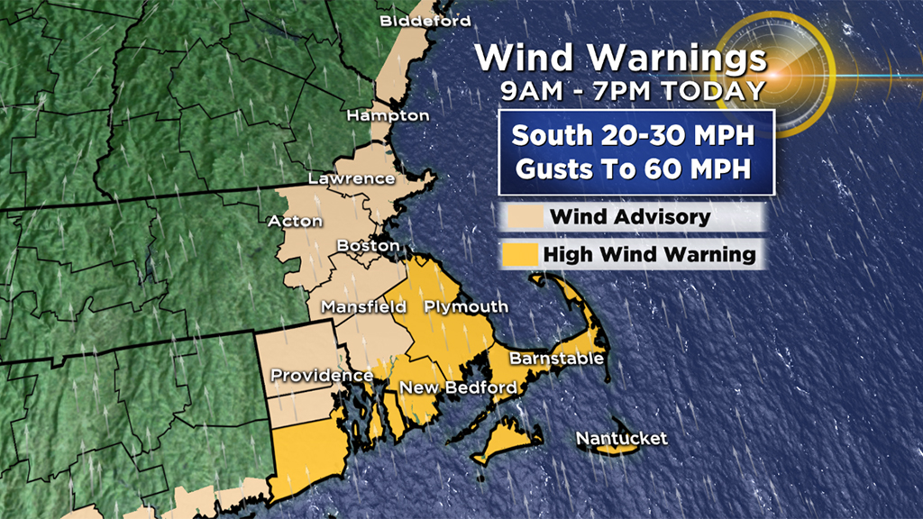
WIND
As a wave of low pressure tracks northward into eastern New York and western New England Thursday afternoon, the pressure gradient will tighten and coupled with a strong jet jet and the heavier rain, the stronger winds will materialize down to the ground so expect some gusts of 45-60 mph over southeastern Mass. and Rhode Island with a bit less wind elsewhere.
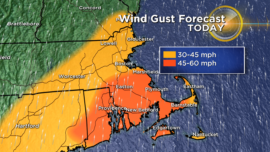
A High Wind Warning has been posted in the stronger wind areas and a Wind Advisory in the rest of eastern Mass. Watch out for falling branches and tree limbs. This cold result in some scattered power outages.
BACK TO REALITY
This meltdown will be short-lived lasting through the daylight hours of Thursday then it is back to reality but not to the harsh conditions experienced earlier this week.
Temperatures by daybreak will have retreated to the range of 26-32 and that means some new icing will show up on some roads, driveways, parking lots, sidewalks, steps, etc. Be cautious and allow extra time for travel because untreated surfaces may be slippery in spots.
WHAT'S NEXT?
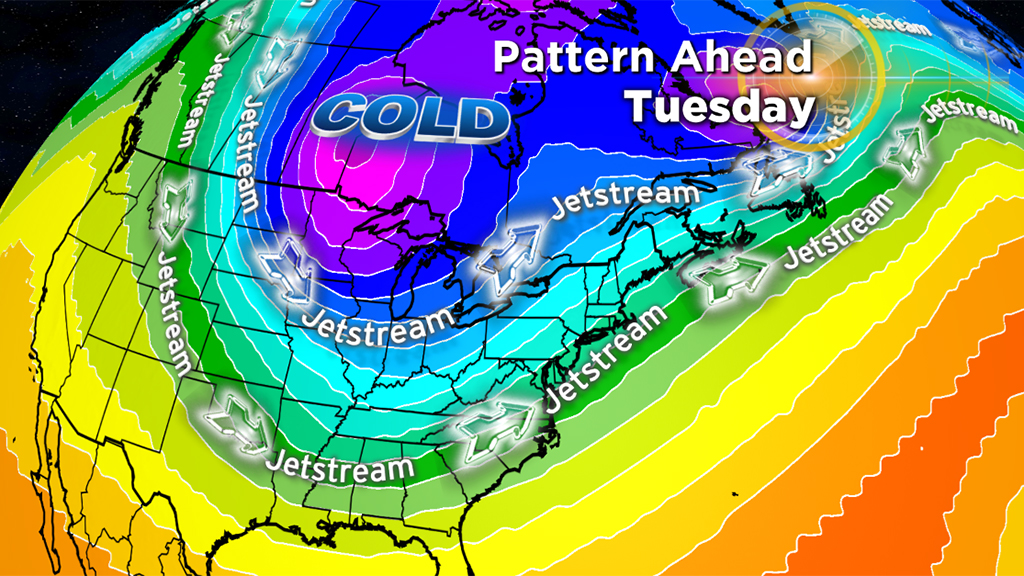
Quiet and cold weather is projected here this weekend as we watch the wobbling reservoir of super frigid in Canada. Parcels of this deep freeze zone will break off and especially effect the Great Lakes area including Chicago.
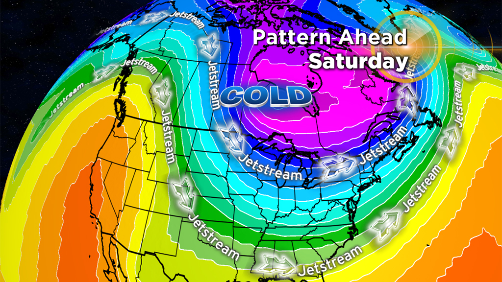
The worst cold will occur out there the middle of next week and some of that intense cold will flow into New England in about a week preceded by a system which could deliver some accumulating snow and rain here next Tuesday.