Light Snow, Rain Mix Coming Wednesday
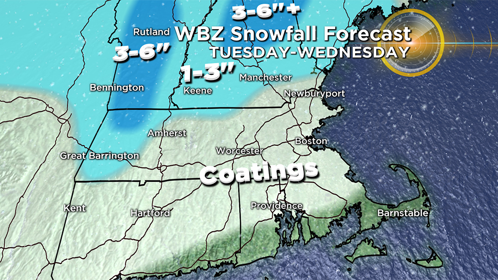
BOSTON (CBS) – We're eight days into 2019 and we've still not seen much more than a few flurries floating around in Boston. The city has only measured 0.2″ of snow for the entire season so far, about a foot below normal. Well, January has a reputation and it's a snowy one. We've got a few chances this week, but once again, it looks like northern New England will get the jackpot snow totals!
Light snow left coatings early Tuesday morning on untreated surfaces, cars and driveways. Just a few lingering showers will impact the remainder of the morning hours. The snow will stick better north of the Massachusetts Turnpike where temperatures stay in the 20's.
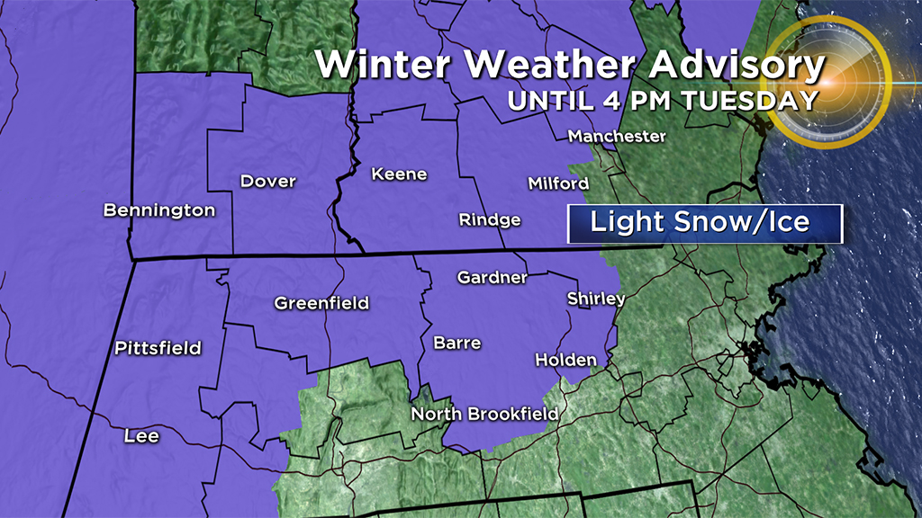
Southerly winds will be picking up and allow for temperatures to warm above freezing from south to north through the morning. This will allow for a transition of any spots showers to become mainly rain showers. Temps may struggle to rise through interior MA leading to a better risk of slick spots on the roadways from a shower or freezing drizzle. Keep that in mind if you have travel plans in that area. A Winter Weather Advisory continues for north-central and western Massachusetts until 1 p.m for slippery travel. The advisory extends into New Hampshire until 4 p.m.
Travel will get difficult the further north you travel as parts of central and northern New England will be the greatest impacted. Some ski resorts will be happy to hear that 6-to-12 inches of new powder is on the way!
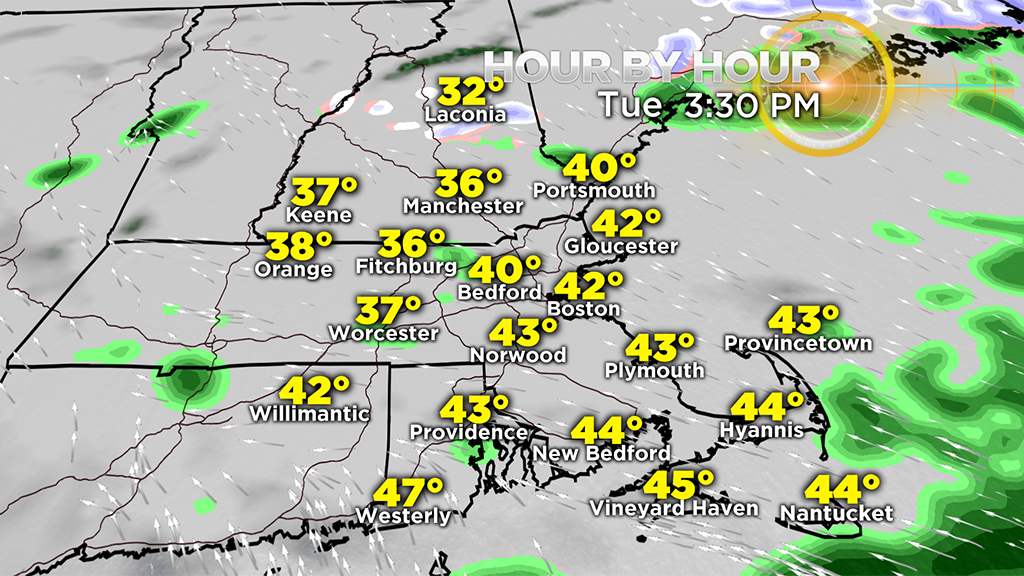
The risk of showers will continue Tuesday afternoon for southern New England as temperatures climb into the 40's over southeastern areas, and remain in the 30's north and west. However, the activity really dwindles and I don't expect a lot of showers out there. There will be plenty of dry times mixed in.
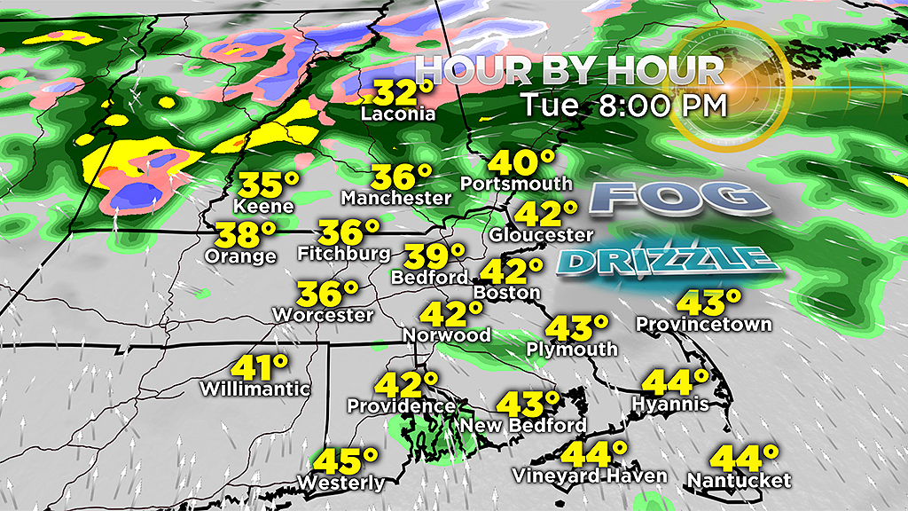
By the evening, a lull in precipitation is likely before another disturbance moves through Tuesday night into Wednesday bringing yet another risk of rain and snow. Just be aware, where temperatures are in the 30s, we'll have to watch for icy spots with pockets of fog and patchy drizzle possible. All it takes is a light coating to create a mess on the roads.
As a band of heavy rain moves in after midnight, a few gusty downpours and even rumbles of thunder can't be ruled out. It will be a damp start to the early Wednesday commute.
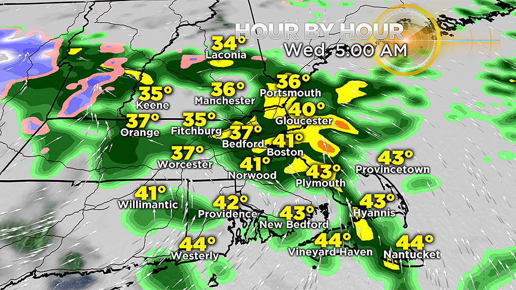
Temps will remain above freezing in most areas. However, as this system lifts north early Wednesday, colder air will work in on the backside and allow a transition to snow for areas north and west and the higher terrain of SW New Hampshire, Vermont and into the Berkshires. Additional accumulations are possible from that transition before the risk of showers moves out by the afternoon.
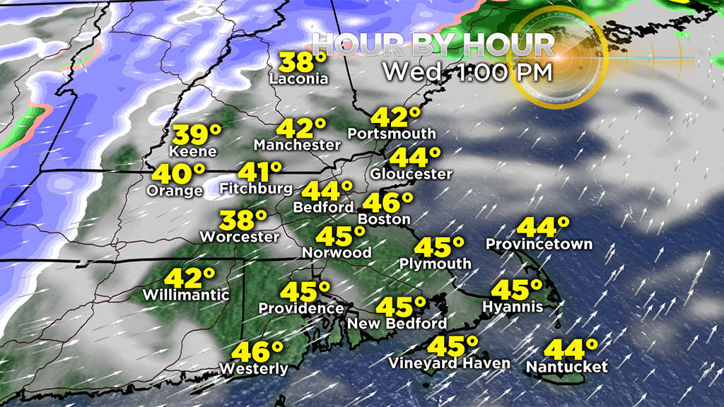
In fact, temperatures will warm in the mid-40s once again, but it will turn breezy with dropping temperatures through the evening.

Behind those "storms," it is likely that we remain cold for an extended period of time and from there we shall see. But it is important to note that larger-scale atmospheric factors are starting to line up in a more favorable fashion for snow here in New England as we head deeper into January and February.


