New Year's Eve In Boston Will Be Wet, A Fitting End To A Rainy 2018
BOSTON (CBS) - 2018 has been a very wet year over many areas of the eastern United States, including New England.
Record-breaking rain amounts have occurred over parts of the southeastern states.
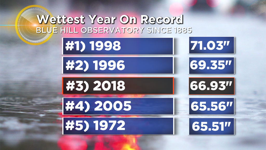
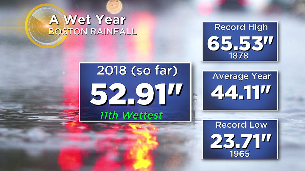
It's the third wettest year on record at the Blue Hill Observatory and the 11th wettest in Boston. So it is rather fitting that the year ends with more rain. That will push Boston's total over 53 inches which is about 9 inches above the average.
TIMING AND AMOUNTS
The daylight hours will definitely remain dry so outside First Night activities will be in good shape.
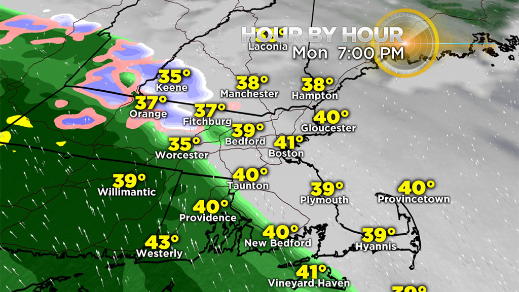
After that, the rain shield shifts into the region and the leading edge should be over Worcester County by 6-7 p.m. and across most of the rest of the area by 8-9 p.m. Initially, the air will probably be sufficiently cold to support a brief spell of wintry mix over parts of north central Mass. and the Berkshires. Farther north, there will be a longer period of snow to sleet and freezing rain. The snow could accumulate a few inches before the transition to ice.
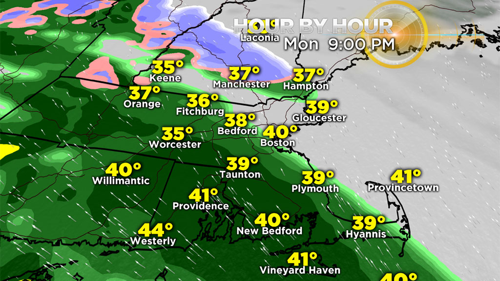
Consequently, the National Weather Service has issued a Winter Weather Advisory for these areas so tricky traveling conditions will be developing up there as the evening progresses. Allow extra time for travel and proceed with caution as you drive to and from the holiday celebrations up north in the wintry precipitation and also where there is some residual heavy rain after midnight! Most signs favor over a half inch of rain ramping up to a bit over an inch in spots.
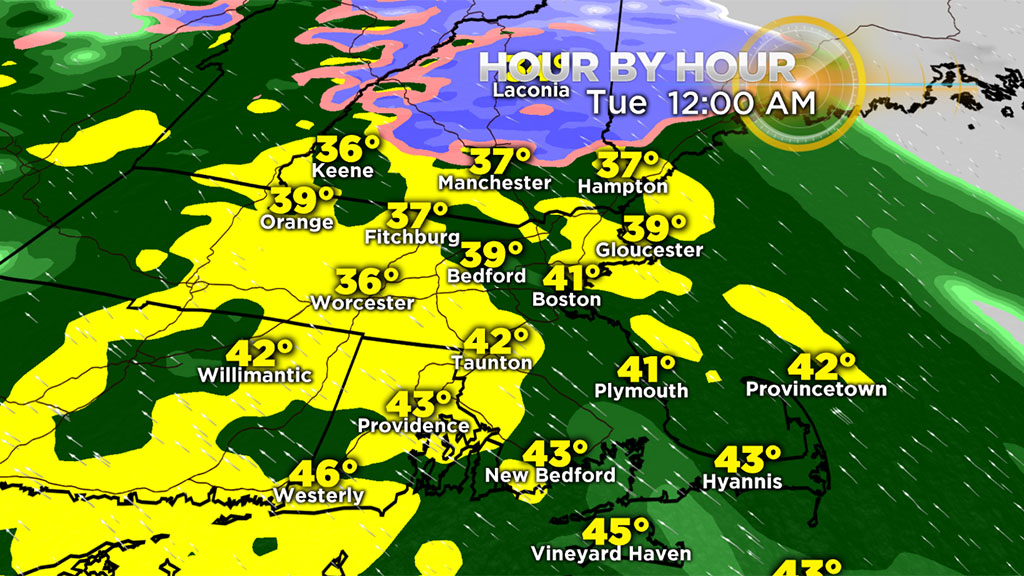
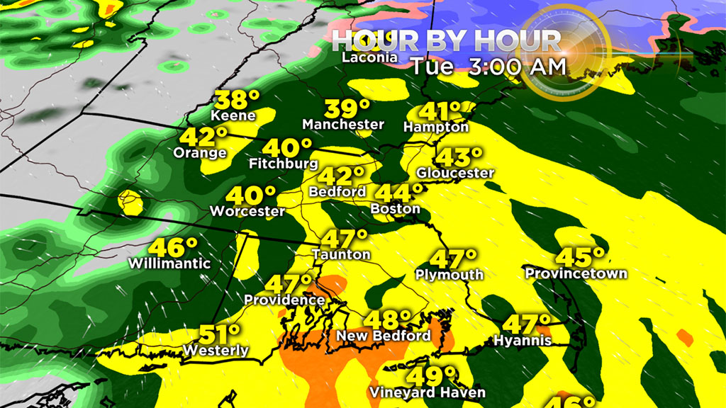
The heaviest rain will likely fall from 10 p.m. to 2 a.m. with rain tapering to scattered showers leading up to dawn. The usual collection of water in poor drainage locations will occur so be cautious but any widespread flooding is not anticipated.
WIND POTENTIAL
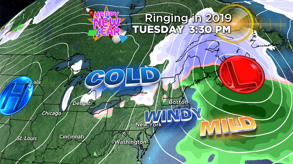
As the storm center churns across northern New England into the Canadian maritimes late tonight into Tuesday, it will intensify causing rapid pressure rises as it moves away. A rush of much cooler air will surge into the region from late morning through much of the afternoon.
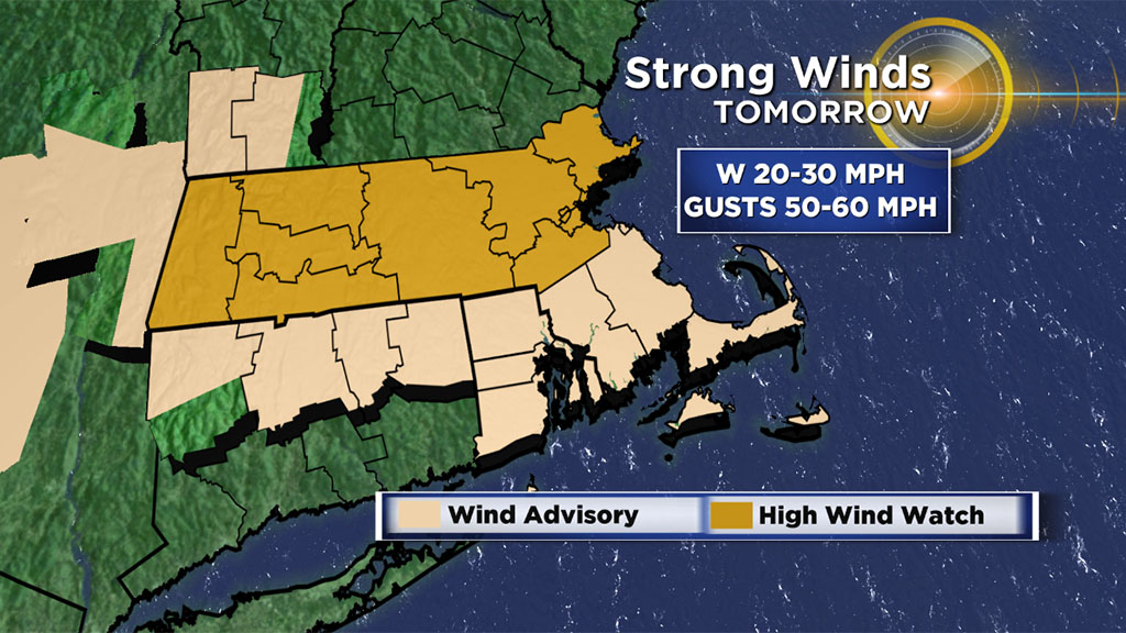
The stage is set for the potential for some damaging wind gusts of 50-60 mph from the west-northwest. Consequently, the National Weather Service has issued a High Wind Watch for much of Mass. with a Wind Advisory posted for much of the area south of the Mass. Pike. The wind will diminish Tuesday night and blow just lightly on Wednesday. The strong winds will build seas up to 8-13 feet but lower scheduled high tides and more of an offshore wind Tuesday negates any threat of coastal flooding.
Check updates on WBZ-TV and right here at CBSBoston.com