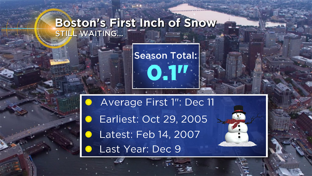
Wintry Mix Not Enough For Boston's First Inch Of Snow
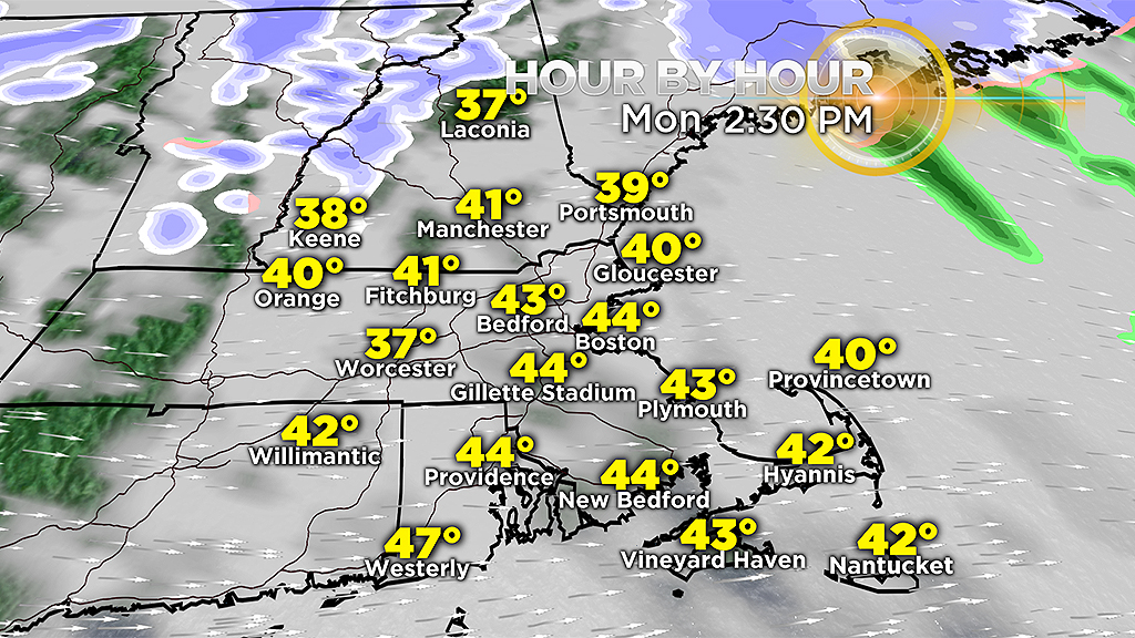
BOSTON (CBS) – A wintry mix of precipitation will impact the Monday morning commute. Spotty rain and snow showers will come to an end through the morning with drier weather developing midday. As low pressure passes south of New England, counterclockwise winds around this system will drain in colder air as the system departs.
Be aware of changing visibilities and quick slushy accumulations on the roads. Less than 1 inch of snow is expected as this system departs.
Despite this wintry mix of precipitation, Boston will continue to search for its first inch of snow. It's not looking likely to hit that this Monday.
All-in-all, the biggest impacts to the roads will be the icy conditions from overnight sleet/freezing rain and minor snow accumulations inland. Temperatures will hover around and below freezing mainly north and west of 495, allowing for icy spots to develop on untreated surfaces. Plan some extra time and be careful on secondary roads that may look wet. Black ice is possible. The snow impact will be brief this morning.
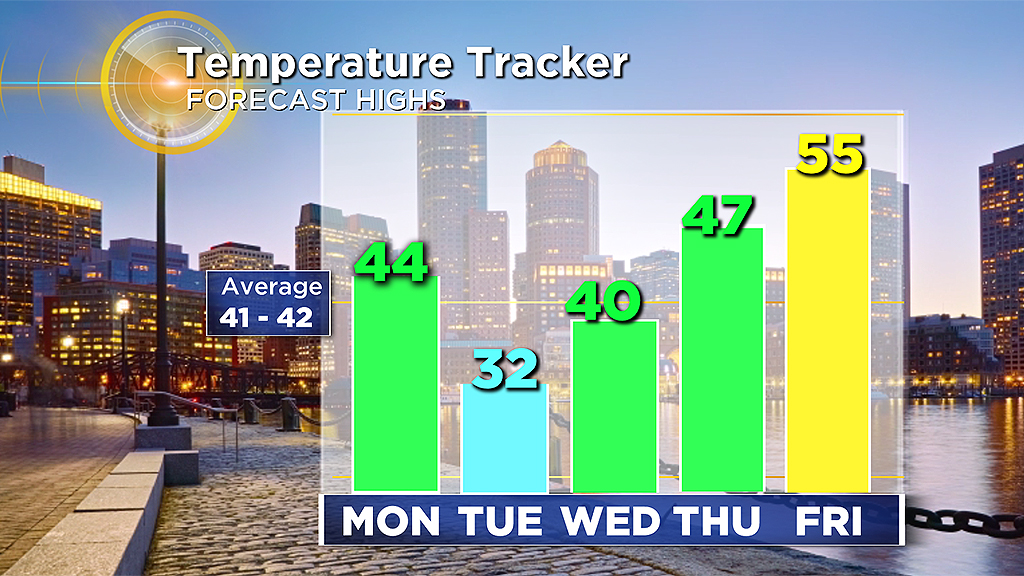
By midday, it will remain cloudy as temperatures will rise to near seasonable conditions in the upper 30's to mid 40's.
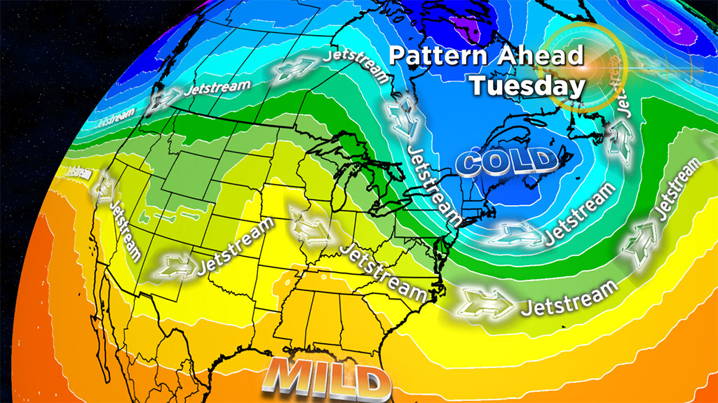
Behind the storm, Arctic air spills in on Tuesday. Highs will be in the 20's and wind chills in the teens.
Fortunately, temperatures are moderate into the middle of the week with more sunshine.
Our next rain threat comes late week, along with milder temperatures.