Downpours Taper To Showers Sunday Afternoon
BOSTON (CBS) - We just wrapped up Meteorological Fall (The 3-month period of September, October and November) as the fourth wettest in Boston history with just over 18" of rain. November alone had over 9" of rain. More than half the month saw measurable precipitation.

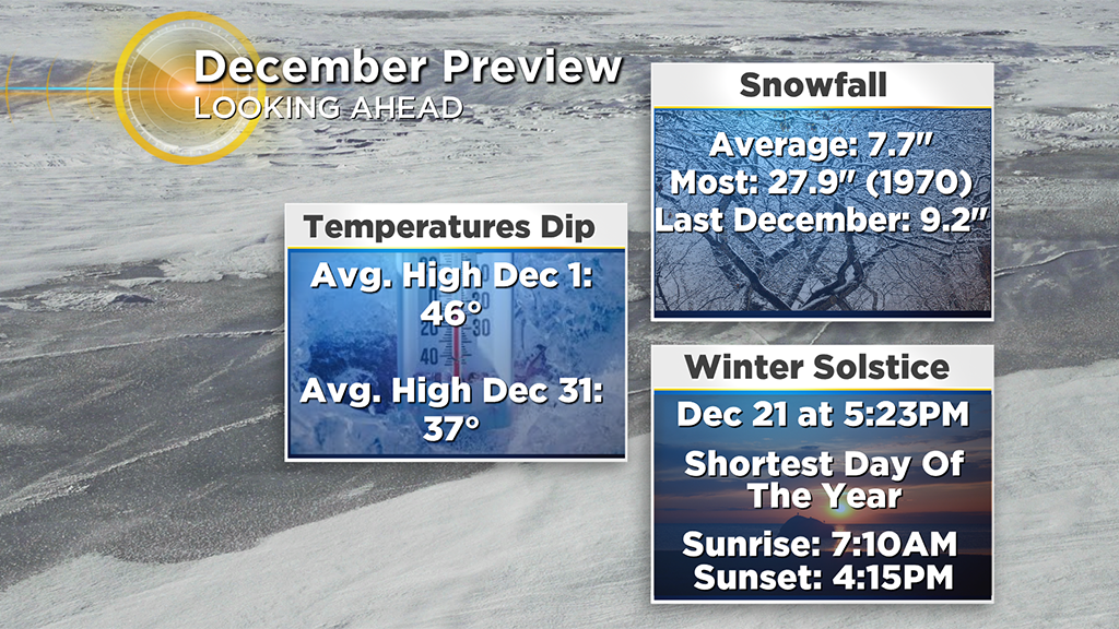
Now we turn the calendar a page to December. The start of Meteorological winter (The 3-month period of December, January and February), the coldest and snowiest time of the year. In fact, December typically starts off with highs in the mid-40s and we end the month with highs in the upper 30s. On average, we receive about 7.7" of snow for the month. Last year it was snowier! We also have the shortest amount of daylight on December 21st, the Winter Solstice, the official seasonal start of winter!
So starting the month off dry and sunny on Saturday was great! However, we knew it wouldn't last.
Downpours and even a few rumbles of thunder may be possible through midday before rain tapers to showers by the afternoon and evening.
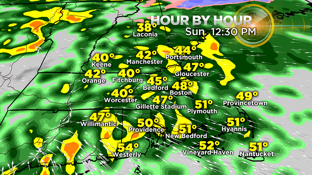
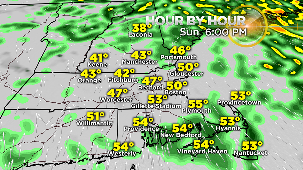
Temperatures will range from the 40s north and west to the 50s across southeastern Mass., with a gusty southeast wind. An isolated shower will continue through the evening as clouds hang around.
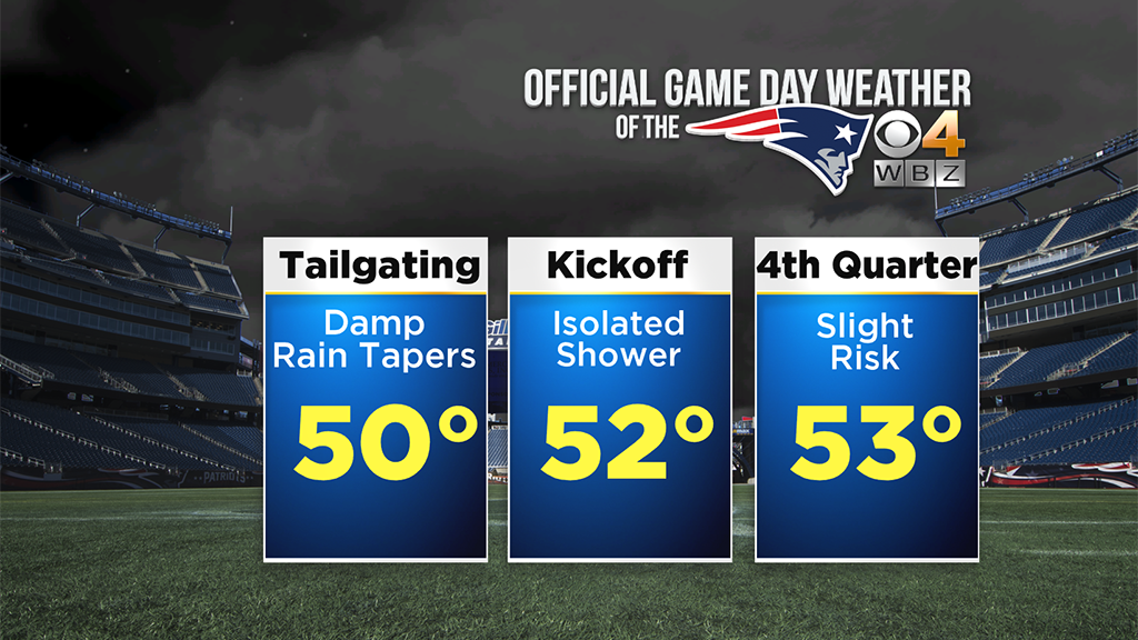
Grab the rain gear if you are tailgating for the Patriots game at Gillette. It will be damp early on, but improvements are likely as the game goes on, although the risk of an isolated shower is possible. Temperatures will be mild for December standards!
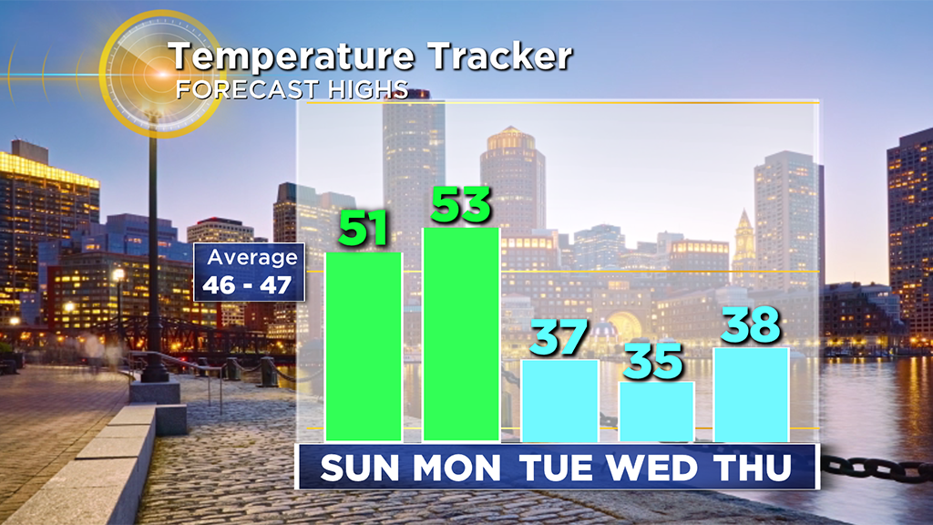
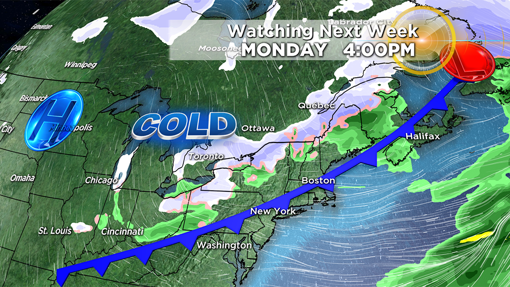
The mild air stays with us to start the week, with highs in the 50s for much of southeastern MA and 40s to the northwest. A cold front will approach the region late in the day. A brief shower is possible to accompany this front, although it looks more clouds and a wind shift is more likely with its passage. This front will be the leading edge of colder air that will spill in the area. Temperatures will tumble late Monday with highs stuck in the 30s for the rest of the week.
Most of the week looks storm free as a coastal storm will look to develop too far south midweek to have any big impacts right now. Besides the chance of a few flurries late in the week, a mainly dry, but cold stretch will be a nice break from the recent rain!
If we go 6 straight days without rain after Sunday, that would be the longest streak since August!