One Storm Just Leads To Another, More Rain Coming Monday
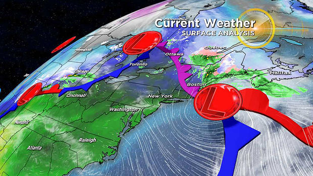
BOSTON (CBS) -- Have you noticed we have been in the path of a parade of storms this fall? The latest to impact the region last night is already on its way out.
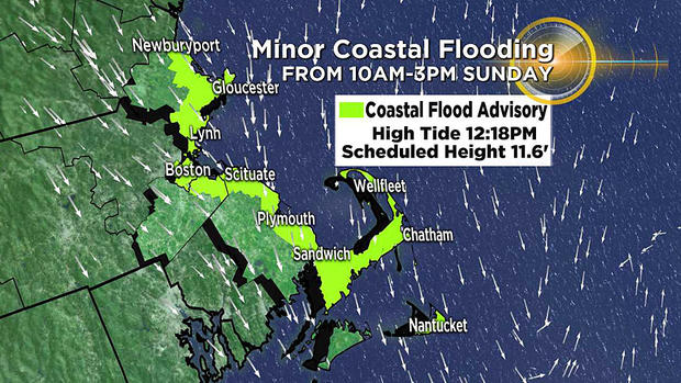
In its wake, there will be some pockets of minor coastal flooding into the first part of Sunday afternoon.
Astronomical conditions, namely the just past full moon, plus an onshore component of strong winds earlier over southeastern MA and offshore will contribute to the high tides at midday.
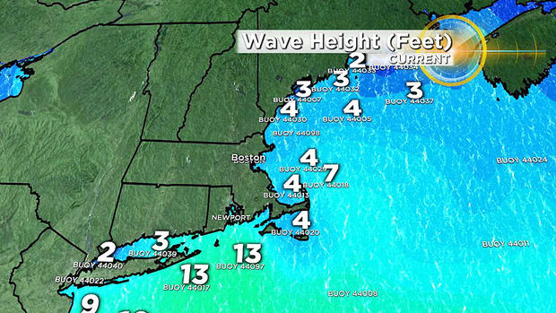
The official scheduled height at Boston is 11.6 feet with a storm surge of up to a foot or so will create those flooded marshes and shore roads that are most vulnerable. The seas have been building and they may reach 6-9 feet early Sunday afternoon before decreasing later in the day.
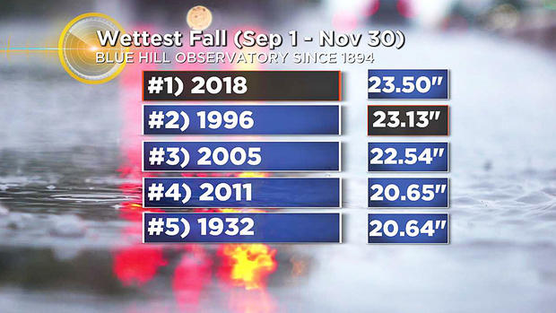
It looks like meteorological fall which runs from September 1 through November 30 will be the wettest ever in many locations here in the Northeast.
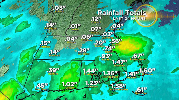
Saturday night's rainfall already hoisted the Blue Hill Observatory's fall total into first place, surpassing the record previously held in the fall of 1996. The heaviest rain fell south of the MA Pike with amounts dropping off dramatically across northern MA northward.
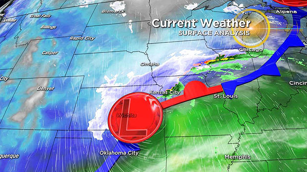
As folks travel back home from the long Thanksgiving holiday weekend, the main trouble zone will be from Kansas, southeast Nebraska into Iowa, northern Missouri into southern Minnesota, northern Illinois, and eventually Michigan.
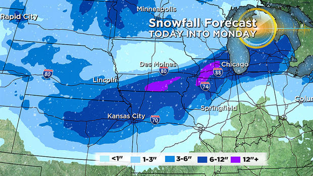
Blizzard conditions are already occurring out there in places as several inches of snow are blown around. Chicago will switch from rain to snow late Sunday afternoon or evening. Thundersnow will occur with those gales out there. That storm will run up into the eastern Great Lakes and a secondary storm will form on the Mid-Atlantic coast and soak us again later tomorrow afternoon and tomorrow night.
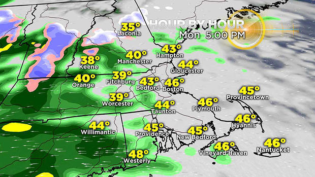
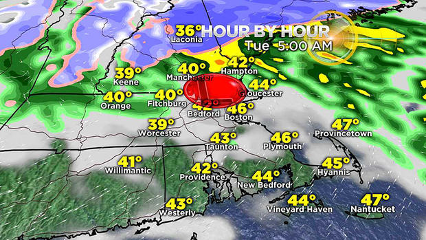
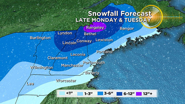
While I cannot rule out migrating bits of mist Monday morning, the main rain will not arrive until the PM commute. The rain will become heavy at times Monday night then taper off to showers and drizzle Tuesday morning. Another half inch up to an inch or so of rain is likely over southern New England. There could be some wet snow over parts of northern MA especially north central to northwestern parts of the state northward with another bonanza of snow over the northern mountains.
After some scattered snow showers across the region on Wednesday, it should be storm-free and sunnier with below average temperatures but not frigid the second half of this week.
Get your weather updates on WBZ-TV and CBSBoston.com.


