Heavy Rain, Damaging Wind Friday Night Leads To Cold Weekend
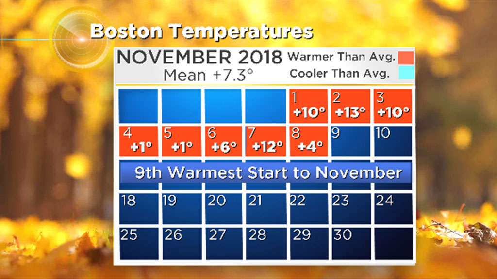
BOSTON (CBS) - November has gotten off to a mild and wet start. In fact, this is the ninth warmest start to November on record with mean temperatures running about 7 degrees above average! We've also seen nearly 3 inches of rain, and we're only 9 days in! Well, get ready for big changes this weekend with cooler weather on the way on the heels of yet another system to bring more rain and wind Friday night.
At least this time, the rain looks to move out to salvage your weekend plans, if you don't mind the cold and wind. By the end of the weekend, there will be a winter feel in the air.
Daytime Friday:
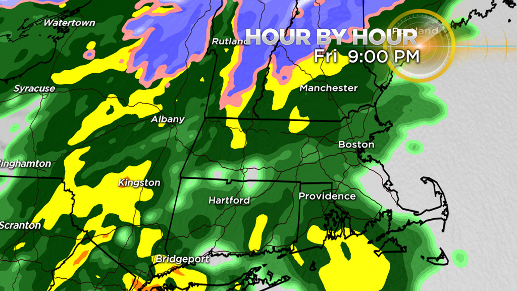
During the day on Friday the clouds will thicken. Most of the day will be dry, so don't cancel any plans. Temperatures will not be as mild as recently, reaching near 50 degrees in many areas. It may be a tad warmer to the south, cooler to the northwest. Overall, not a bad day. Rain chances increase in the afternoon and evening.
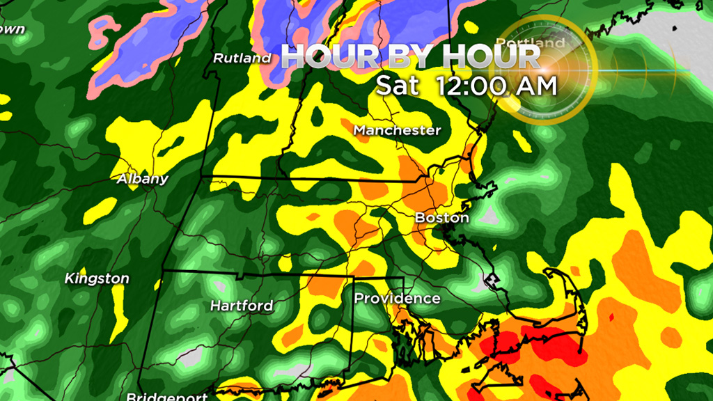
Friday Night/Early Saturday:
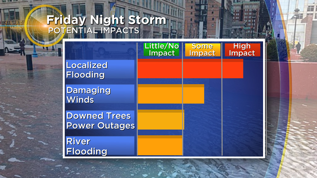
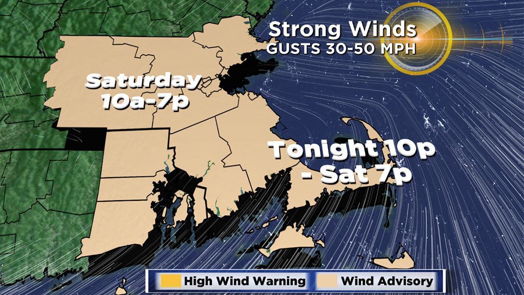
This is the period of heaviest rain and highest risk of urban/street flooding. There is a Flood Watch for all of southern New England Friday night through Saturday, excluding the Cape and Islands.
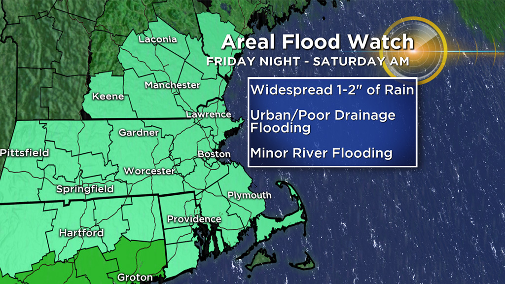
We anticipate 1-to-2 inches of rainfall, with locally higher amounts. It will fall in a short window of 6-to-12 hours this evening and overnight, ending around daybreak Saturday. There will be some embedded thunder and downpours within the waves of rain.
Make sure to clear any storm drains of debris or leaves, as that may help alleviate street flooding concerns.
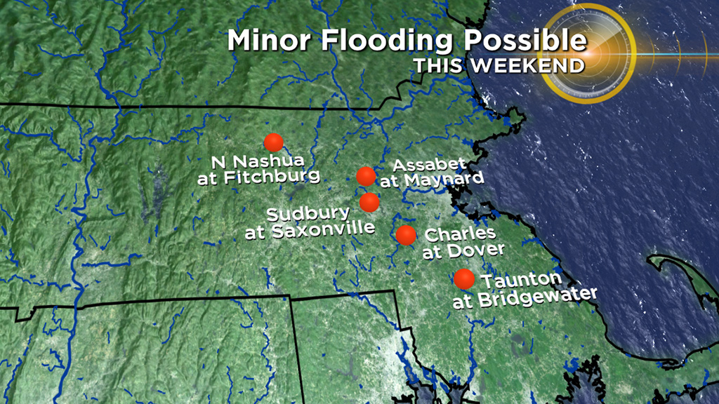
Be aware on the roads for ponding and minor flooding, especially at night because visibility will already be reduced. By Saturday some small rivers and streams will need to monitored for any rapid rises leading to flooding.
Strong to damaging southeast to southerly winds are anticipated Friday night into Saturday morning, mainly over southeastern New England. A Wind Advisory is in effect starting at 10 p.m. and continues through 6 a.m. Saturday for the Cape and Islands where the strongest winds are expected. Southeast to southerly gusts 40 to 50 mph are possible. Tree damage and scattered power outages are possible.
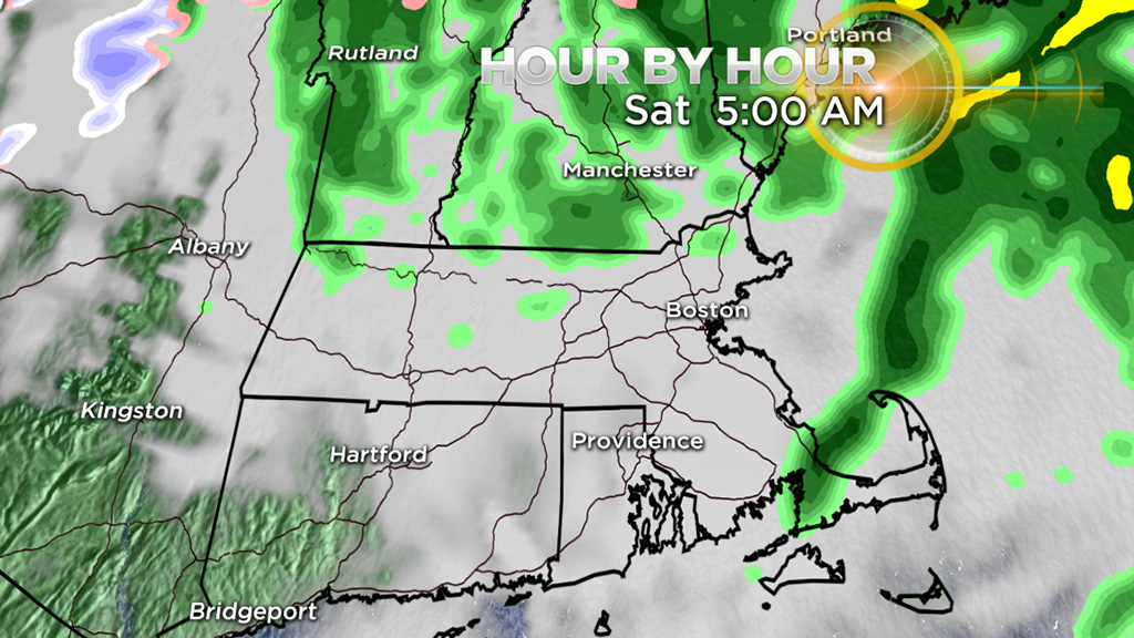
Saturday Afternoon/Evening:
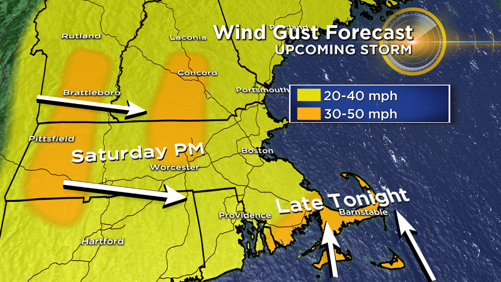
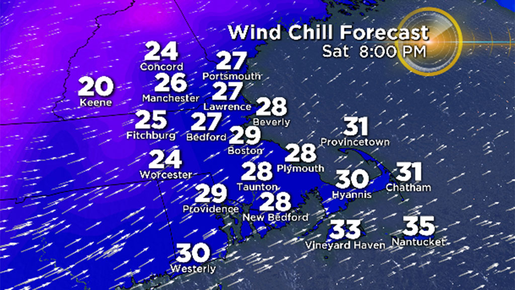
The rain will be done and clouds will be decreasing. This time period is all about the wind. Strong to damaging westerly winds will develop through Saturday night. Gusts of 35 to 45 mph are possible. This wind will also make for chilly conditions with wind chill values in the 30's dropping into the 20's Saturday evening.
Saturday Night/Sunday:
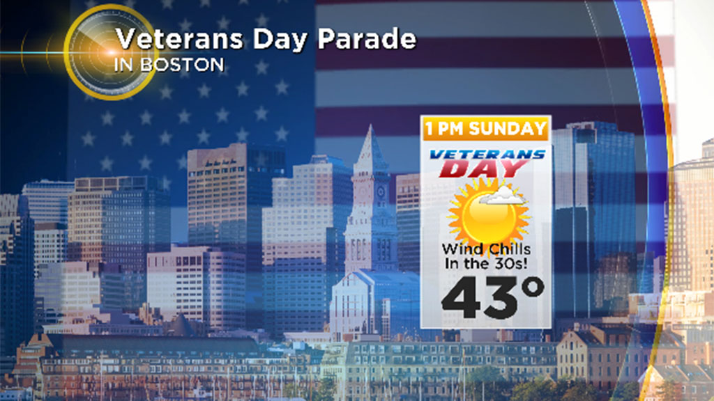
The winds will be active overnight and remain breezy on Sunday. It will be cold! Temperatures have the potential of falling close to freezing in Boston. We haven't done that since April 11th! Despite sunshine, don't expect much of a warm up. Highs will be in the low 40's. There will be a winter feel to the air on Veterans Day. If you are headed to the Veterans' Day parade in Boston dress for wind chills in the 30's.
We'll have another mostly sunny but chilly day on Monday ahead of our next storm! Yup, another system could soak the region and bring strong winds. Behind it - a major shot of cold air!
Follow Sarah on Twitter @sarahwroblewski