Rain Moves Out Of New England, But Winds Could Gust Up To 60 MPH
BOSTON (CBS) – A sharp trough of low pressure was approaching New England this morning. This package of potent energy is igniting a storm over New England and it is destined to intensify rapidly on its way into Maine.
Atmospheric conditions were marginally favorable for a few rapidly-moving thunderstorms near severe levels. The National Weather Service did issue two brief Severe Thunderstorm Warnings lasting 15-30 minutes between 6-7 a.m. One was located in southern Rhode Island and the other one just south of Boston from near Stoughton to near Hingham.
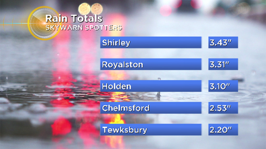
No damage reports have been received as of late morning and the threat of severe storms ended by 8-9 a.m. This setup also generated copious amounts of rain with the highest amounts west-northwest of the Boston area this morning. Leaf drop clogged catch basins and all the poor drainage areas on country roads, town streets, highways and other urban areas were flooded for a time. Now the big story for the rest of the day will be the strengthening wind on the back side of the developing gale center.
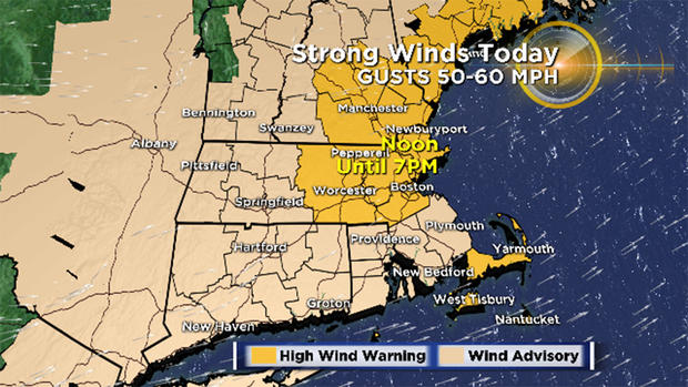
The wind will become westerly and ramp up to 30 to 60 mph in gusts as the afternoon progresses. The strongest wind should blow from mid-afternoon to about mid-evening. After that, the wind will decrease to 12-25 mph overnight and drop further to only 5-10 mph for most of Sunday.
Due to saturated ground, some foliated trees and weaker trees, the region is vulnerable to scattered wind damage from branches, limbs and whole trees coming down. Beware of this danger as you walk and drive about the region through this period. Expect some scattered power outages into tonight.
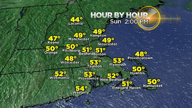
Sunday will be a peaceful day in comparison with light wind and ample sunshine. After starting out in the upper 30s to near 40 degrees tomorrow morning, the afternoon highs will be in the lower 50s which is about 2-3 degrees below the average highs for November 4.
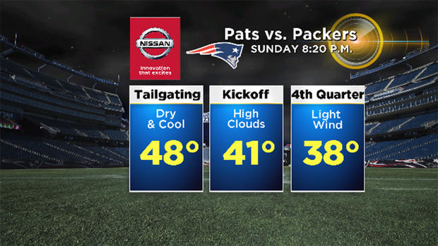
That is a good lead-in to the Pats/Packers Game tomorrow evening at Gillette Stadium. It will be chilly as the temperature drops to the upper 30s in the 4th quarter. Go Pats!
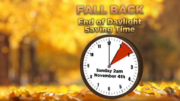
Tonight's the night. It's the night to fall back one hour so you CAN get an extra hour of sleep and I think we can all use that! The bad news is the early sunsets going forward starting at 4:34 p.m. Sunday! OUCH!
The plus is the dark mornings will become brighter earlier for a while. The earliest sunset occurs on December 8 at 4:11pm. That's only 4 hours and 14 minutes earlier than the latest sunset on June 26!
Check weather updates on WBZ News and CBSBoston.com
Follow Barry on Twitter @BarryWBZ