Localized Flooding, Damaging Winds To Hit Southern New England
BOSTON (CBS) -- Here we go again. Last weekend it was a nor'easter. Monday it was severe weather and tornadoes. Now, yet another strong storm system is heading our way. New month, same story.
This fall has been anything but bright and sunny. Parts of southeastern Massachusetts are nearing record amounts of autumn rain. Blue Hill Observatory in Milton had more than 15 inches in September and October, the 6th most ever recorded. Other locations including Brockton and Taunton are nearing 20 inches in the same time span. That is nearly half a years' worth of rainfall! One has to wonder if the atmosphere will have anything left to give once winter arrives. (That's a story for another day.)

So, once again, your weekend plans are going to be rudely interrupted by Mother Nature.
TIMELINE/DETAILS
Daytime Friday:
During the day on Friday we will see just some scattered showers and a few downpours. Not a washout and, in fact, several hours during the day will actually be dry. Temperatures will also be quite warm, reaching near 70 degrees in many southern New England towns!
Friday Night/Early Saturday:
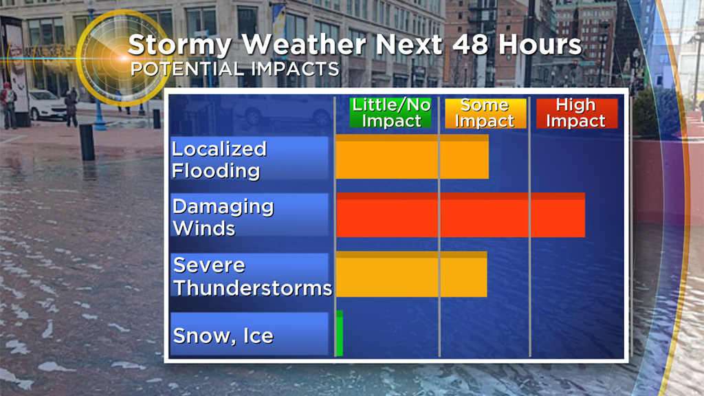
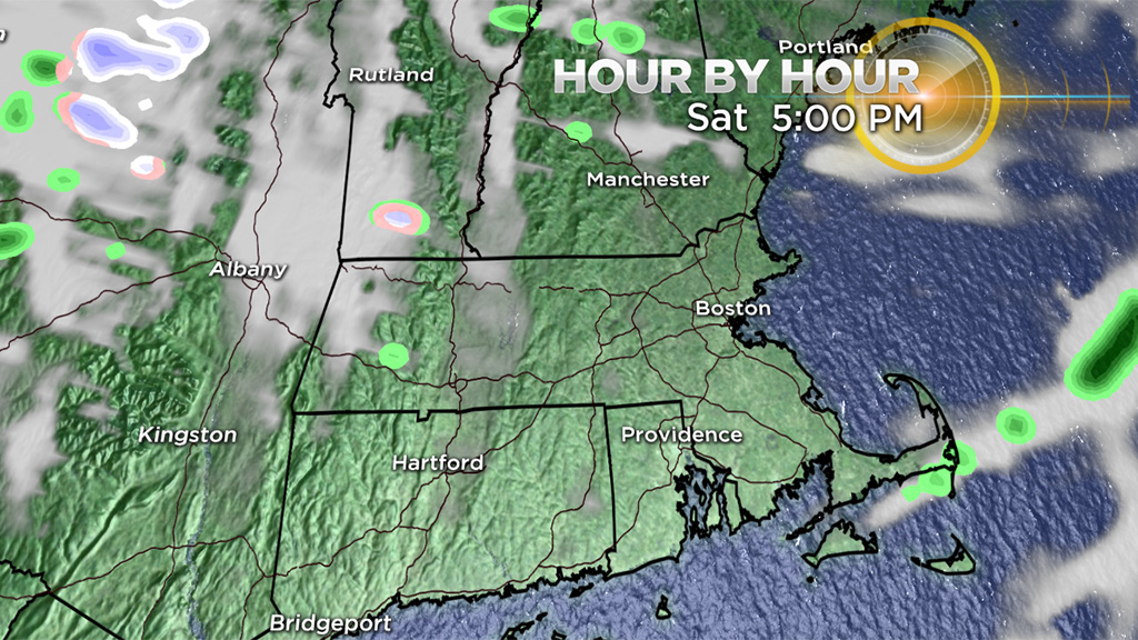
This is the period of heaviest rain and highest risk of urban/street flooding.
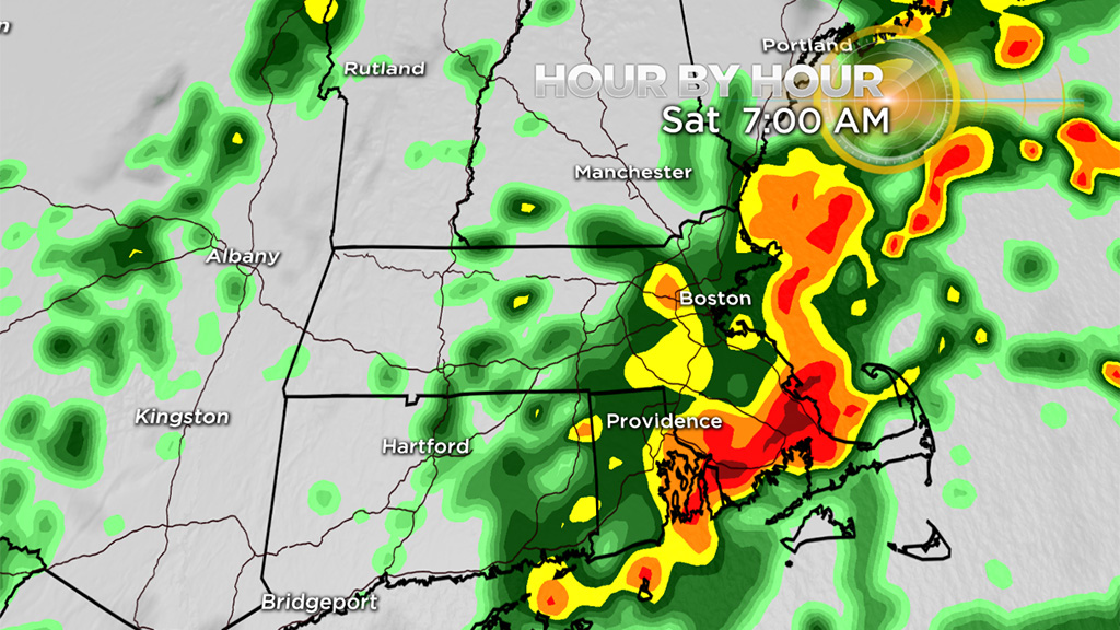
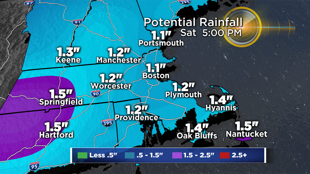
We anticipate 1-to-2 inches of rainfall between about 9 p.m. Friday and midday Saturday. There will be some embedded thunder and downpours within the waves of rain. Severe thunderstorms, while not likely, are a possibility.
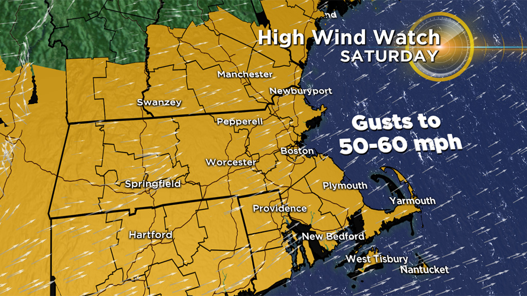
Winds will be very gusty over Cape Cod and the Islands on Saturday morning. South-southwesterly gusts to 50 mph or higher are possible.
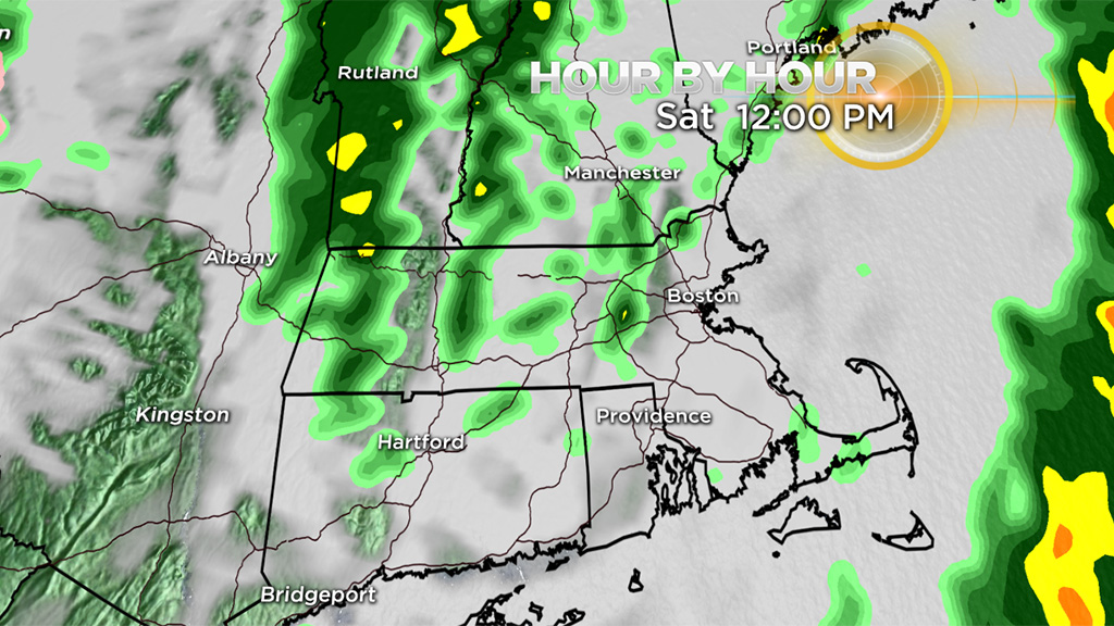
Saturday Afternoon/Evening:
This time period is all about the wind. The rain will taper off in the early afternoon hours and the winds will start to howl.
As the cold front pushes east, the colder air will rush in quickly. Winds will gust out of the west between 30-50 mph for all of southern New England, perhaps up to 60 mph in higher elevations. The leaves will be flying off the trees and several small limbs and branches will litter the ground by Saturday evening. With so much tree damage likely to occur, some scattered power outages are nearly certain.
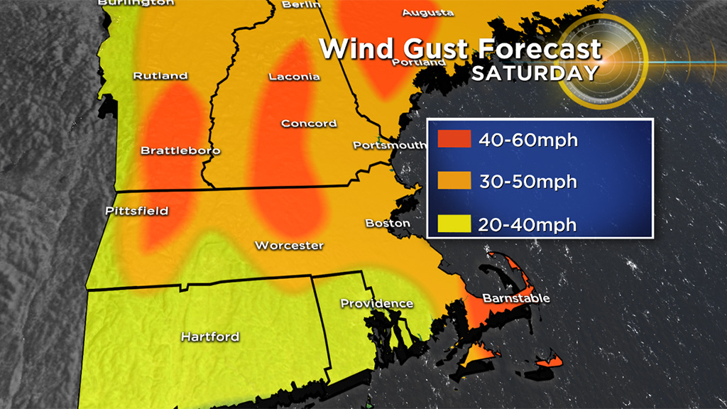
The winds will slowly diminish overnight and be nearly calm on Sunday. Peak wind gusts occur between 2 and 8 p.m. on Saturday. Temperatures will plunge Saturday afternoon from the 60's through the 40's in just a few hours.
So, if you have outdoor weekend plans - push them to Sunday! A completely different day. Partly to mostly sunny skies with just some high cirrus streaming in late. The winds will quiet down quickly, and temperatures will generally be 50-to-55. Got tickets to the Pats game? Looks quiet. Temperatures dropping through the 40's during the game.
Oh and don't forget to turn your clocks back Sunday at 2 a.m. Sunset on Sunday is 4:34 p.m. Winter is coming.
Follow Terry on Twitter @TerryWBZ