Hurricane Florence Could Bring Up To 30 Inches Of Rain To Carolinas
BOSTON (CBS) - Here we go. The outer rain bands from Hurricane Florence have begun to come ashore in North Carolina. Conditions will gradually deteriorate from here as Florence crawls ashore in the next 24-36 hours.
Hurricane Florence: Tracking Maps and Computer Models
There was some good news overnight. The winds from Florence have decreased a bit, now at category two level (below major status). While, of course, this is a good thing, by no means should anyone down in the Carolinas feel that they are out of the woods. First off, additional weakening is unlikely until the eye comes ashore. Also, the hurricane-force winds and tropical storm-force winds have been expanding. Currently, the hurricane-force winds extend outward 80 miles from the center and tropical storm-force winds extend nearly 200 miles from the eye.
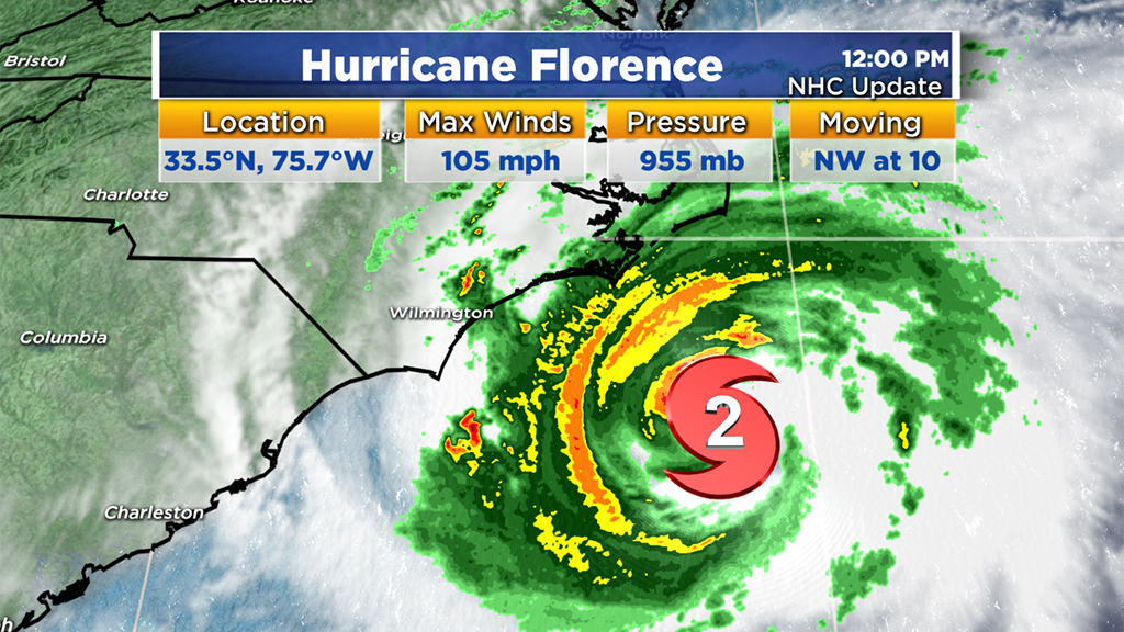
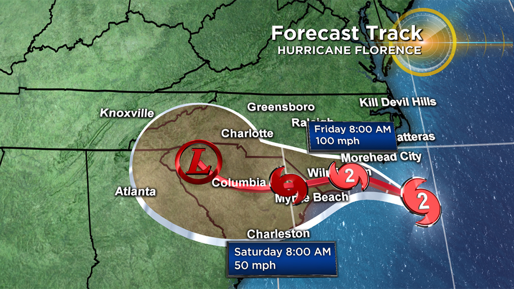
Given that the forward speed of Florence will slow to a crawl today and tonight, coastal areas in the Carolinas will have to withstand these destructive winds for a very long period of time. Current projections do not have the center completely over land until sometime later on Friday.
There are several hazards associated with Florence over the coming hours and days.
STORM SURGE
The wave action and strong winds of Florence will cause a large amount of water to pile up along the coast of North and South Carolina. Surges as high as 9-to-13 feet are currently forecast from Cape Fear to Cape Lookout.
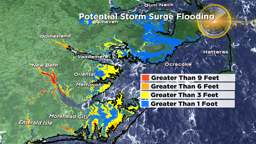
Farther from the epicenter, surges between 6-to-9 feet are expected near Myrtle Beach and Ocracoke Inlet.
WIND
Again, while the maximum wind speeds have been decreasing, the scope of the wind field has been growing.
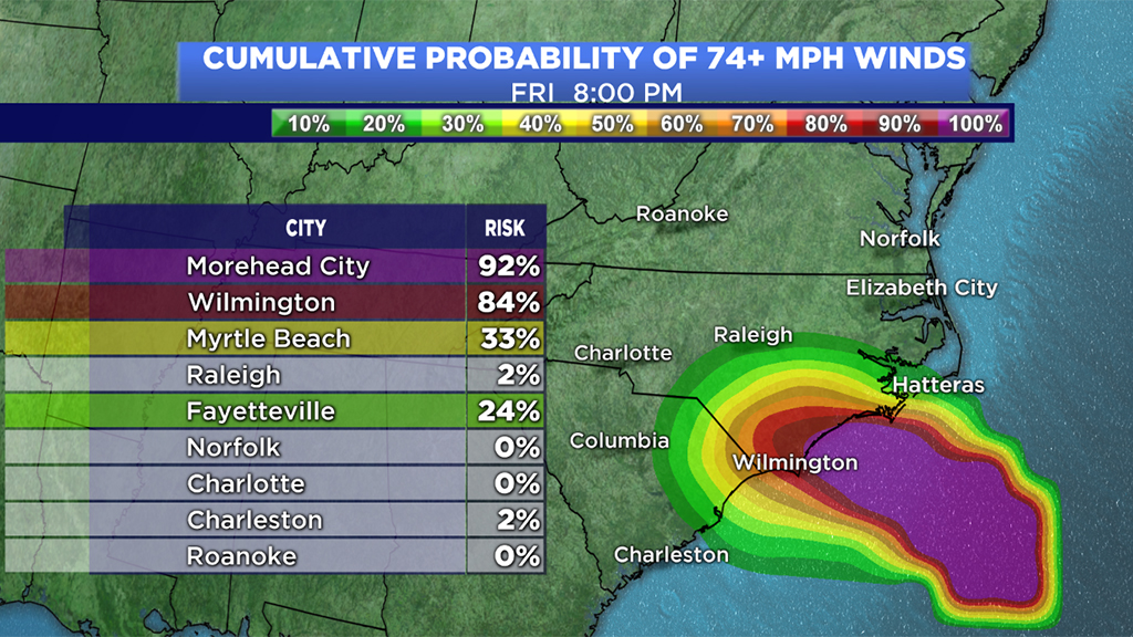
Hurricane force winds (74 mph+) will reach the coastline by this evening and continue to batter the area all day Friday.
RAINFALL
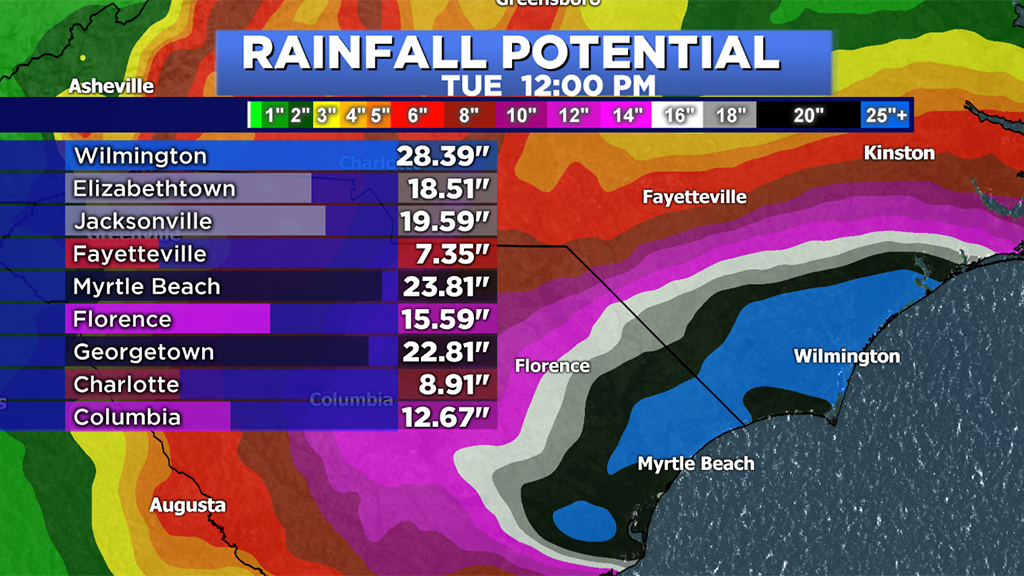
Incredible amounts of water will fall from the sky over the next several days in the Carolinas.
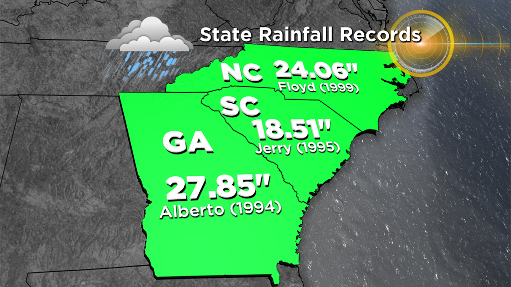
In fact, state rainfall records may be broken as rainfall totals reach 20-to-30 inches or higher. Catastrophic river flooding and flash flooding will occur for a large portion of eastern North and South Carolina.
TORNADOES
It is very common for quick, spin-up tornadoes to occur during land-falling hurricanes. A large portion of eastern North Carolina is under a tornado watch all day today and into tonight.
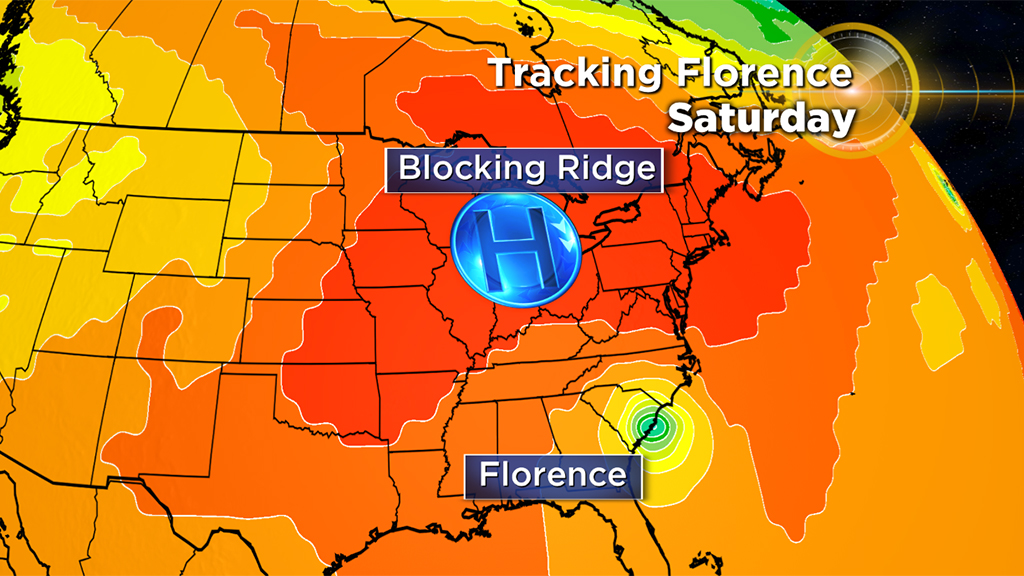
Thankfully, a large high pressure center will keep us safe from Florence over the weekend here in New England. However, the remnants of Florence may get drawn into a cold frontal passage early next week. There is a chance some of that tropical rainfall could pass through portions of the Northeast next Tuesday or Wednesday before we can finally say good riddance to Florence for good.


