Florence Likely To Be Major Hurricane Off East Coast Next Week
BOSTON (CBS) – The Atlantic Hurricane season has suddenly roared to life. While the record breaking heat and humidity dominated the headlines for most of this summer, thankfully, the Tropics remained quiet. Cooler than normal ocean water off of Africa, wind shear in the Tropics and large amounts of Saharan dust all have contributed to what has been a very quiet and below average Atlantic Hurricane season thus far. But as we often like to say, it only takes one.
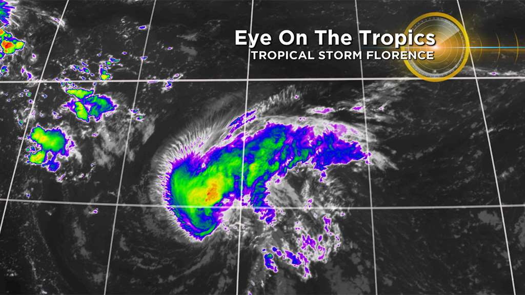
Conditions have suddenly become more favorable for development and the tropical wave train off of Africa has fired up. There are now three storms we are watching. Florence, Helene, & Isaac. Florence formed about a week ago, early on the morning of Saturday, September 1. It has been quite a week for Florence. It was given hurricane status on Tuesday, became a major hurricane on Wednesday and then was nearly torn apart in an unfavorable environment Thursday and was once again downgraded to a tropical storm by early Friday.
Check: Florence Tracking Maps
Florence continues to meander westward at about the same size and strength as it battles its way through a southwesterly wind shear. By later Sunday Florence will encounter a much more favorable environment and should begin to rapidly strengthen once again. It should regain hurricane status and likely become a major (cat 3 or cat 4) hurricane by early next week. The official track from the National Hurricane Center now takes Florence well south of Bermuda on Tuesday and continues heading west on Wednesday towards the southeastern United States.
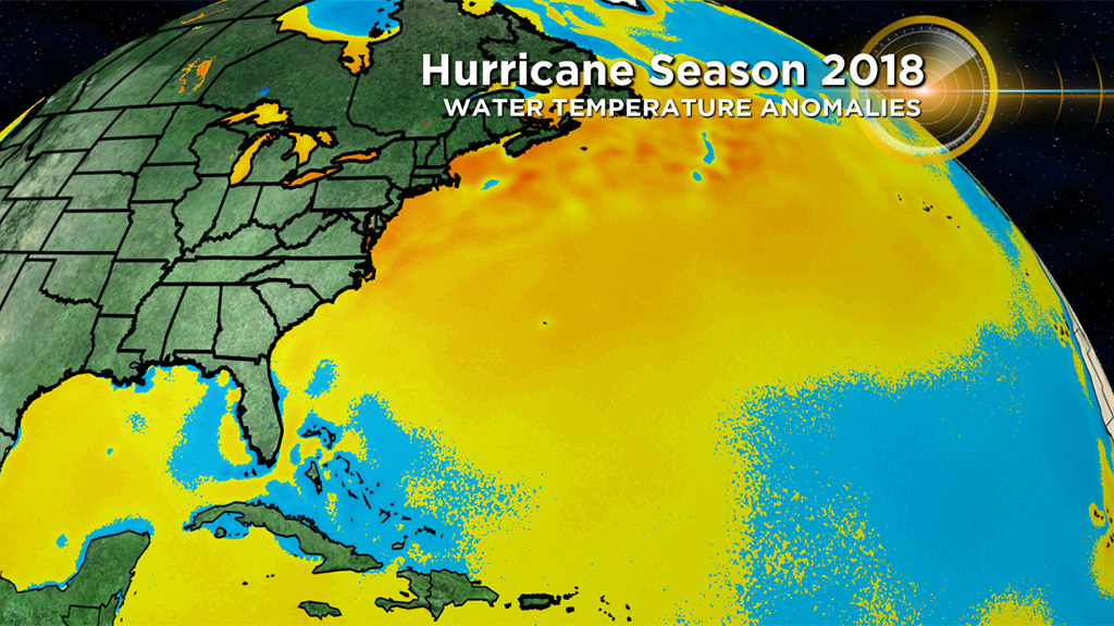
With ocean water temperatures warmer than average off the U.S. coastline and very little wind shear in its path, Florence is likely to be a beast of a hurricane by the middle of next week as it heads for the East Coast. What happens from here is still TBD.
You may have already seen or heard quite a bit of chatter online about potential landfall locations – from Miami to Massachusetts. Many folks take delight in posting individual weather model runs showing a major, catastrophic landfall over populous cities. This is irresponsible and dangerous. As forecasters, we look at model trends, historical analogs, and a wide variety of other factors in trying to determine the ultimate path of a hurricane that is still many days and thousands of miles away from making an impact.
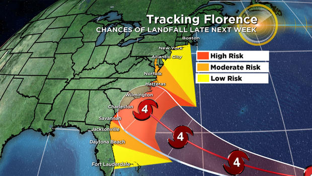
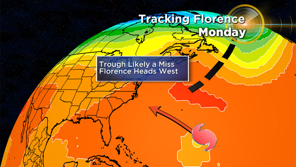
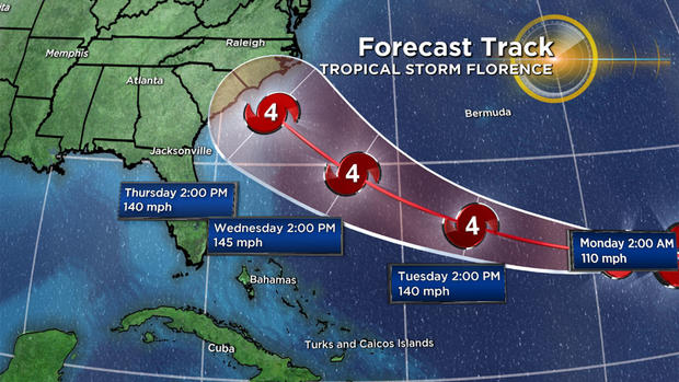
With regards to any potential East Coast impacts/landfall, it would be wise for the entire coastline to stay tuned to updates. However the trend over the last 24 hours has been for a farther southerly track, meaning the Carolinas may be at a slightly higher risk than say the Mid-Atlantic or Northeast.
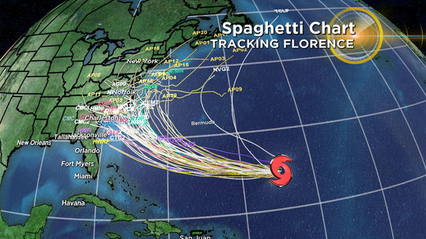
The truth is Florence still has a long ways to go, hundreds and thousands of miles to travel and it is simply too early to forecast with any certainty a likely landfall area.
Please disregard any erroneous information that claims to tell you otherwise.
I would recommend following our weather team along with other credible sources such as the National Hurricane Center for updates over the weekend and into next week.