Record High Temperatures, Severe Storms Possible Thursday
BOSTON (CBS) - Ask anyone when they consider summer to truly be over and you may get a variety of responses.
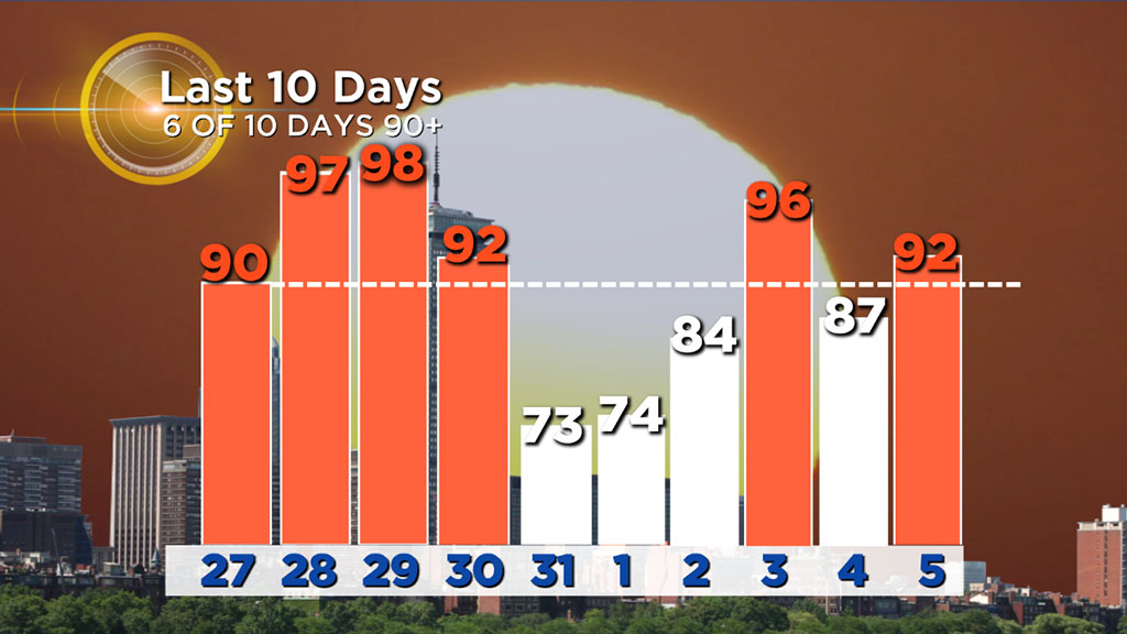
Meteorologically speaking, summer ends August 31. Your desk calendar begs to differ. The autumnal equinox officially arrives on September 22. Others consider Labor Day weekend as the end of the summer season (vacation season anyway). Funny thing is, nobody bothered to ask Mother Nature. Boston hit 90 degrees for the 22nd time in 2018 on Wednesday.
Six of the last 10 days have been 90+ in Boston. And oh by the way, there is another potential record breaking scorcher on the way for Thursday. Like it or not, summer isn't over.
Thursday might be our last truly oppressive day of the year. While we could hit 90 again as early as next week, hitting the mid-90s with dew points in the mid-70s (like they will be Thursday), is awfully tough to do in mid-or-late September.
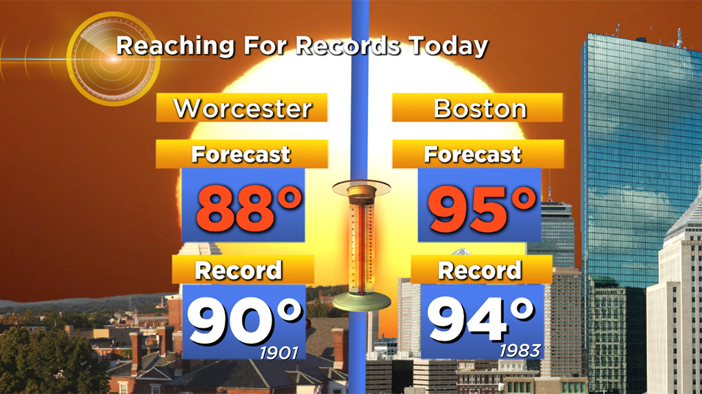
We are forecasting 95 degrees in Boston on Thursday, this would beat our old high temperature record by a degree (94, 1983). Combine that with very high dew points (stop me if you've heard this before), and it will feel like 95-102 degrees outside.
The National Weather Service has issued a heat advisory (again) from 11 a.m.-7 p.m. on Thursday, stressing that if you have to spend time outdoors that you drink plenty of fluids, stay out of the sunshine and try to schedule strenuous activities for early morning or late evening.
There is an end in sight! After Thursday we get a dramatic change in air mass, things get downright fall-like here over the weekend. Break out the pumpkin beverages!
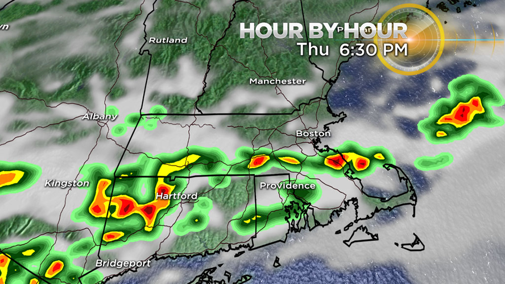
The transition from hot and humid to cool and dry may be a bit bumpy however. In addition to the oppressive heat and humidity, we also have a severe thunderstorm threat on Thursday. The Storm Prediction Center has placed all of southern New England in a "marginal" risk for severe weather.
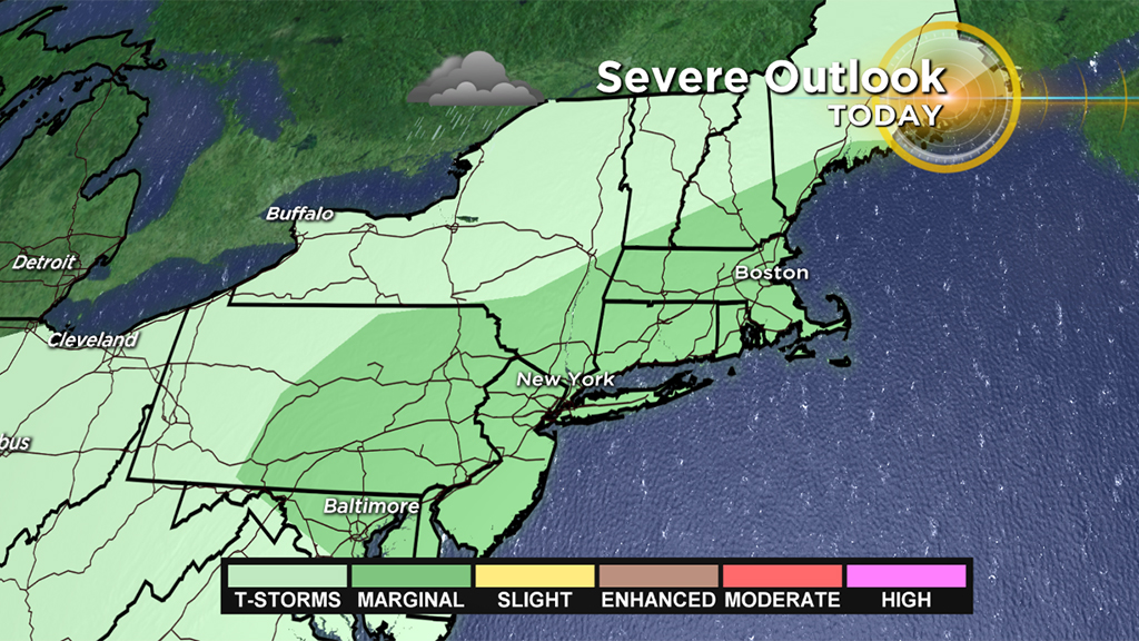
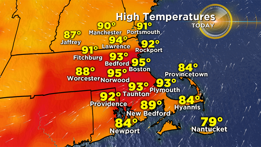
The highest threat zone is over Connecticut, Rhode Island and southeastern Mass. Thursday afternoon. The main impacts would be some localized heavy downpours and street flooding and perhaps some brief wind damage.
Thereafter it is pure fall-like weather with temperatures in the 60s and 70s for several days.
The current forecast for the Patriots opener on Sunday is 68 degrees - nearly 30 degrees cooler than Thursday.