The Warmest Summer On Record In Boston? It Could Be 2018
BOSTON (CBS) - Kids back to school, pumpkin spice lattes on the menu and temperatures near 100 degrees - three things you don't typically say in the same sentence! Tuesday and Wednesday of this week will be some of the hottest days of our entire summer. We aren't just breaking daily temperature records, we are smashing monthly and perhaps seasonal records as well!
Read: School Closings, Early Dismissals List
Take a look at some of the records we are likely to challenge or break in Boston in the next few days:
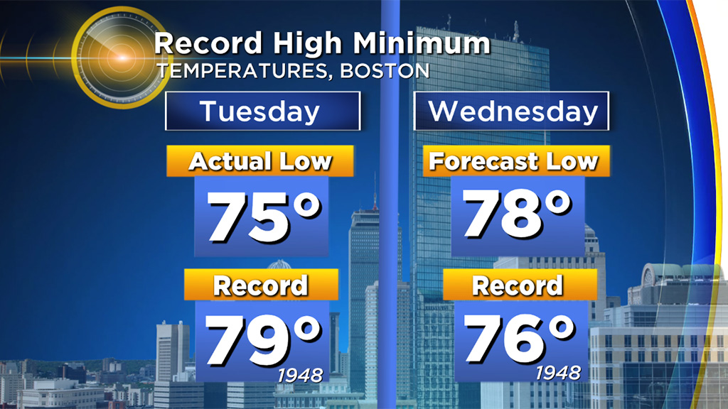
Record High Minimum Wednesday:
Current record: 76 (1948)
Forecast: 78
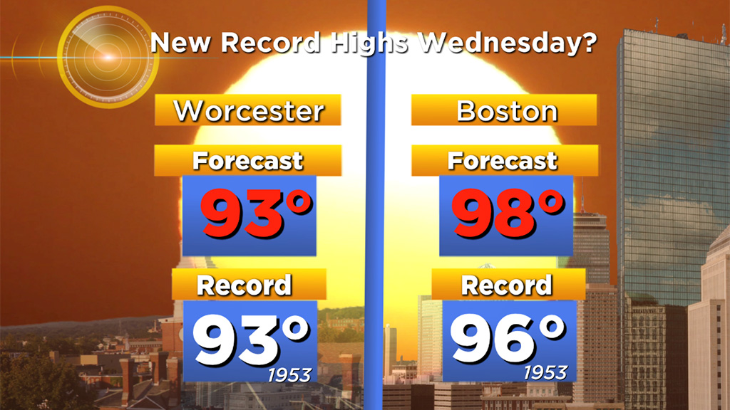
Record High Maximum Wednesday:
Current record: 96 (1953)
Forecast: 98
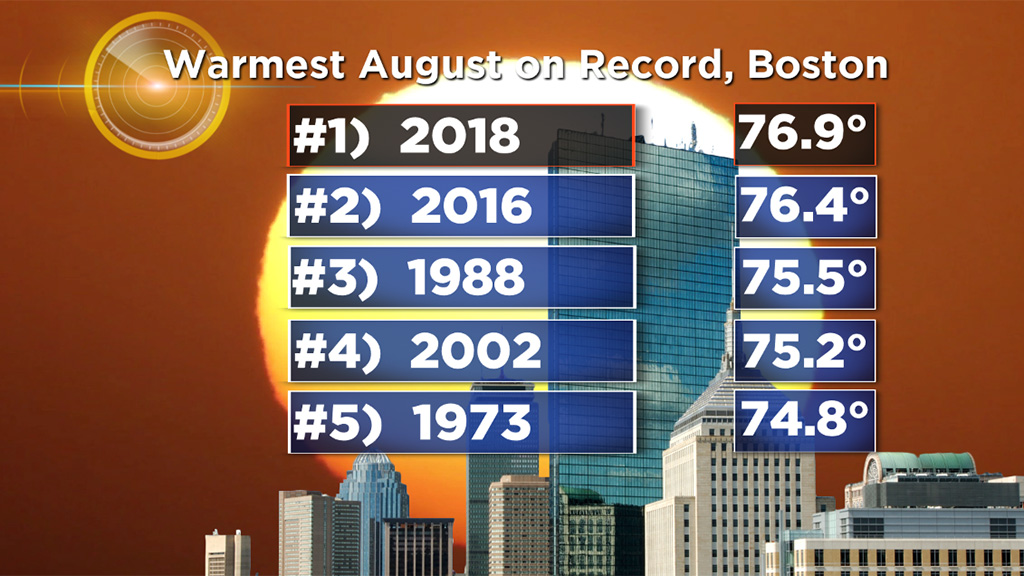
Warmest August on record:
Current record: 76.4 (2016)
Aug 2018 so far: 76.9 and rising!
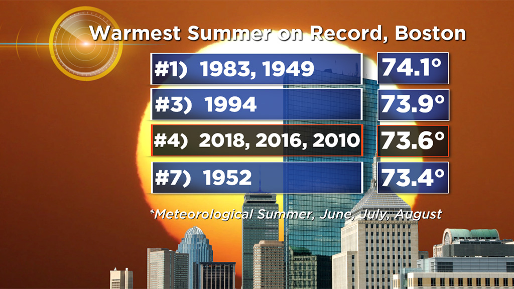
Warmest Meteorological Summer on record (June-July-August)
Current record: 74.1 (1983, 1949)
Summer 2018 so far: 73.6 and rising
It is rarefied air to hit 98 degrees or higher this late in the summer. In fact, it has only happened 6 times ever on record in Boston, and the last occurrence was 35 years ago! Long story short, this is fairly unprecedented heat that we are experiencing this week and this summer.
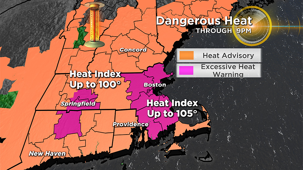
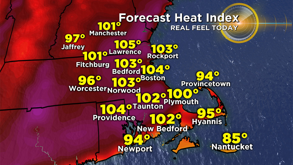
The National Weather Service has issued excessive heat warnings for parts of our area through Wednesday. This is due to heat indices reaching near 105 degrees (combination of temperature and high humidity). Needless to say, in conditions like these you should limit your time outdoors, particularly during the hottest parts of the day, avoid strenuous outdoor activity, and make sure to stay hydrated.
Thankfully, a cold front will snap the heat wave on Thursday, after a hot start (likely near 90 by mid to late morning), building clouds and a few scattered showers and storms will push through during the midday and afternoon. The timing of this front is key - a passage early in the day would limit the potential for any severe weather and also hold back temperatures from soaring well into the 90s again (this is currently the more likely scenario). If the front were to arrive a bit later in the day, we are looking at another oppressive, dangerously hot day and an increased likelihood of severe thunderstorms.
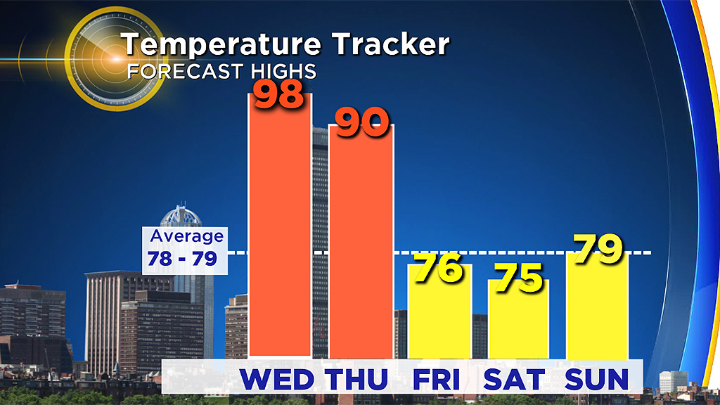
Either way, highs on Friday and Saturday will drop back to more seasonal levels (75-80) and the humidity will be noticeable lower as well!