Weather Alert: High Heat, Oppressive Humidity And Potential Thunderstorms
BOSTON (CBS) - A WBZ-TV Storm Watch Weather Alert has been issued for high heat, oppressive humidity and potential thunderstorms Tuesday afternoon into the early evening.
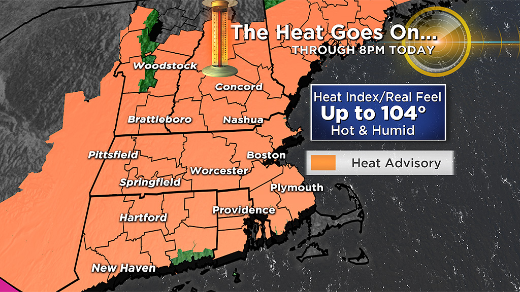
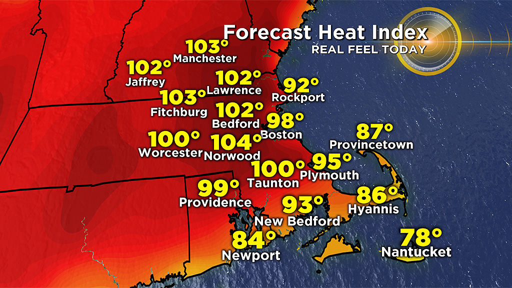
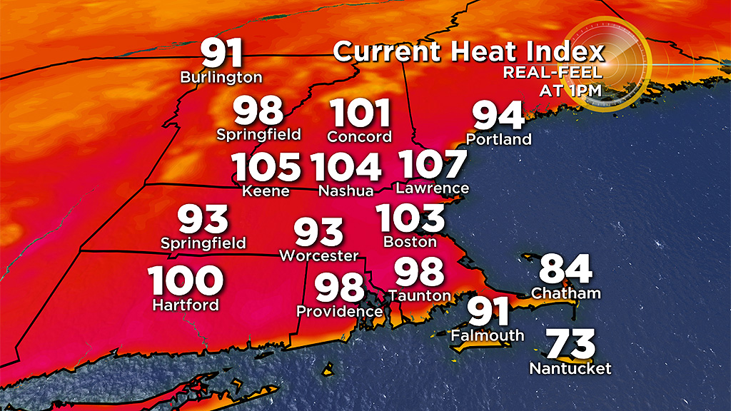
The National Weather Service has a Heat Advisory posted until 8 p.m. for "real feel' temperatures of 98-to-104 over much of the region excluding Cape Cod and the Islands.
Unlike the previous hot days, this one may contain a few thunderstorms this afternoon into the evening. A weak boundary will be settling into southern New England from the north. Sufficient convergence and uplift should occur closer to this focus boundary to create some scattered thunderstorms.
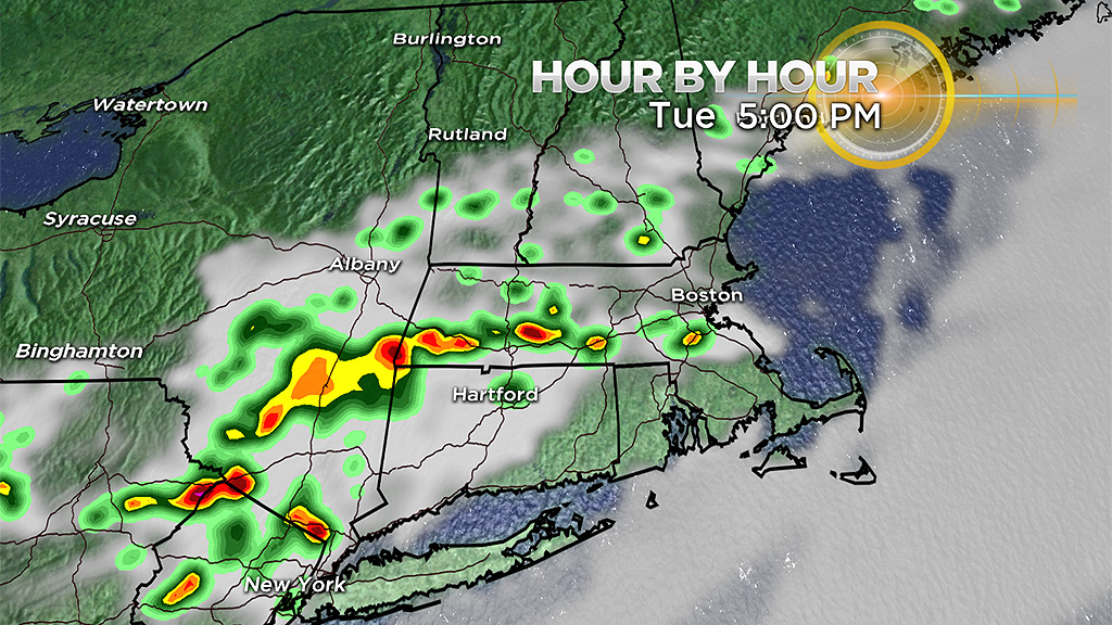
The primary feature from these slow-moving boomers will be drenching tropical downpours capable of producing local street flooding. Watch out for dangerous cloud-to-ground lightning as well.
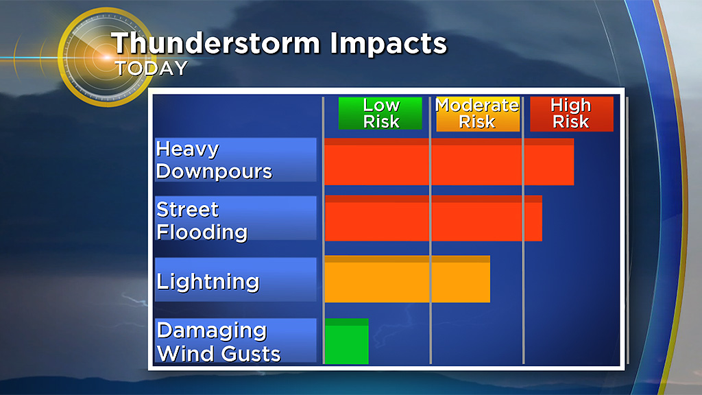
The risk of damaging wind gusts remains rather low.
Heat Wave Tips
- Check WBZ-TV, CBSBoston.com and The National Weather Service for critical updates.
- Never leave children and pets in enclosed vehicles
- Stay hydrated by drinking plenty of fluids even if you do not feel thirsty. Avoid drinks with caffeine or alcohol.
- Eat small meals and eat more often.
- Avoid extreme temperature changes.
- Wear loose-fitting, lightweight, light-colored clothing. Avoid dark colors because they absorb the sun's rays.
- Slow down, stay indoors and avoid strenuous exercise during the hottest part of the day.
- Postpone outdoor games and activities.
- Use a buddy system when working in excessive heat.
- Take frequent breaks if you must work outdoors.
- Check on family, friends and neighbors who do not have air conditioning, who spend much of their time alone or who are more likely to be affected by the heat.
- Check on your animals frequently to ensure that they are not suffering from the heat.
After the refreshing weather along the coastal plain Monday, it is torrid at many east-facing beaches this afternoon. As of 1 p.m. the temperature at Logan Airport in Boston is 95 degrees and factoring in the oppressive humidity with a dew point of 72 degrees, the 'real feel' temperature is a whopping 103 degrees!
For many locations more than a few miles away from the ocean, this will be a protracted heat wave probably maxing out at 7 or 8 consecutive days! The number of days at 90 or more will be reduced closer to the coast as onshore ocean breezes will provide some slight relief again Wednesday. Boston got 3 straight days on Friday, Saturday & Sunday to make it an official heat wave but that was broken Monday by a high of only 83 at Logan.
Boston's longest heat wave was comprised of 9 days on July 3-11, 1912. There have been several 8-day heat waves in Boston over the past approximately 140 years. One of the more recent heat waves amounted to 7 days in 2013 from July 14-20.
The ridge of high pressure will eventually be squashed southward enabling a return to refreshing air late Friday or Friday night. This weekend we will have genuine relief with low humidity and temperatures in the upper 70's on Saturday and middle 80's on Sunday.
Stay cool and take it easy!


