Say It Ain't Snow! Quick Burst Arrives For Monday Morning Commute
BOSTON (CBS) – Happy April! We're tracking more snow.
No need to panic, just a short burst for Monday morning. Then we can look forward to a big mid-week warm up (along with some thunderstorms). Here are the details for this next snow maker.
TIMING
Most of the snow holds off until the morning commute. Not good timing, but the snow consistency is pasty and wet with temps in the mid 30s. So most accumulation should be on the grass or elevated surfaces. Not so much on the warmer roads.
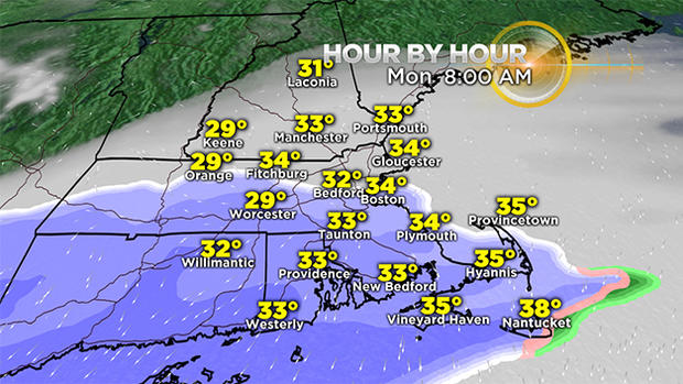
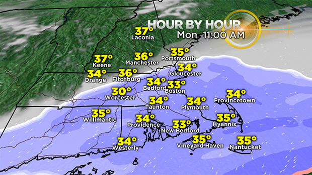
However, there could be slick spots and reduced visibility in the heaviest bands of snow. Height of the snow should be between 8-11 a.m.
One inch per hour snowfall rates are possible along the south coast.
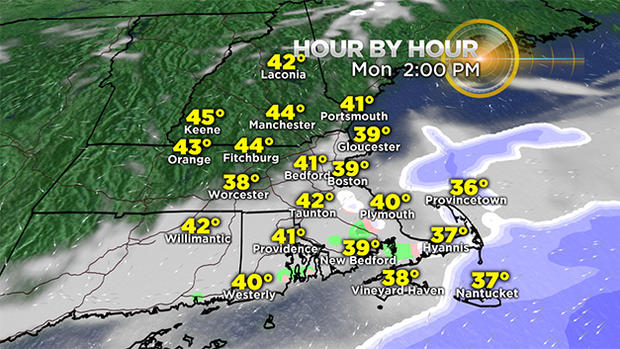
The snow tapers off as the clipper system passes to our south, heading east and out to sea by mid-afternoon. That's it! No coastal threat. No wind threat.
TOTALS
A widespread coating to 2 inches of snow all across Massachusetts. Isolated spots with 3 inches along the south coast of CT, RI and MA.
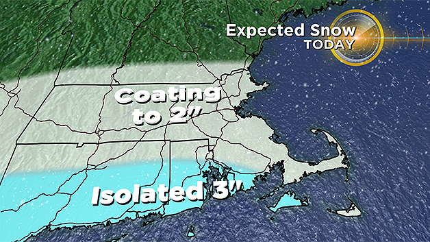
The upper Cape could also see three inches, with more mixing towards the outer Cape. Again most snow accumulation will be on the grass. And it will melt quickly as we dry off by late afternoon, clear out, and warm up to highs in the 40s.
ADVISORIES
The National Weather Service has issued a winter weather advisory for the south coast Monday.
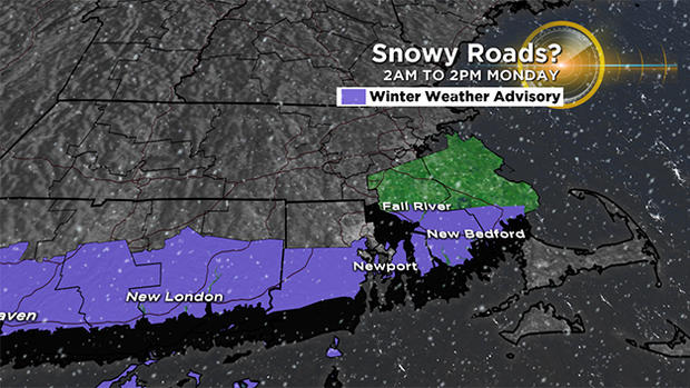
Roads may be briefly snow covered and visibility could be near zero in the heaviest snow bands during the morning drive.
WORK-WEEK OUTLOOK
First half of Tuesday will be dry and cool, highs in the mid 40s. Chance for a brief wintry mix Tuesday night, changing to scattered rain Wednesday morning as a warm front lifts north. That ushers in a warmer airmass in the afternoon.
Temps nearing 70 Wednesday with a gusty southwest wind. Cold front moves through Wednesday night…that may trigger a thunderstorm or two, along with rain. Much colder for Opening Day at Fenway Park Thursday, high of 44, breezy but dry.
Our active weather pattern continues into next weekend and highs may be stuck in the 40s. Possibly a coastal storm threat in the 7-9 day outlook. But let's not get into that right now!
Have a great first week of April!
Follow Pamela Gardner on Twitter.


