Brutal Wind Chills, Dangerous Cold To Dominate Forecast Into New Year
BOSTON (CBS) - Bitterly cold air has moved into New England and it is going nowhere fast.
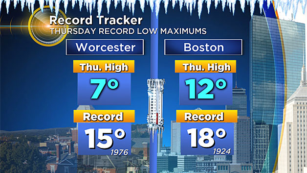
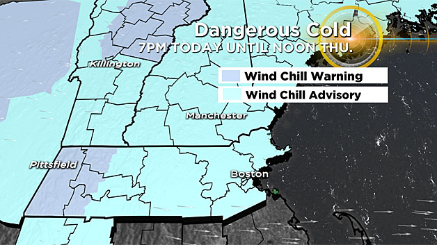
Strong arctic high pressure will dominate our weather pattern for the next several days, bringing record cold high temperatures and dangerously cold wind chill values.
This is the type of cold you don't want to mess with.
Frostbite and hypothermia are concerns when the temperatures and wind chill values drop to these levels the next few mornings.
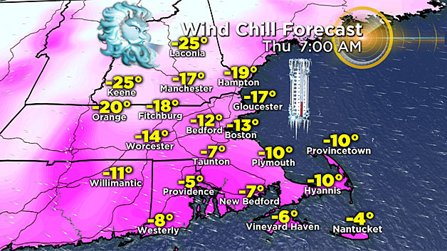
I know it goes without saying, but it's crucially important to layer up and cover up exposed skin in these conditions. Frostbite can develop in as little as 30 minutes if you're not careful.
Looking ahead to New Year's Eve - another round of dangerously cold wind chill values is likely, so you'll want to plan accordingly for your celebrations.
In terms of the threat for snow, chances are pretty limited the next few days with extremely dry air and little moisture in place.
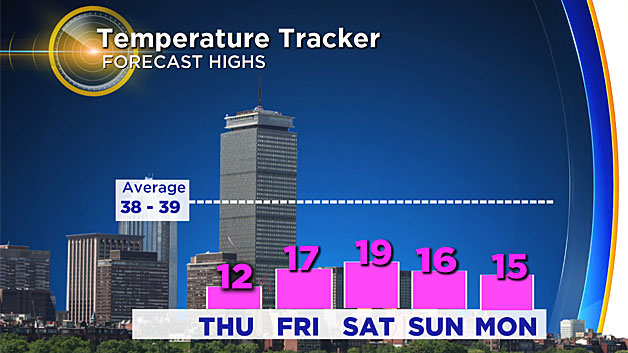
Late Friday a weak disturbance approaches the region and may bring some late day snow showers.
While the threat of a major coastal storm for the weekend has diminished somewhat, plowable snow cannot be completely ruled out Saturday night into Sunday morning, so stayed tuned!


