This Weekend Brings A Chance For Boston's First Flakes
Find Eric Fisher on Twitter and Facebook
We had our last fling with mild air Wednesday morning, and now it's time for winter to take the reins. The same front that ushered seasonable chill back into the area will take a 2-day vacation off the coast and then make a move back at us to start the weekend. Exactly how far it backtracks will determine whether we get a surprise snOMG event or a more subtle novelty snowfall to get the winter party started. Here we goooooooo......
 Water Vapor loop across the eastern U.S.
What we're watching is a long stalled-out front that's draped from Texas to the eastern seaboard. It's a pretty impressive tropical plume of moisture being held at arm's length from us by the trough digging into the east. This will hang out and wait for the next arctic impulse to slide down out of Canada and give it a push Friday into Saturday. At the same time, cold air is draining south to the Gulf Coast. Weird as it sounds - some flakes could fall in places like Louisiana and Alabama before they fly in Boston!
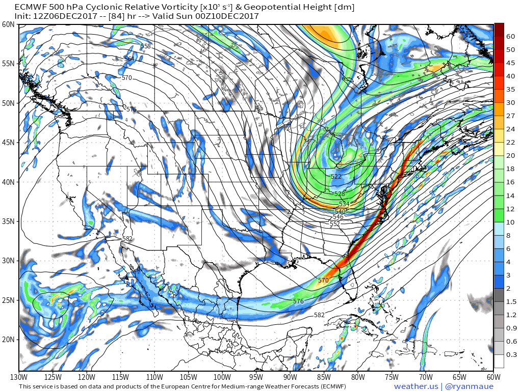
The next arctic 'kicker' shoving our wave east on Saturday. The question is - will there be a little more phasing with this...which in turn could produce a larger and closer storm? It's a close call, but the overall tilt of the trough is pretty lazy (positively tilted) so expectation is that it will force the boundary away instead of grab it and draw it westward like a negatively tilted trough would.
A wave of low pressure will develop along the front and that's what we have our eyes on locally. The general flow looks relatively flat and that keeps a major nor'easter off the table for us. Which means we're not talking about an all-out waves, wind, flooding type of storm. Merely the back edge of this wave moving over us, and it will likely be a very sharp cutoff between haves and have-nots. All guidance points to the precipitation dropping off dramatically toward central/western New England...and perhaps as far east as Boston with the majority staying offshore.
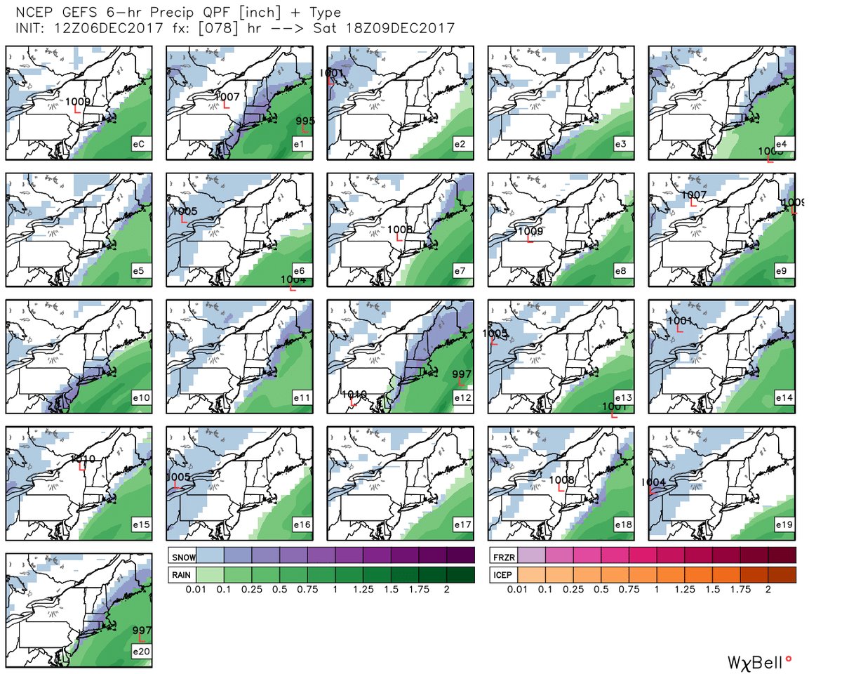
Wednesday's GEFS members with a range of solutions still...with the European model's EPS doing the same. Still tough to lock in on an exact scenario just yet.
The first chance for some rain/snow mix will be Friday night across Cape Cod and the Islands. Water temperatures are still very mild, and so any onshore wind warms things up enough to make for sloppy wet snow or rain. High-impact weather looks unlikely Friday night. During the day on Saturday, we'll be watching that wave of low pressure ride up the east coast and pass just out to sea. At the same time, there's a strong jet streak moving over New England, which helps air to rise and should help the plume of snow to extend inland. Then things will shove farther out to sea heading into Saturday night and be gone by Sunday.
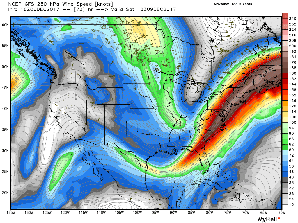
A strong jet streak in the east should enhance precipitation to the west of the front...keeping us in play for snowfall. Also - flights from Miami to Boston should be quick on Saturday!
How much are we talking? Surface temperatures look borderline in the 30s and the ground is still fairly warm, so all told it looks like a coating to as much as a few inches will be possible in our viewing area. Nothing huge, but our first rodeo of the young season. And with temperatures at or below freezing Saturday night, it should be an opportunity for DPW crews to head out for the first time as well to treat roadways. The mixing of rain with the wet snow on Cape Cod and the Islands should keep things slushy and accumulations on the lower end, with the best chance for some respectable accumulation across the bridge into southeastern Massachusetts and the 95 corridor.
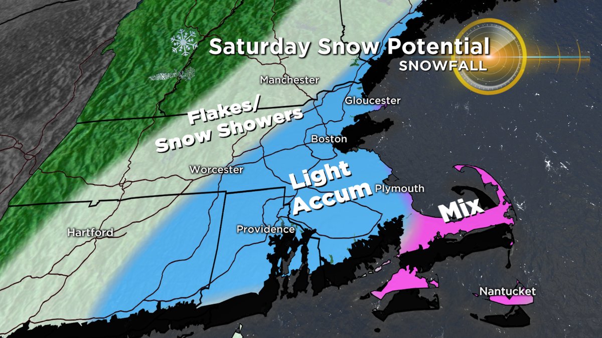
What could change? Since there's a really sharp back edge to this one, we could miss almost the entire thing. Or at least see it just grazing Cape Cod. On the flip side, a little jog west is entirely possible, which could add a few more inches to the fray and produce some actual travel slowdowns farther inland. We should be able to nail down the exact numbers and track on Thursday as all the players get into position.
And if we miss this one, we'll have another shot for snow lovers next week. A clipper will dive down out of Canada and rapidly intensify near our coastline late Tuesday into Wednesday morning. At this range it's impossible to say exactly how close in that intensification will occur, but it's one to watch and will regardless usher in some real-deal arctic cold for the middle and end of next week.
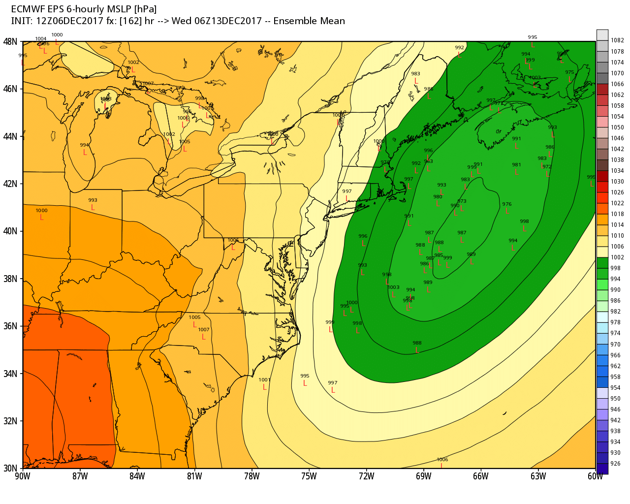
A coastal low should quickly ramp up late Tuesday. If it pops right over us, we would miss most of the precipitation. If it gets going too far east, we also miss most. Will have to be just right to sneak in a snowstorm.


