A Sunday Supermoon With A Side Of Big Tides
Find Eric Fisher on Twitter and Facebook
What do we do when weather is quiet and boring? We turn to space! The full 'cold' moon is slated to grace our skies on Sunday, and it will in fact be a supermoon. Is that phrase totally overused? Yes. Does it make a huge difference in the beauty of the full moon? No. Will you be able to throw a lasso around it and pull it on down? No. But it'll be a full moon at close proximity to earth, which will make for some photo ops and high ocean tides.
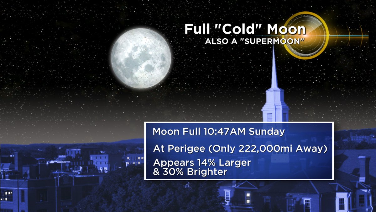
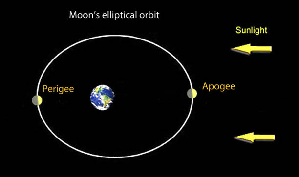
While the moon of course is not actually any larger, it can appear 30% brighter and appear 14% bigger when at supermoon status, which is a full moon close to perigee. Perigee is the closest point in its monthly orbit around earth. It technically needs to be within 90% of its closest pass to qualify (closer than 225,027 miles), and since perigee for this month's orbit is on Monday, this one makes the grade!
There are 4 to 6 supermoons, on average, every year. This year gets just one full supermoon (Sunday's) but the next three are all technically supermoons (Jan 2nd and 31st) PLUS January gets even more funky with its moon lore. Since there are two full moons in the month, the one on the 31st is a blue moon AND a supermoon. Does any of this matter? No not really. They're all excellent and beautiful and anything that gets people to go outside and look up is a win in my book. So superbluemadeofcheesemoons are great.
The moon is 'full' at 10:47am, so you could really say both Saturday night and Sunday night are a 'go.' It's a tossup.
Saturday - Moonrise: 3:55pm Moonset: 6:31am
Sunday - Moonrise: 4:43pm Moonset: 7:43am
How about the ocean? Full moons and new moons add their gravitational tug to that of the sun, and produce extra high and low tides. Since this full moon is closer to earth, the tides will be higher and lower than usual. We call these 'perigean spring tides.'
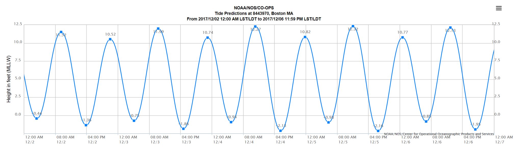
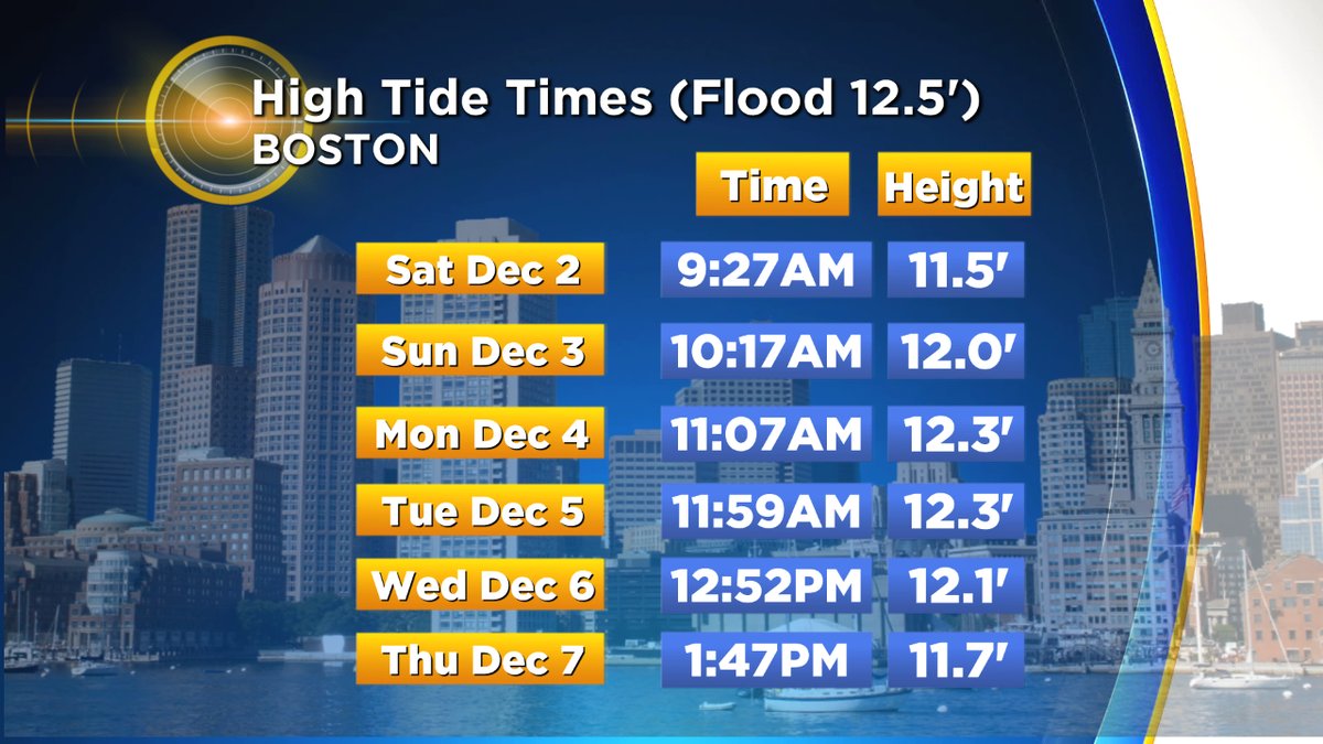
Taking a look at the tide forecast for the weekend into early next week, you can see the impressive effect. We'll top out just about an inch shy of the highest tide of the year on Monday and again Tuesday, at 12.3' in Boston Harbor. The high tides will likely flood vulnerable areas, like Hampton Harbor, Long Wharf in Boston, Morrissey Boulevard, etc. Any coastal dweller is probably familiar with the typical flood zones.
When these high astronomical tides coincide with storms, they can produce the threat of significant flooding. But we look to be fortunate this time around. Monday and Tuesday both look quiet weather-wise and shouldn't have too much onshore flow. Monday may funnel some water in a few vulnerable spots with a NNW wind, namely the north side of Nantucket and you'll likely see very high water on the bay side of Cape Cod. Something to be wary of if you live near the water.
And as for the forecast for cloud cover, both Saturday night and Sunday night are looking O.K. There may be some ocean-effect cloudiness both days across Cape Cod and the Islands in the northerly flow, as well as some spotty high cirrus clouds across the interior. If I had to pick a night to take pictures, I'd probably go with Saturday night. An inverted trough Sunday evening could bring areas of clouds around moonrise, and even a spotty rain/snow shower too.
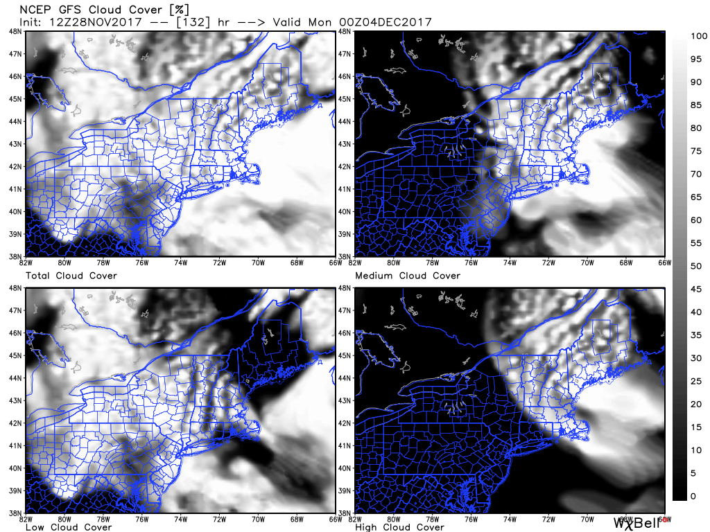
Sunday evening will likely feature more cloud cover than Saturday evening across the area.


