Arctic Blast Could Bring Record Cold This Weekend
By Terry Eliasen, Meteorologist, WBZ-TV Exec. Weather Producer
BOSTON (CBS) - Well, so much for fall…did it ever really happen? New England is known for its sudden weather changes, literally shifting from one season to the next in mere hours. But straight from summer to winter? That's a new one!
Just last Friday it was 75 degrees in Boston, that after the second warmest October on record and THE warmest September-October for all of New England…fall, what fall?
And now it seems we are headed straight for winter. No easing into the cold, no slow decline in temperatures, but instead, a blast of cold straight from the Arctic which is LOADED with frigid air right now.
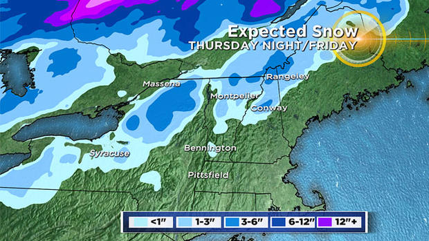
SNOW SQUALLS THURSDAY NIGHT INTO FRIDAY
Our most severe shot of cold is ushered in late Thursday night behind an Arctic cold front. This will likely spark a few rain showers in southern New England overnight and some heavy snow squalls in parts of central and northern New England…dropping 1-3" of snow on some of the higher elevations of the Greens and Whites.
Oddly enough, our official high temperature on Friday will go into the books near 50 degrees! This high will occur shortly after midnight, just as the front is about to pass through…during the day on Friday temperatures will be in freefall.
FRIGID FRIDAY
The cold air pours in during the day on Friday. Temperatures will drop through the 40s in the early morning, through the 30s in the afternoon and into the 20s at night.
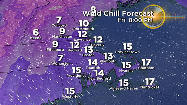
With winds gusting 20-40 mph on Friday out of the northwest, wind chill values will be in the teens and 20s. Overnight winds will gust 12-25 mph and wind chills will drop into the single digits in many locations.
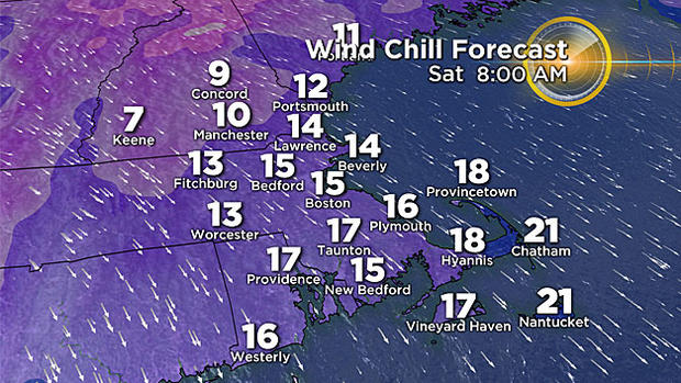
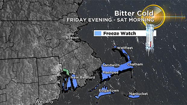
RECORD SETTING SATURDAY?
The cold will bottom out Saturday morning. Got an early morning soccer game? It doesn't get much colder than this for mid-November.
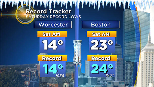
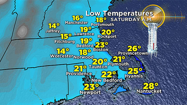
In fact, low temperatures will drop to near record levels early on Saturday. Current records of 24 degrees in Boston and 14 degrees in Worcester will be challenged!
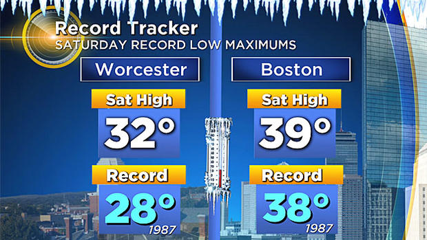
Add in winds of 10-25 mph and "feels like" temperatures early Saturday will hover between 0-15 degrees! Temperatures recover a bit by Saturday afternoon but we may still make a run at one more record…The coldest maximum temperature for November 11th is 38 degrees, set back in 1987. Boston's high temperature this Saturday will be pretty close to that number.
Where do we go from there? Well there's only one way to go…up! Sunday morning will be cold, but likely nothing record setting (20s and low 30s). By Sunday afternoon temperatures will be downright balmy in the mid 40s.
The next weather event to watch is a potential coastal storm early next week. Details still need to be worked out, but there is potential for a couple days of rain and wind.