Potent Storm Approaching This Weekend
Find Eric Fisher on Twitter and Facebook
A wet stretch is about to get wetter in New England. After loads of sunshine and beautiful autumn weather, a pattern shift is loading up the storms and a particularly interesting one is setting up for late Sunday into Monday. A tropical connection, tied in to a very dynamic setup, could yield unusual results here in the Northeast.

NHC monitoring 93L, which will be one of several ingredients for the late weekend storm. Source: National Hurricane Center
The signal for an 'outlier' event is showing up in computer models, which is a reason to watch this one closely. The first piece of the puzzle is 93L - a tropical disturbance in the Caribbean. While this is not expected to organize too much and only has a small chance to become Tropical Storm Philippe, it has tropical moisture and wind energy to offer. This will get sucked in to an approaching trough at the start of the weekend and rapidly head north up the eastern seaboard.
The pattern is flashing 'strong storm' with plenty of upper-level support late Sunday into Monday morning.
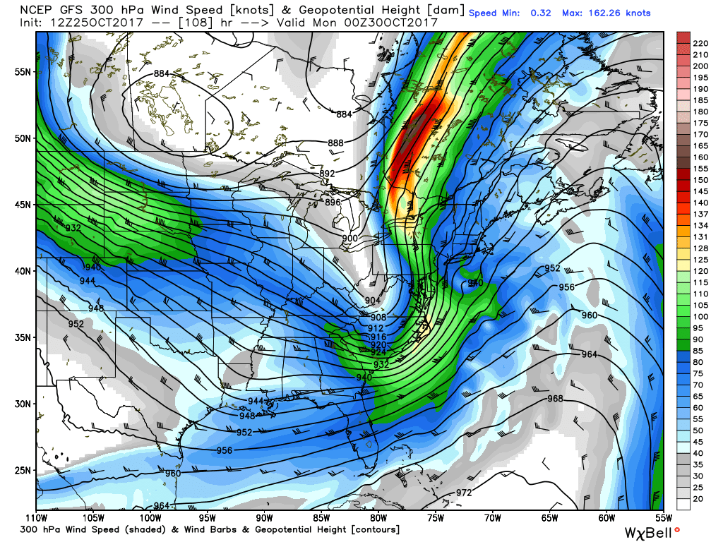
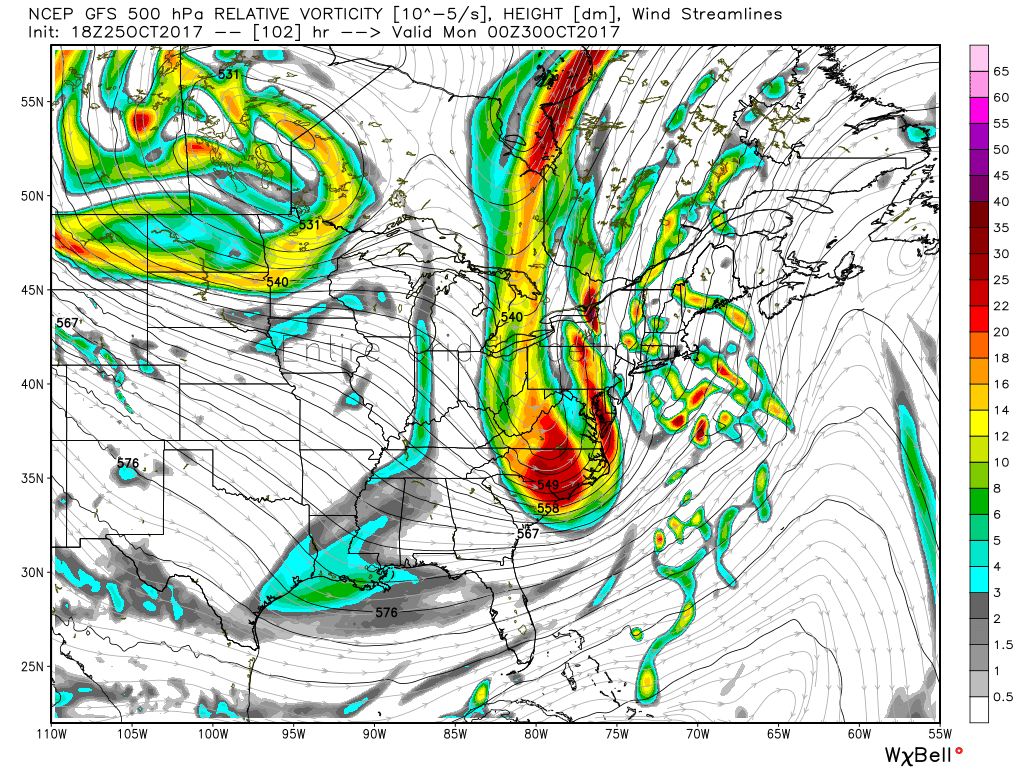
As for the general setup, it's a potent one even without the tropical assist. We'll be watching another deep trough digging in across the Midwest and Northeast, which will help capture 93L. From there, we have a jet stream setup that almost always delivers impressive results. Guidance is showing coupled jet streaks, which can produce strong areas of low pressure that intensify rapidly. There is a ton of divergence aloft, which helps air rise and vents the storm. And we have a trough going negative tilt, which also helps aid in lift.
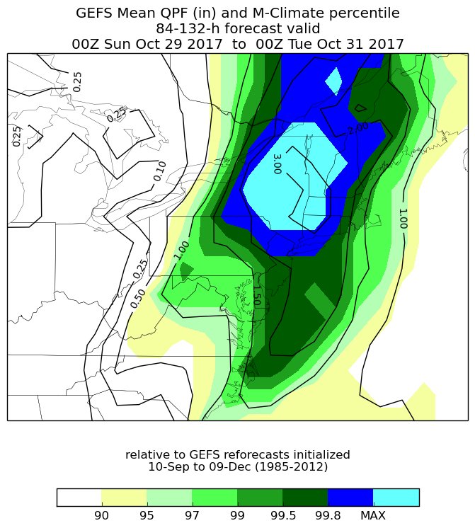
Wednesday's GEFS rainfall forecast is above historical fall forecasts here in the Northeast.
So when you put all these ingredients together, you have the recipe for a lot of rain and wind. I think some of the computer guidance is having some convective feedback issues and is overdoing some of the winds, but no doubt a powerful low-level jet will ramp up on the eastern flank of this storm. If you've seen model maps showing 100mph winds for us, please throw them directly into the trash bin. We don't get 100mph winds out of the south unless it's a hurricane, and even that is pretty rare. And we won't have a hurricane. It ain't happening. But the potential is there for some gusts over 50-60mph, especially across the coastal plain - Cape Cod - Cape Ann. The trickiest thing in these setups is figuring out how much of the LLJ will be able to transfer to the surface, and how much of it stays locked up above our heads.
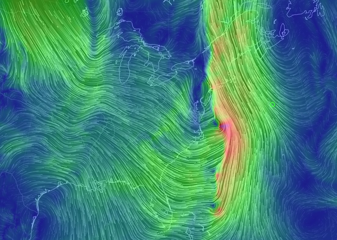
Winds at 850mb late Sunday showing the strong low-level jet and deep tropical origins yet again
For the rainfall side of things...it comes down to how much tropical energy gets infused, where exactly the storm tracks, and how fast it moves. Odds at the moment favor western New England and New York for the biggest rain amounts, and if we get all the pieces together we could be talking over 4" of rain for parts of that max zone. I'd expect things to shift at least a little over the next few days but the potential for flooding is certainly there.
Timing it out, looks like rain would be moving into our area locally sometime late on Sunday. Unlike the current storm, this one is moving *much* faster. So it may bring a quick but strong punch of wind and heavy rain before moving out pretty early on Monday. It's too early to tell if that rain would be here during the Patriots game, but at the very least it should be windy, cloudy, and mild Sunday afternoon.
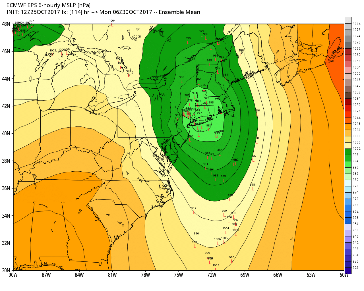
Euro EPS tracks showing strong agreement on a track off to our west. This produces a sou'easter instead of a nor'easter! Mild, mainly southerly winds instead of cold northeast ones.
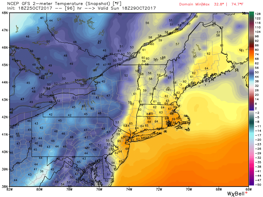
Since it looks like the center will track to our west, we'll be on the mild side. Another big push of 60s to near 70 degree temperatures is likely, along with high humidity. This should also solidify October as the #1 or #2 warmest on record in Boston. But again since this one is moving faster, that won't last long. It'll be a lot drier and colder by Monday afternoon and this ushers in a true early November air mass (at last!).