Storm Brings Torrential Rain, Damaging Winds Through Wednesday
BOSTON (CBS) -- Torrential rainfall and damaging winds on the way. It sure has been a while, hasn't it?
After one of the warmest and driest first three weeks of October ever recorded, some dramatic changes on the way in the next few days. While all these spectacularly sunny and warm weekends have surely been a treat, there is no doubt we can use the rain. For the first time in several months, parts of southern New England dropped back into the "moderate drought" designation last week. Boston has received less than .5" of rain this month, more than 2" below the average.
We could make up that entire deficit and then some before the week is over.
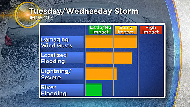
The main impacts from this event will be the heavy rain and the strong, potentially damaging winds. Let's break it down hour by hour.
Tuesday Daytime:
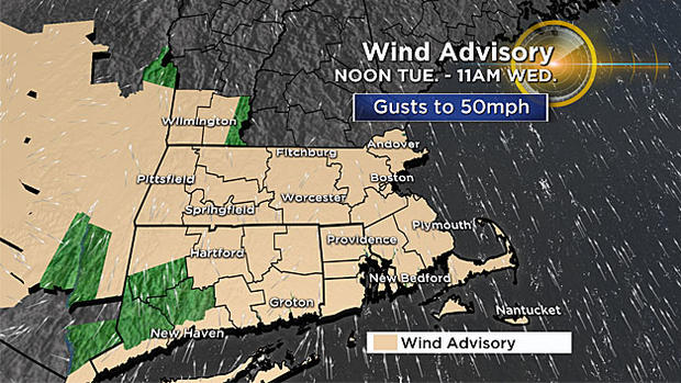
Areas of showers and embedded downpours will be scattered throughout the day, a sign of the humid air pushing into the region. You'll definitely want the umbrella on standby. Winds will increase throughout the day out of the south-southeast, gusting 20-to-40 mph. Lots of leaves flying around and some isolated damage will start to pop up.
Tuesday Evening/Night:
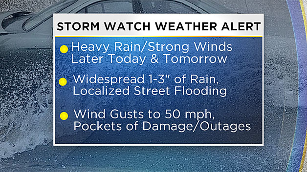
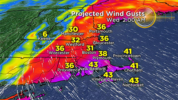
Winds continue to be active, gusting 30-to-45 mph from the SSE. The strongest wind gusts will coincide with the heaviest downpours; some gusts to 50 mph will be possible, resulting in pockets of damage/outages.
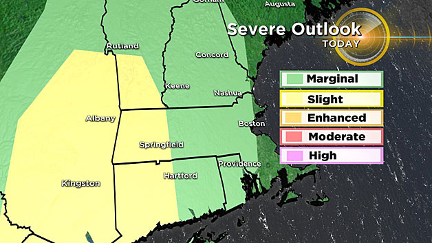
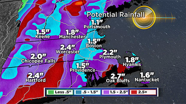
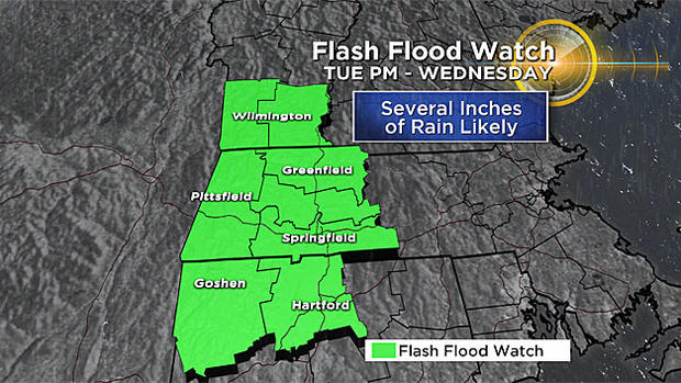
Rain showers become more numerous, but the main area of downpours will be out in western Mass. Several inches of rain are likely there where a flash flood watch is in effect. There is actually risk of a few severe thunderstorms across western Mass., again a rare occurrence for this time of year. After midnight and closer to dawn, heavy rain and strong wind will push into eastern Mass.
It will be a very warm, muggy night.
Wednesday Morning:
Torrential rainfall with pockets of damaging wind gusts arrive in central and eastern MA, and make for a very slow AM commute. Localized street flooding with lots of leaves and limbs on the ground by late morning and midday. Gusts will be highest within the heaviest downpours, likely between 40-50 mph. It certainly won't feel like late October with dew points in the 60s, a more tropical-like feel in the air. In fact, we may even hear some rumbles of thunder at times.
Wednesday Afternoon/Evening:
The most impactful weather shifts to eastern and eventually southeastern MA. Periods of heavy rain will persist in these areas through the afternoon and evening on Wednesday, producing a widespread 1-2" of rainfall with pockets of 2-4" amounts. Lots of water, leaves, and limbs on the roads by the evening commute.
Wednesday Night:
The heaviest rain moves east and offshore, leaving some lighter areas of rain over eastern MA, particularly over Cape Cod. Winds gradually decrease overnight, with the last of the 40 mph+ gusts ending over Cape Cod and Nantucket after midnight.
Thursday:
The high impact weather is over, but most of Thursday will remain cloudy with periods of rain redeveloping. Winds will no longer be a factor and the humid/muggy feel is also gone. Temperatures also return to more typical late-October levels, mainly in the 50s to near 60.
And a quick look at next weekend--Friday and Saturday look quite nice right now, with lots of sunshine and highs in the 60s. Sunday remains a bit of a question, as our next batch of heavy rain will be on the approach late in the day.
Follow Terry on Twitter @TerryWBZ


