Beyond The Forecast: Hurricane Irma Will Miss New England
BOSTON (CBS) -- Forecasters now say that Hurricane Irma will make landfall on Florida's Gulf Coast, sparing New England.
So what does this mean for the Southeast United States?
TROPICAL UPDATE:
The eye is moving across the Florida Keys this morning. Extreme wind of 130 mph, rain, and storm surge occurring there.
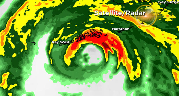
There are tornado watches up for all of southern Florida, bands of Irma bringing widespread damaging wind, and torrential rain from coast to coast on the peninsula.
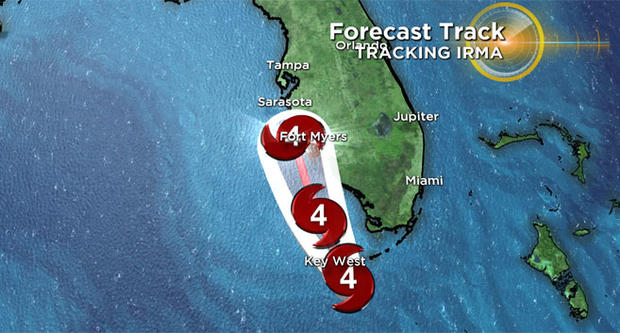
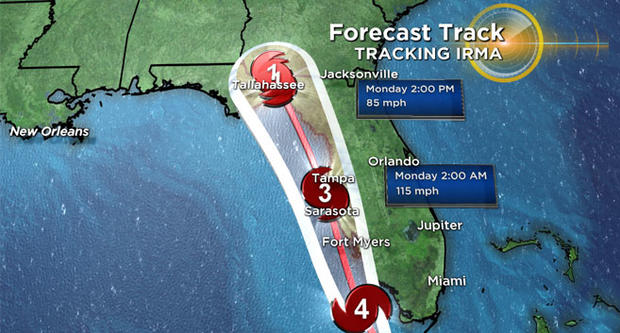
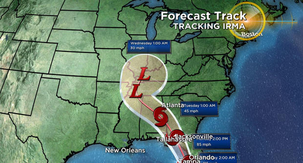
The latest update from the National Hurricane Center has Irma hugging the west coast of Florida, potentially making another landfall near Sarasota before moving northward near Tampa.
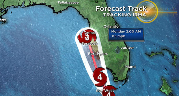
It will still be a major hurricane tomorrow, then weaken as it interacts with land to a Tropical Storm by Monday over Georgia.
Catastrophic damage for the Sunshine State will result with life threatening storm on both coasts and major erosion. Along the coast from the Keys to Ft. Myers, storm surges could be 8-12 feet.
Florida residents can expect widespread continued wind damage with long term power loss and localized flooding with 5-10" of rain (up to 20" in spots) along with the threat for weak, isolated tornadoes.
What does this all mean for us in New England? The few showers that remain by Wednesday will try to make a run at the south coast of New England, but a strong high pressure area parked over the northeast will likely block most if not all of the wet weather from getting here.
Bottom line--no impact, no worries here in New England from Irma.