Weather Alert: Strong Storms Likely Friday
BOSTON (CBS) - Friday brings a return to heat and humidity, and with those factors in play some storms as well. Much like what we saw on Tuesday, only parts of the area will be impacted by this round. In particular, areas northwest of Boston will be the zone to watch for any Friday afternoon and evening travels or plans. Anyone south of Boston is unlikely to see any action. Since it's the kickoff to a big holiday weekend, pay extra close attention to the changing weather as heavy rain, lightning, and strong winds could all head into the area.
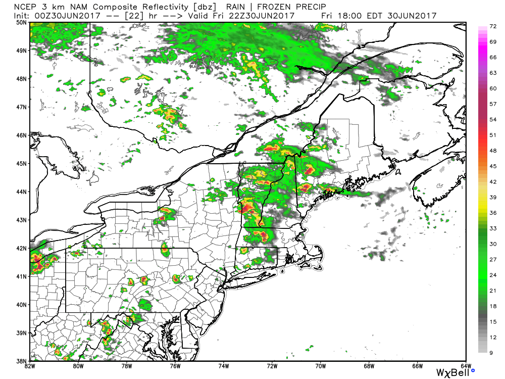
Simulated radar at 6pm Friday
These storms should begin to fire up by early afternoon in New York State and begin their trek eastward into Vermont, Western Mass., and eventually New Hampshire by late afternoon or early evening. Locally, our main time-frame to watch is 3pm through 11pm from west to east. They'll have plenty of juice to work with, so to speak, with temperatures topping out in the 85-90F degree range and lots of humidity compared to our comfortable mid-week stretch.
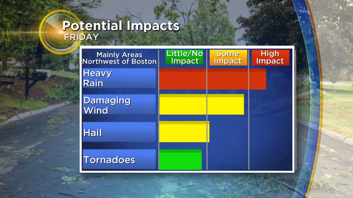
Since the air will be a lot more tropical, one of the main issues will be torrential downpours in any storms that get going. A quick 1-2"+ of rain will be possible in the heaviest storms. There's also plenty of wind energy in the atmosphere this time around, so damaging wind gusts will also be a risk. I don't expect to see as much hail as we did back on Tuesday, and the tornado risk is relatively low (albeit non-zero...there is a lot of wind shear to work with).
Once we hit the 10 to 11 o'clock hour, these storms should rapidly weaken and diminish as they approach Boston and points south, with a steamy humid night to follow and areas of fog. The Saturday storm setup looks similar, with many of the same spots seeing the highest chance of storms again after a hot day.