Warmest Weekend Of The Year On Deck
Find Eric Fisher on Twitter and Facebook
Are we there yet? Climatological Summer started on June 1st, but for most it's not summer until it actually feels like it. It definitely hasn't felt like it. Highs in the 40s and 50s Tuesday are as cold as it gets in early June, and every calendar day this month has featured at least *some* rain in Boston. Cloud fatigue has set in, so no one would begrudge you drooling over the 7-Day. Much-deserved warmer air is around the corner!
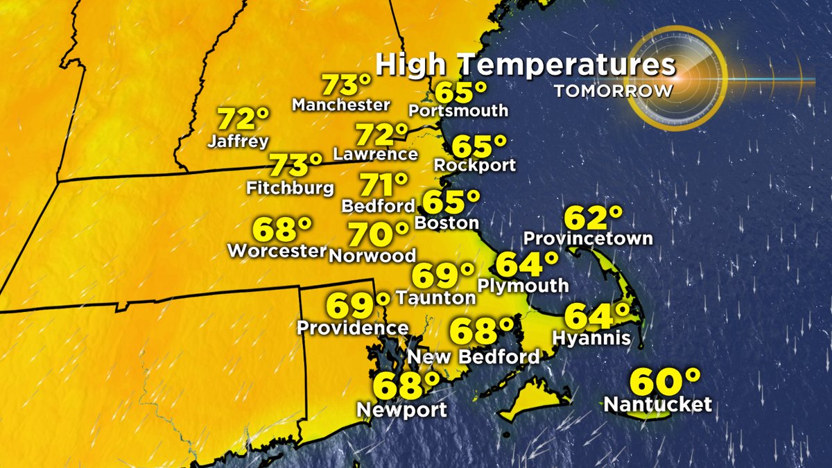
Wednesday's expected highs across the area.
We start off slow, which probably is a good thing. If we jumped to the 80s right away we'd spontaneously combust after this stretch. Wednesday and Thursday will still be a touch below average for this time of year but it should feel great. Brightening skies and highs in the mid 60s (coast) to low 70s (inland) are a-okay for a pleasant Wednesday afternoon. Thursday goes a touch warmer with most towns in the 70-75 range and some 60s at the immediate shore. A couple of days to dry out and let the sun go to work on all that standing water out there. Plus, a chance to mow the elephant grass thriving in most yards.
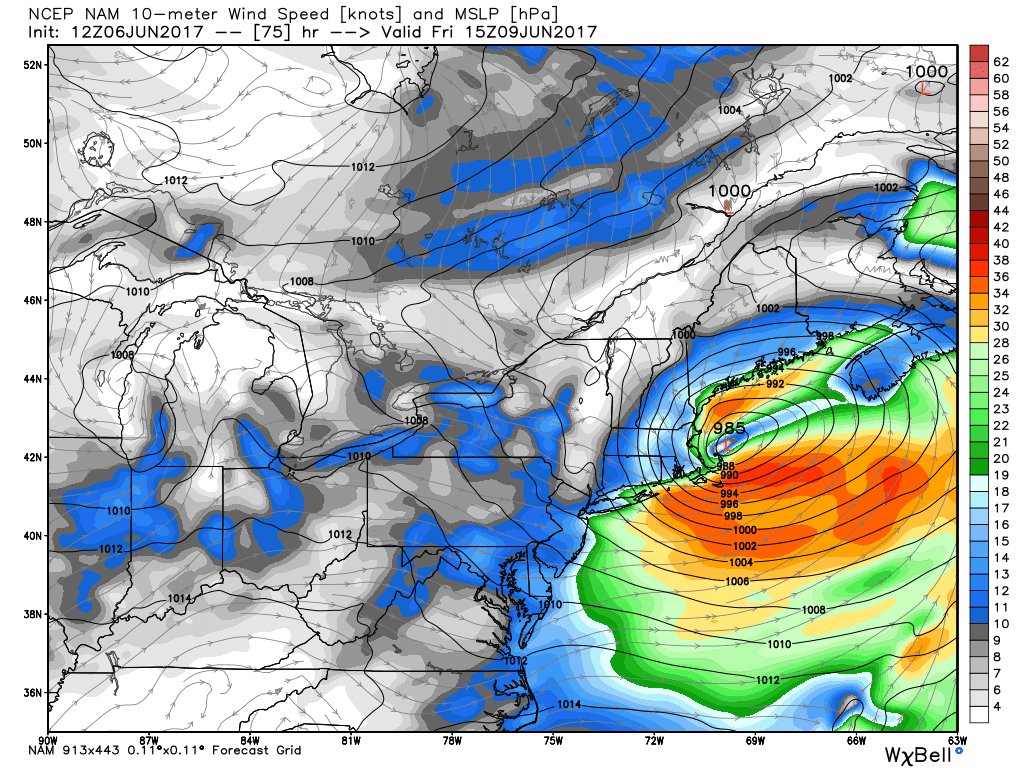
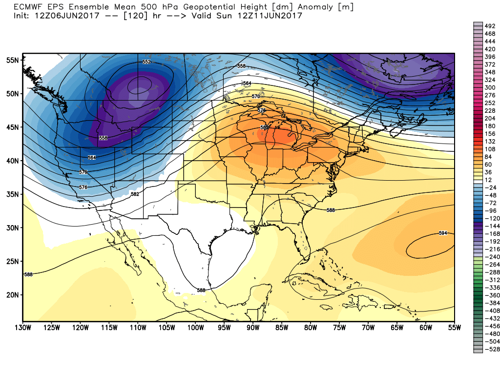
Guidance has been waffling back and forth between a major nor'easter and a glancing bit of rain for Thursday night into Friday morning.
Fly in the ointment? Yes there is one, and it rides up the coast Thursday night into Friday morning. This is kind of like a winter storm forecast, with a hundred miles or so making a huge difference. Normally it would just be the difference between a rainy or dry day, but since it's been so wet the stakes are a little higher. A track that brings the nor'easter closer to the coast could soak us with 1-3" of rain, cause flooding, and likely bring down trees with gusty winds. Would only take speeds in the 40s to bring down quite a few, considering the wet ground.
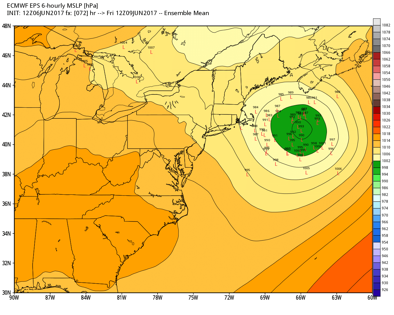
If this was winter, forecasters would be pulling their hair out. There's an unusually high spread of uncertainty for such a short range on where this storm develops. It hinges on a dance of upper-level support that will be swinging south Wednesday and then digging in toward the coast Thursday.
A glancing blow looks more likely at the moment, which means some early morning rain toward the Cape, Islands, and coastal Massachusetts/New Hampshire before the storm continues to chug out to sea. The highest odds overall are for Cape Cod and Nantucket, where it wouldn't take much of a wiggle to get over 1" of rain. There is still a large amount of uncertainty in the track at this short-range, unfortunately. We should be able to nail down the exact outcome by Wednesday.
Regardless of the coastal low, there's another front moving in from the west Friday afternoon. That should be enough to power some scattered showers/rumbles, especially for interior sections. So either way, some rain is expected to end the week. Because we're wobbling between the coastal system and the incoming front, our temperatures should get capped in the 60s to low 70s for highs.
How 'bout that weekend?! We're still not 100% dry but at least it's warmer. Yet another disturbance zips through the region Saturday, bringing with it some afternoon showers/storms scattered about. But at least we get a more westerly wind direction, allowing temperatures to warm into the 70s to low 80s. Not expecting a rainout...just some scattered activity to dodge.
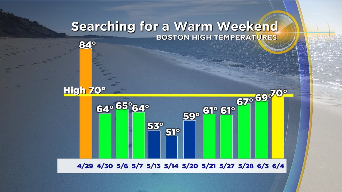
Sunday holds even more promise for summer weather fans with temperatures jumping into the 80s and perhaps even some low 90s. We haven't had a weekend day top 70 degrees in Boston since April! Caveat is that observations are on the coast in Boston, and that some inland areas have been warmer. But the point remains the same - weekends haven't been particularly balmy. Current forecast calls for a high near 88 in Boston, which would be the warmest weekend day of the whole year. Easter Sunday was actually the warmest so far with a high of 86. Seems like a long time ago! If your plans take you to northern New England, scattered thunderstorms look likely on Sunday but at the moment thinking we'll stay mainly dry across southern New England.
A protective ridge doesn't fully develop over us until late Monday into Tuesday...so we'll still be at risk for some scattered thunder through the weekend and early Monday before the core of hottest and driest weather moves in.
While early next week looks HOT, it's not slam-dunk hot yet. A ridge builds over the Northeast but guidance has been hinting at some backdoor cold front shenanigans around, especially Monday. Ridge-riding thunderstorms could help buckle the pattern over us, especially for central to northern New Hampshire and Maine. It's still a little TBD whether or not that front will slip all the way down the eastern New England coast. Something to be wary of, because if it does it not only will be cooler but we'll get additional chances for thunder/showers.
I'd say highest odds for the hottest day look to be Tuesday, where 90s are a solid bet. It's odd to think that in a year where everyone feels like it's been so chilly, we could be WELL ahead of a typical pace for 90 degree days by the middle of next week. If we pick up 3 or 4 Sunday through Wednesday, we'd be up to 6 or 7 to date. Boston only averages about 13 for a whole year, and we've barely even kicked off summer!


