Soaking Storm With A Silver Lining?
Stop me when this sounds familiar - a big rainstorm is on the way. We've had plenty of 'em! But at least they've all been spaced about a week apart. That A) keeps us sane B) allows conditions to dry out enough to limit any river flooding. Even with all the rain and some significant northern New England snow melt this spring, we've barely had any river flooding to deal with. And even with another drenching coastal storm this coming weekend, we will likely keep that streak going.
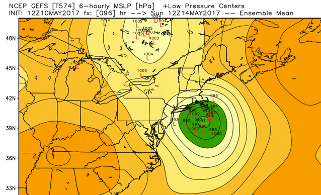
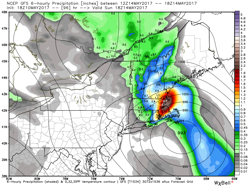
A map you're familiar with from snowstorm season! Clustering of potential low pressure centers just south of Nantucket. Perfect for snowstorms...or spring rainstorms. GEFS shown here.
If it were two months ago, the snow hounds would be absolutely licking their chops. Our incoming storm looks like a classic 'benchmark' low tracking close to 40N 70W - the sweet spot for snowy nor'easters. Alas, it's just a little too warm for snow this go-around. Doubt too many will complain about that, except maybe Barry Burbank. Model guidance has come close to locking in on this track and it should provide a blast of heavy rainfall across all of southern New England.
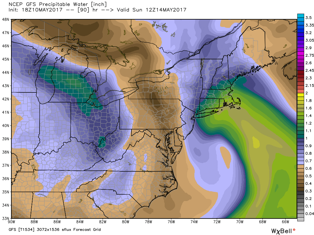
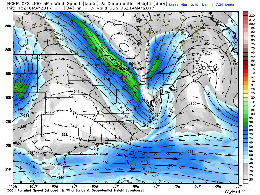
Precipitable water values will be well above average for May, especially for areas south of the Pike. Cascading jet stream energy will allow for nice divergence aloft, helping air to rise.
With a slug of tropical moisture to work with and nice venting aloft, we should squeeze out at least 1-2" of rain. The GFS has been particularly bullish, calling for some 3-5" totals in spots. The Euro is slightly less enthusiastic on rainfall but still soaks us. The GFS may be an outlier, but I wouldn't rule out some 3-4" amounts in the area, especially toward Connecticut, Rhode Island, and southeastern Massachusetts.
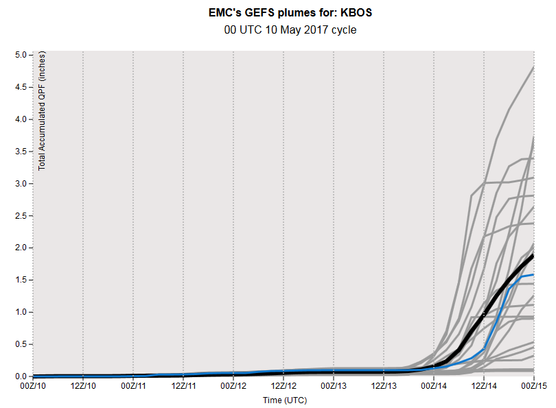
GEFS members have an average of about 1.9" of rain for the storm in Boston, but there are some high-end members that we should be wary of.
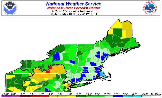
Flash flood guidance says we'd need more than 3" of rain over 6 hours time to produce significant river flooding issues. This isn't totally out of the question, so we'll have to monitor the trends over the next few days. The typically prone rivers, like the Pawtuxet and Taunton rivers, etc, will be ones to watch. Northern New England shouldn't have any issues.
Here's the good news - it looks like the timing may be somewhat in our favor. It's a big weekend, and I'm not interested in making the moms of the world angry. Keeping heavy rain out of their plans would be ideal. We may be able to do just that.
While exact timing may still shift a bit, it looks like the steadiest rain will arrive here Saturday evening, with the majority falling Saturday night into Sunday morning. If it's going to rain on a holiday weekend, that's a 'best worst-case scenario.' Most of Saturday, while cool and gray, would be dry. And after a morning indoors we would get a chance to go out and about during the day Sunday. Neither one is a beauty but the less time we need to spend driving around in downpours, the better. And if we're lucky, we'll drown a few gypsy moth caterpillars. Bonus!
Heaviest rainfall is looking like approx midnight to mid/late Sunday morning, at the moment.
In terms of temperatures, it looks like more 50s on Saturday and on Sunday, though Sunday's are the trickiest. If the storm nudges north a bit, it'll drag more 50s and even 60s into the area. If it stays more offshore, it'll be mainly 40s and 50s. That's something we'll update as we get closer.
Some even better news - this is the storm that finally starts to break down this pattern a bit. Doesn't look like a wholesale change to warm weather, but at least there are 60s back on the 7-Day! The storm keeps Monday windy and cool in the 50s to low 60s, and a couple showers likely will pop up. But Tuesday looks bright with 60s, and we may even make a run at 70 on Wednesday for inland locations. That's much more typical for this time of year. Hopefully we can start putting more plants in the gardens and enjoy little league practice without heavier coats next week.