Beyond The Forecast: Freezing Rain Advisory For Some North And West
BOSTON (CBS) -- Welcome to spring in the Northeast! Cooler than the rest of the Lower 48 and waves of a wintry mix.
Spring started on Monday, March 20th. The sun's rays are becoming slightly more direct in the Northern Hemisphere. And we gain daylight!
Tonight's sunset was at 7:04 p.m.! Too bad we couldn't really see it since the clouds have dominated the forecast for the last few days. More clouds & rain on the way.
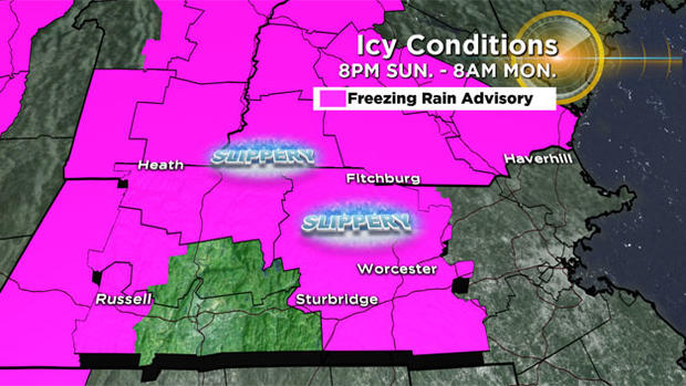
A freezing rain advisory is up for southern New Hampshire, Worcester County, and western MA 8 p.m. tonight to 8 a.m. Monday.
Widespread light icing (glaze to 0.1") will be possible in the higher elevations overnight. While outside of 128, north & west of Boston we could still have light icing, just more spotty.
Temperatures will hover around freezing so use caution tonight and tomorrow morning.
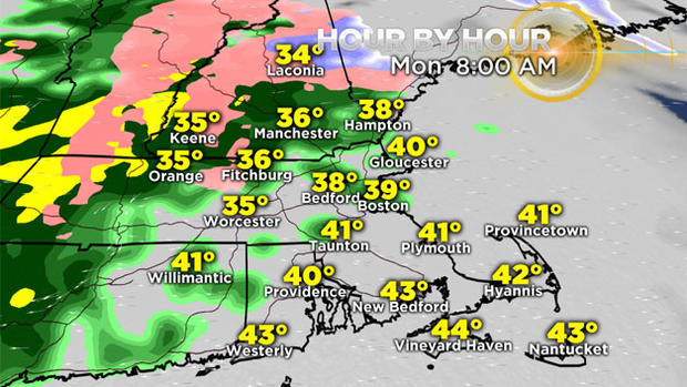
Then a warm front lifts north, and temps quickly increase Monday morning/afternoon.
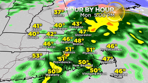
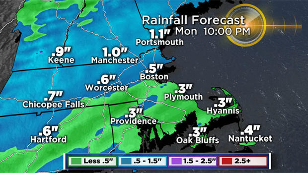
Periods of rain will rule the day, becoming heavy at times through Monday evening. We will receive 0.25" to 0.75" of rainfall gradually through Monday night.
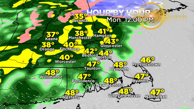
Tuesday, we may see an early period of dry weather, but another system will be approaching.
If we see some sun, combined with a southerly wind, temps inland may approach 60 degrees.
We stay cooler along the coast, around 50 degrees.
Tuesday night into Wednesday morning, a cold front will cool temps slightly. Then sunshine will round out the work week. Low 50s Wednesday, to mid 40s Thursday and Friday.
No major storms, no major cool downs either in your extended forecast. Happy Spring!