Beyond The Forecast: Major Winter Storm On The Way Tuesday
BOSTON (CBS) -- Lock it in. This snow storm is a go. For those that may have been wishing for a big shift in the storm track–sorry, you're out of luck.
While we're still about 48 hours out from the onset of this event, we're gaining more clarity in the WBZ weather center of how this storm will pan out. Here it goes:
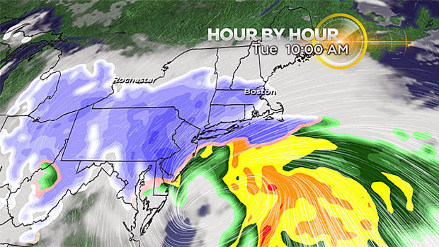
Timing & Impacts
Snow develops Tuesday morning and will last all day long. It will ramp up quickly too; 1- to 3-inch-per-hour snowfall rates will fill in through late morning and continue into the early evening.
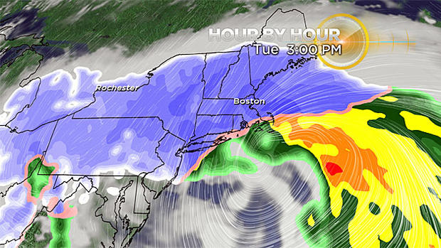
Snow will gradually taper in intensity and coverage Tuesday late evening and overnight with just some lingering snow showers Wednesday. In the most intense bands of snow, visibility will be reduced to near zero at times in blowing and drifting snow (blizzard conditions) and travel will be downright treacherous.
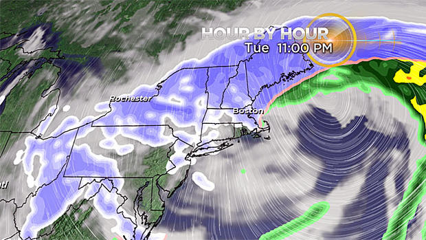
In fact, road conditions will deteriorate rapidly as the snow moves in and only go downhill from there. A snow day is likely for many schools across the region Tuesday.
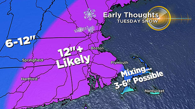
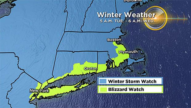
Amounts
There will be tweaks and updates to this map over the next couple of days. Why? Because the exact track of the storm will determine where the heaviest snow and banding occurs and whether or not snow mixes with or chances to rain at the coast and on Cape Cod. Currently, a foot of snow seems likely for much of southern New England, with lesser amounts on Cape Cod. The snow will be fluffy inland, but more wet in consistency the closer you get to the coast.
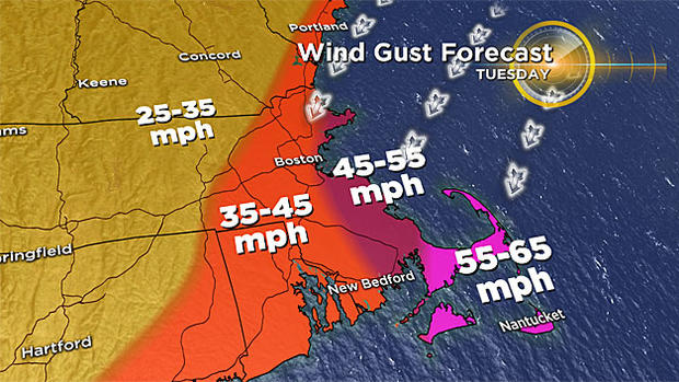
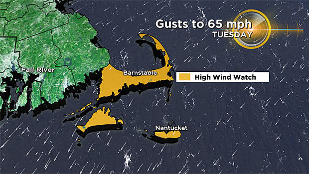
Wind
Damaging wind gusts will be possible, mainly at the coastline Tuesday afternoon and evening. The strongest wind will be closest to the storm center (Cape/Islands) where gusts to 65 mph are possible. From Cape Ann to Boston and the South Shore, gusts to 55 mph could result in isolated pockets of damage. Gusts will diminish the farther inland you travel.
Coastal Flooding
The extent of our coastal flooding will depend highly on the timing of the strongest wind gusts and their direction. Minor coastal flooding and beach erosion is likely with pockets of moderate coastal flooding possible during the Tuesday afternoon high tide cycle. The onshore wind combined with building seas (10-20') will create a 2 to 3 foot surge at our shorelines. The next high tide cycle just after midnight may also result in minor coastal flooding.
Stay tuned for the very latest on this nor'easter both on-air and online!
-Danielle