Latest Storm Could Bring Foot Of Snow To Much Of New England
By Barry Burbank, WBZ-TV Meteorologist
BOSTON (CBS) – February has been the fickle winter month over the past few years. It continues to create consternation for us forecasters this weekend.
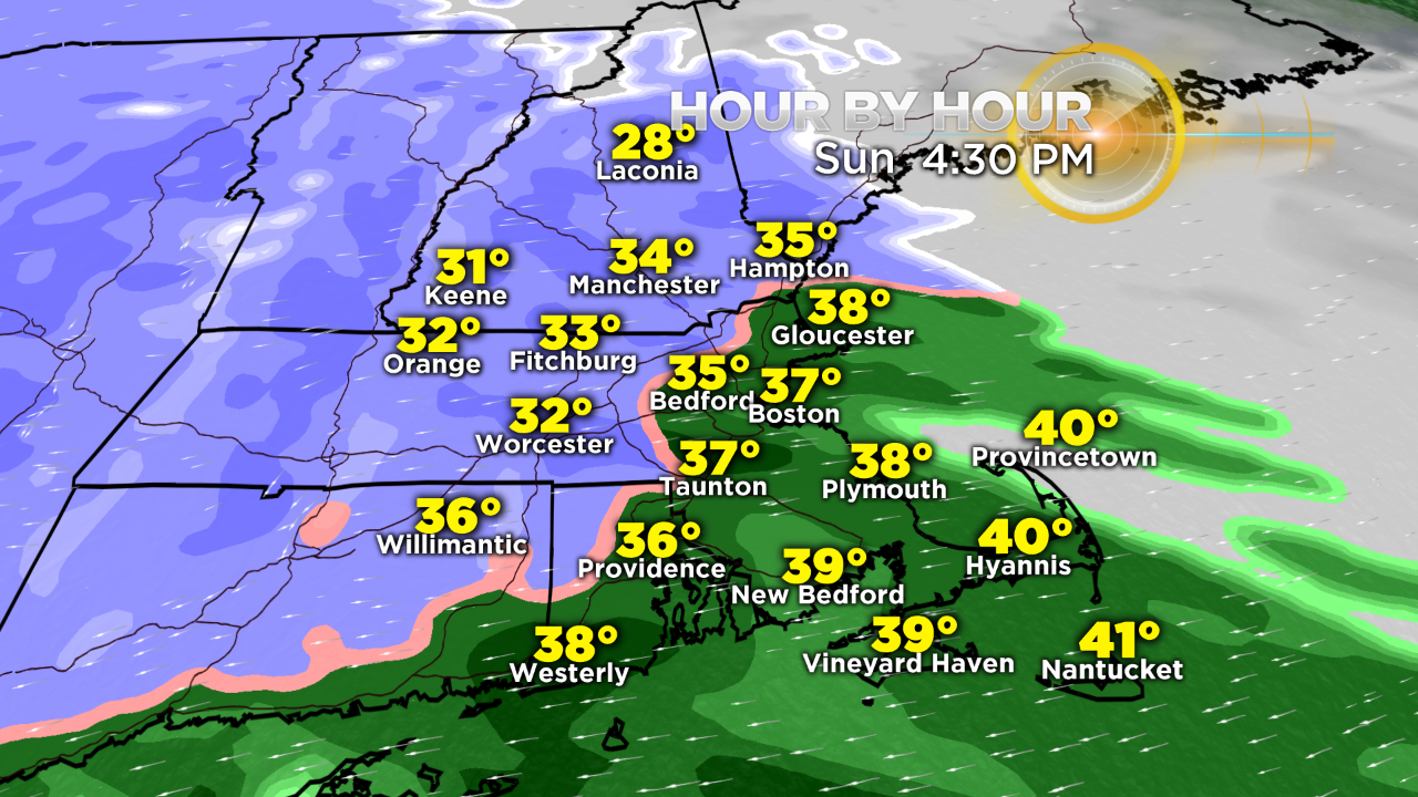
Following the overnight snowfall of 2-4 inches in most areas, a bit of a surprise developed this morning. As noted in this late morning temperature map below, plentiful low-level cold air is locked over northern New England into northern Massachusetts.
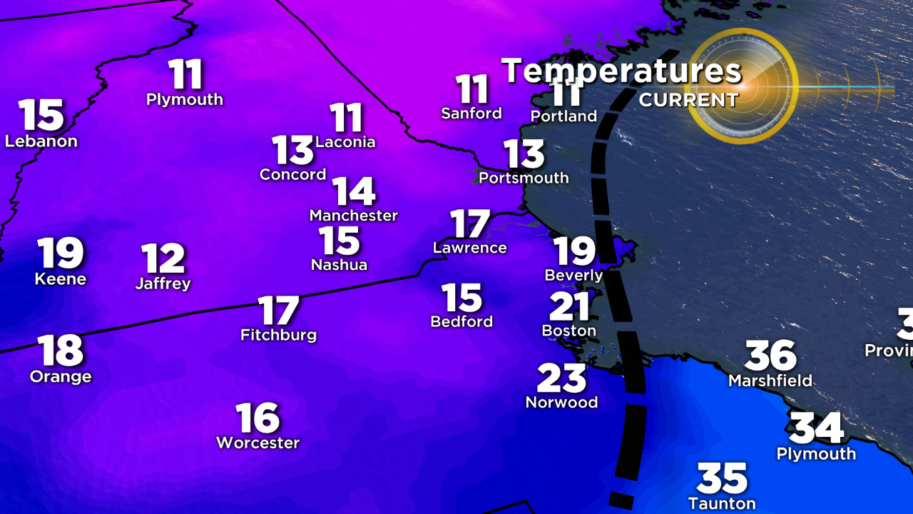
Thanks to North Atlantic blocking, warm air to our southwest cannot push this cold, dense air out. Milder air is attempting to penetrate into southeastern MA from the ocean and a coastal boundary became more pronounced from Cape Ann to near Boston southwestward.
There was sufficient convergence along this boundary to produce light snow and snizzle. Some areas over northeastern Massachusetts, including Cape Ann, received 1-3 inches of fresh snow on top of last night's 3 inches.
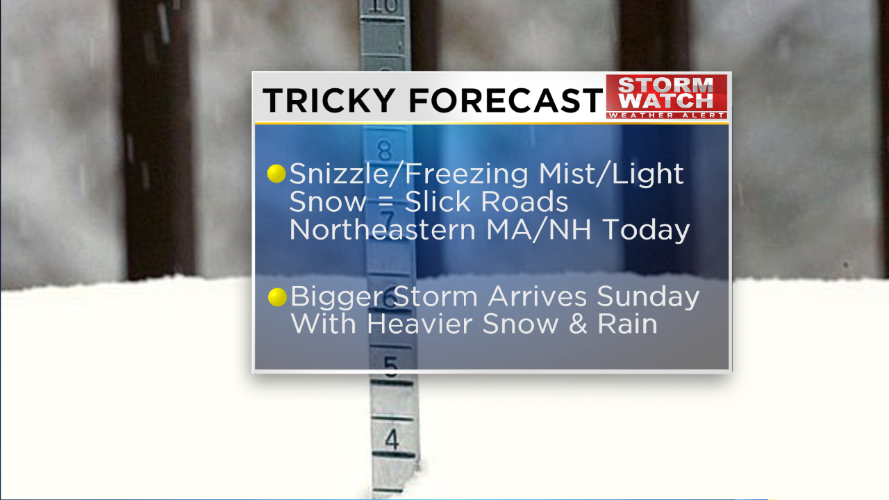
I am not expecting additional accumulation most of those areas this afternoon but some snizzle or freezing mist is possible from time to time. This setup has nothing to do with the next impending significant storm that will arrive tomorrow.
STARTING WITH SNIZZLE
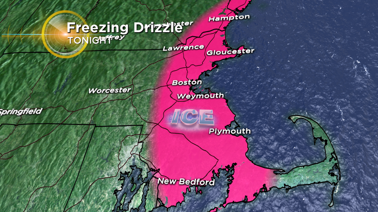
Watch out for the potential of freezing drizzle or snizzle to occur over eastern Massachusetts again tonight as more moist air rolls in from the Atlantic. Roads could easily quickly glaze over but the temperature should be on the uptick tomorrow morning suggesting a mainly rain event will unfold from Cape Cod into southeastern Massachusetts westward to the I-95 corridor.
The precipitation associated with the approaching developing low pressure area will overspread the region later tomorrow morning.
MAJOR STORM POSSIBLE
The potential exists for a major storm but the specific details on its impact here remain somewhat fuzzy at this time. It is highly a function of the precise location of the explosive intensification of a secondary storm tomorrow.
Its exact path will play a key role in the bullet points for our area. Fortunately, the storm should be progressive rather than decelerating as it approaches Cape Cod. Nevertheless, the dynamics dictate quite the clobbering.
If the storm position shifts a meager 25-50 miles, a much different outcome can materialize so keep abreast of our updates on WBZ-TV, WBZ NewsRadio 1030, www.cbsboston.com and on social media.
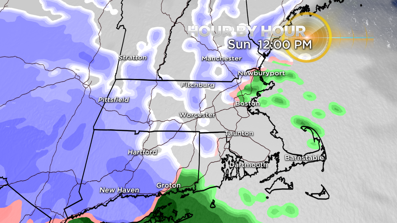
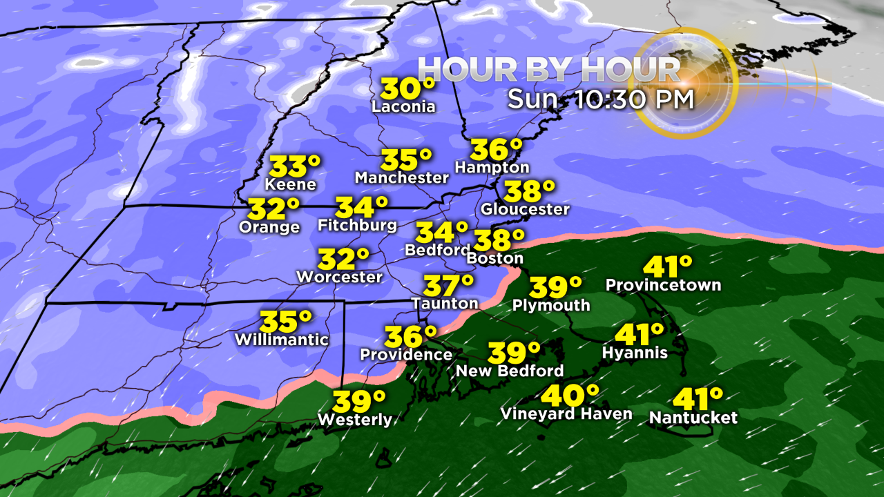
COLLAPSING SNOW LINE
The snow line will gradually collapse back toward the coastline tomorrow night as the storm center deepens near to just east of Cape Cod.
Unlike its predecessor, this storm is destined to crank out a much higher density snowfall so it will be more difficult to remove.
Take it easy shoveling. Additionally, this wetter snow will ramp up the risk of scattered power outages in much of the region and especially along the coast where the wind will become powerful later tomorrow night through Monday.
WINDS
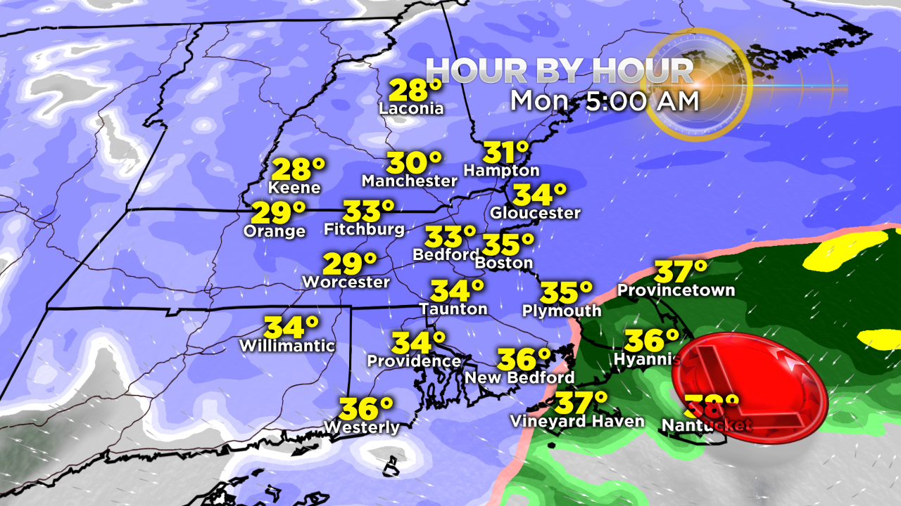
A high wind watch is posted for Cape Ann and Cape Cod from early Monday morning through Monday night for the potential of northwesterly winds of 35-45 MPH with gusts to 65-70 MPH.
The snow line collapse onto southeastern MA and Cape Cod so the least amount of snow is expected there but it will be ripping Monday morning with near whiteout conditions not only there but over much of eastern MA as bands of heavy snow pivot around the backside of the gorilla at sea.
SNOW TOTALS
This profile map of the potential snowfall will likely be tweaked as more clarity evolves about the precise position and behavior of this complex system. Presently, I predict closer to 7-8 inches in the immediate Boston area ranging down to 4-5 inches in Plymouth County to 2-4 inches on most of Cape Cod.
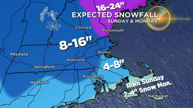
Conversely, the amounts will ramp up farther northwest of Boston to perhaps as high as 12-16 inches north central Massachusetts into New Hampshire. The jackpot region in excess of 16 inches with perhaps up to 20-24 inches will exist in eastern New Hampshire into Maine.
COASTAL CONCERNS
Regarding coastal concerns, there should not be an issue with the midday high tide tomorrow. The scheduled height of the midnight tide tomorrow night is lower so as the storm is strengthening and producing increasing east to northeasterly winds, there should be nothing more than a bit of splashover at some of the vulnerable shore roads.
The strongest winds will occur Monday and the component of the wind will be more northwesterly at that time during the incoming tide Monday morning. Consequently, that will reduce the surge and flooding potential so so significant issues will occur with that high tide just before 1pm. We will continue to monitor and evaluate the wind and tidal situation over the next 24-48 hours.
Follow Barry on Twitter @BarryWBZ.