Weather Alert: Snow, Sleet, Freezing Rain Coming Tuesday Evening
BOSTON (CBS) - Another winter storm is heading our way. This is the same storm that brought ice accumulation across the central Plains over the weekend. We do not expect major icing here, however some sleet or freezing rain may mix with the snow or rain. It all depends on where you live.
UPDATE: Weather Alert: "Kitchen Sink Storm" Arriving
Timing:
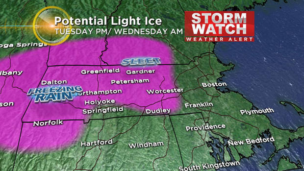
Tuesday afternoon through Wednesday for the duration of the storm. The sleet or freezing rain moves into the Berkshires Tuesday afternoon and evening.
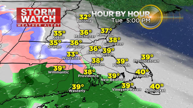
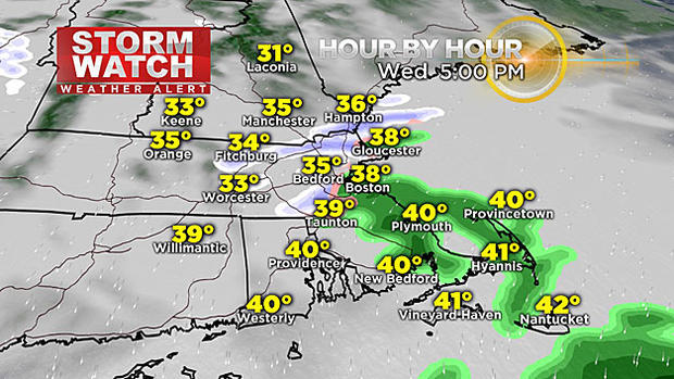
Wet and pasty snow mixes in with the sleet across the Worcester hills by 7 p.m. Tuesday, while in Boston we may see some snowflakes briefly mix in with the rain. Then it's all rain for the duration of the storm. In fact, all of Cape Cod & southeastern Mass. will get rain.
The precipitation spreads across all of New England for Tuesday night. The question is how far south will the freezing line go, and how will temperatures look from each level in the vertical atmosphere. It may be the kind of night were you see rain to sleet to snow in central or southeastern Mass. A temperature profile (GFS sounding) for Tuesday night indicates a temperature of 40 degrees at the surface for Boston, going to 32 degrees half a kilometer above the ground, then well below freezing temps from 1.5 kilometers above the ground and all the way up through the atmosphere. This is what makes the precipitation forecast such a challenge on this particular storm.
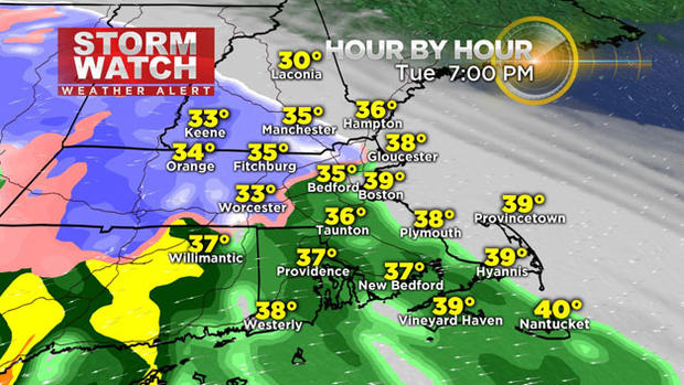
The Wednesday morning commute will also be tricky. The snow continues to fall across Worcester county and MetroWest, a brief mix in Boston, then rain southeast. The wind will gust between 30 and 40 mph from the northeast.
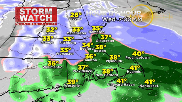
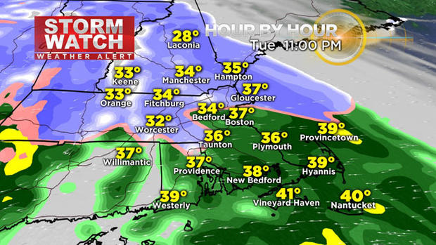
The system tapers off to light flurries over the Merrimack Valley Wednesday evening. Getting a mix across the north shore and Boston, rain in southeastern Massachusetts and Cape Cod. A gusty northeast wind continues.
Advisories:
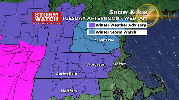
A winter weather advisory is in effect for central Middlesex, western Essex, Franklin, Hampshire, Hampden, Berkshire and Worcester counties from Tuesday afternoon to Wednesday morning. A trace of ice is in the forecast (in addition to light snow). But it only takes a trace of ice to get to advisory criteria. A winter storm watch is up for southern New Hampshire for that same time period.
Totals:
Initially some sleet or freezing rain will fall across the higher elevations. This is where a glaze up to a tenth of an inch of ice accretion may occur. Keep in mind, if we get more sleet that mixes in, our snow totals could go down a tad.
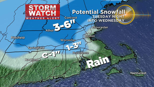
Plus as the snow accumulates, the weight of it will compact it, also making it tricky to measure. Going 3-6" of snow across southern New Hampshire, southern Vermont, in the Worcester Hills. A sharp cutoff in snowfall as you go southeast.
This is a challenging system to forecast-not cut and dry like our previous storm. Stay tuned to WBZ for further updates.
Stay updated on this impending storm on WBZ-TV, WBZ NewsRadio 1030 and cbsboston.com


