Weekend Snow? A Close Pass With 2 Coastal Storms
Find Eric Fisher on Twitter and Facebook
It rained Tuesday, so naturally all the snow lovers are writhing in misery and lamenting the 'lost winter' of 2016-17. A slight exaggeration perhaps, but this is hands down the time of year where we start getting inundated with 'is it ever going to snow?' emails and tweets. Probably a good time to remind people that the snowiest winter on record didn't even start until nearly February. Also, most of the snow in the Boston area tends to fall late-January into early March. I think this often gets forgotten in our memories. Sure - it can snow in November and December (and sometimes even October). But the snowiest part of winter usually doesn't truly get started until the Patriots start playing playoff games and the ocean gets cold.
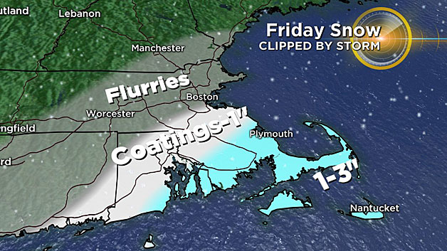
The days ahead give us a couple of chances for snow. First up, a nearby coastal system on Friday. This one doesn't look particularly daunting and is passing southeast of the Benchmark (40N, 70W), but it should come close enough to graze us. Odds favor southeastern Massachusetts, especially Cape Cod and the Islands, for a bit of snow. Right now it's looking like a coating to as much as a couple of inches. However, we'll need to keep watch on any possible ocean-enhancement. This may be the wildcard as a very cold air mass at 850mb (around -14C) will run over the mild waters of Cape Cod Bay (still in the low 40s Fahrenheit). Those little mesoscale details aren't often clear until right before, so if adjustments are needed to the forecast it would likely be on Thursday. Just something to keep in mind, especially from the Plymouth area southward.
Of more interest is a potential storm for Saturday. This is the same one that's generating some weather-hype in the south for possible snow/ice (beware any apocalyptic snow maps!). While *some* snow and ice is definitely possible in the southeast, the bigger question is what the storm will do when it tries to come up the coast. There are a few elements of intrigue here that I'll try to outline.
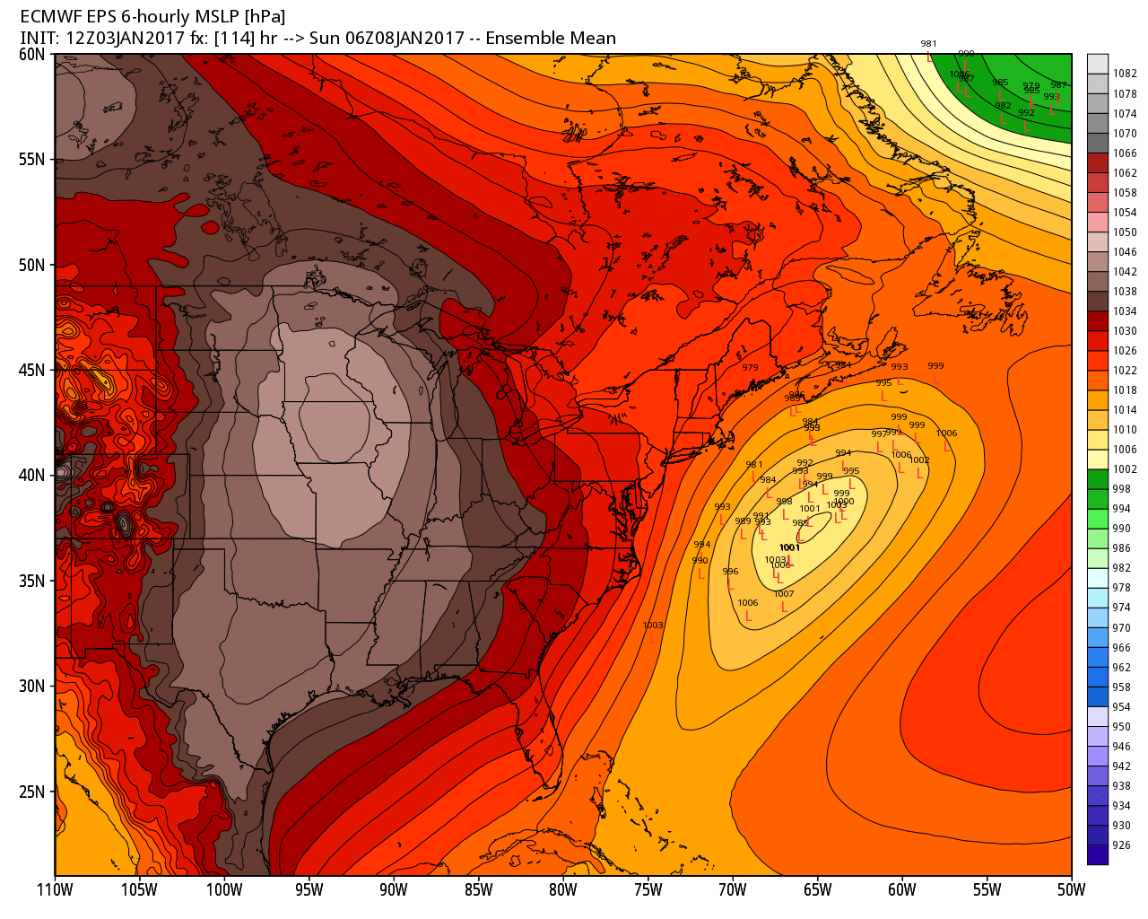
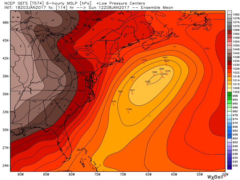
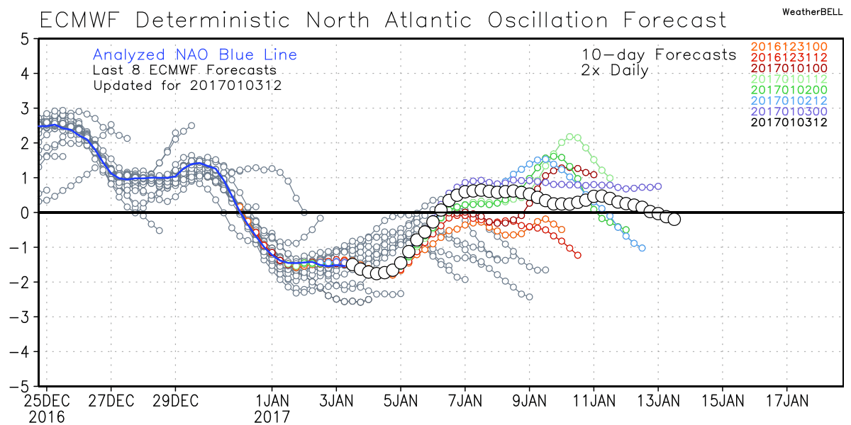
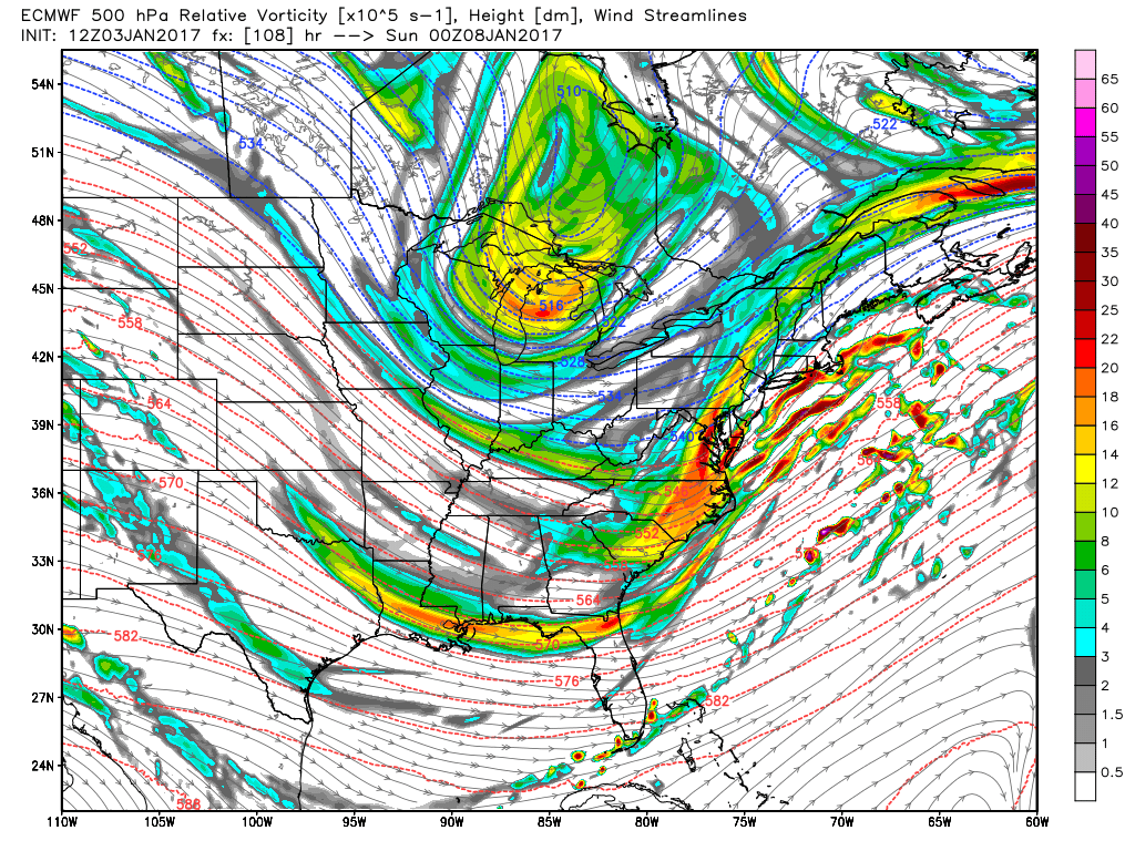
First of all, most guidance is pretty far out to sea. Again, the general theme seems to be southeast of the benchmark. But there are a few outliers that are close enough to make us wary. The GEFS is solidly out to sea and would essentially bring us nothing. The Euro has trended a touch west, and has a few 'members' of its ensemble guidance close enough to us for plowable snow.
What's the difference between the two? Amplification and speed of the pattern aloft. The GFS (American) system is a little lazier with the energy responsible for this storm, and thus allows it to slide farther east. The Euro has a more energetic disturbance (both the lead and the 'kicker' coming in from the Great Lakes) and also brings that northern stream energy in faster. You can see the effect on the ensemble members. The stronger lows, from a more amplified solution, can turn farther north toward us. The weaker lows, in a less amplified environment, slide east.
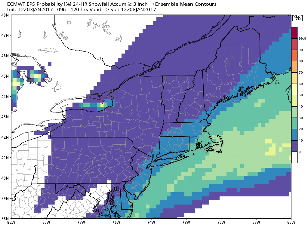
Even with this more amped and farther west solution, the storm is pretty progressive and doesn't necessarily produce big snows for us. The bullish Euro EPS has only middling odds, 10-30%, for 3"+ of snow in southeastern Mass. But a decent snowfall isn't out of the question. Cape Cod and the Islands, along with the rest of far SE Mass., have the best chance of seeing plowable snowfall if this storm can turn north. It looks very unlikely that any of interior New England will get much/anything from it. Sorry ski country, you had your storm last week!
One other thing to consider is that we'll be switching NAO (North American Oscillation) phases during this storm, going from negative to positive. This transition time is often a window in which we see New England snowfall. While there won't be much blocking in place to slow the storm down, we can still pick up snowfall during these types of flips. Plenty to watch and refine over the next few days with all solutions from plowable snow to a complete miss still on the table for now.